Property Record
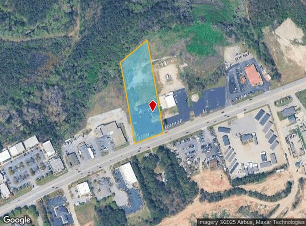
5032 Sunset Blvd, Lexington, SC 29072
NEARBY LISTINGS FOR SALE OR LEASE
Property Detail
5032 Sunset Blvd
003500-03-081
Prepared For Royalty Properties Llc
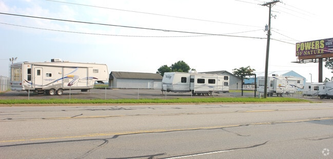
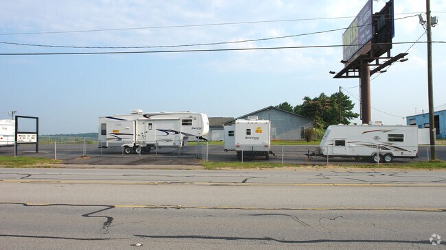
Officebuilding
1.35 AC & 1.20 AC
X
Lexington
45063C0139J
South Carolina
2025
2.55 AC
2024
Lexington
021038
Columbia
2,400 SF
Columbia, SC
DEMOGRAPHICS near 5032 Sunset Blvd
1 Mile
3 Mile
5 Mile
2024 Total Population
3,259
31,605
100,601
2029 Population
3,525
34,249
109,554
Pop Growth 2024-2029
+ 8.16%
+ 8.37%
+ 8.90%
Average Age
36
39
41
2024 Total Households
1,161
12,064
41,154
HH Growth 2024-2029
+ 8.27%
+ 8.51%
+ 9.11%
Median Household Inc
$100,809
$87,274
$70,683
Avg Household Size
2.80
2.60
2.40
2024 Avg HH Vehicles
2.00
2.00
2.00
Median Home Value
$272,929
$239,766
$194,664
Median Year Built
2004
1998
1991
Nearby Places
Map Layers
Map Styles
 Street
 Aerial
- Restaurants
- Banks
- Shops
- Fitness
- Groceries
PUBLIC TRANSPORTATION
COMMUTER RAIL
DRIVE
WALK
Distance
17 min
9.3 mi
AIRPORT
Columbia Metro
DRIVE
WALK
Distance
Columbia Metro
26 min
12.6 mi
Nearby Properties
Address
Land Use
TOTAL SIZE
Lot Size
Zoning
Address
Land Use
TOTAL SIZE
Lot Size
Zoning
58,664 SF
6.01 AC
Address
Land Use
TOTAL SIZE
Lot Size
Zoning
37,794 SF
22.37 AC
ID
Address
Land Use
TOTAL SIZE
Lot Size
Zoning
63,658 SF
17.56 AC
GC
Address
Land Use
TOTAL SIZE
Lot Size
Zoning
38,496 SF
19.41 AC
HDR
Address
Land Use
TOTAL SIZE
Lot Size
Zoning
3,406 SF
19.99 AC
HDR
Address
Land Use
TOTAL SIZE
Lot Size
Zoning
204,927 SF
24.82 AC
GC
Address
Land Use
TOTAL SIZE
Lot Size
Zoning
78,131 SF
24 AC
GC
Address
Land Use
TOTAL SIZE
Lot Size
Zoning
58.81 AC
RD
Address
Land Use
TOTAL SIZE
Lot Size
Zoning
86,935 SF
9.91 AC
ID
Address
Land Use
TOTAL SIZE
Lot Size
Zoning
99,628 SF
13.09 AC
RD
Address
Land Use
TOTAL SIZE
Lot Size
Zoning
64,281 SF
11.71 AC
GC
Address
Land Use
TOTAL SIZE
Lot Size
Zoning
79,246 SF
9.04 AC
GC
Address
Land Use
TOTAL SIZE
Lot Size
Zoning
3,079 SF
15.93 AC
HDR
Address
Land Use
TOTAL SIZE
Lot Size
Zoning
2,065 SF
19.73 AC
HDR
Address
Land Use
TOTAL SIZE
Lot Size
Zoning
85,600 SF
22.08 AC
Address
Land Use
TOTAL SIZE
Lot Size
Zoning
136,940 SF
20.36 AC
GC
Address
Land Use
TOTAL SIZE
Lot Size
Zoning
59.61 AC
ID
Address
Land Use
TOTAL SIZE
Lot Size
Zoning
126,000 SF
8.89 AC
Address
Land Use
TOTAL SIZE
Lot Size
Zoning
102,553 SF
13.30 AC
GC
Address
Land Use
TOTAL SIZE
Lot Size
Zoning
3,825 SF
18.45 AC
RD
Address
Land Use
TOTAL SIZE
Lot Size
Zoning
127,329 SF
10.91 AC
Address
Land Use
TOTAL SIZE
Lot Size
Zoning
85,508 SF
9.22 AC
GC
Address
Land Use
TOTAL SIZE
Lot Size
Zoning
39,700 SF
73.29 AC
ID
Address
Land Use
TOTAL SIZE
Lot Size
Zoning
66,043 SF
2.70 AC
ID
Address
Land Use
TOTAL SIZE
Lot Size
Zoning
62,141 SF
7.28 AC
GC
Address
Land Use
TOTAL SIZE
Lot Size
Zoning
8,269 SF
12.99 AC
RD
Address
Land Use
TOTAL SIZE
Lot Size
Zoning
37,404 SF
9.32 AC
Address
Land Use
TOTAL SIZE
Lot Size
Zoning
51,657 SF
3.48 AC
ID
Address
Land Use
TOTAL SIZE
Lot Size
Zoning
10.52 AC
ID
Address
Land Use
TOTAL SIZE
Lot Size
Zoning
33,218 SF
4.40 AC
GC
The World's #1 Commercial Real Estate Marketplace
Connect with us
© 2026 CoStar Group
The information above has been obtained from sources believed reliable. While we do not doubt its accuracy we have not verified it and make no guarantee, warranty or representation about it. It is your responsibility to independently confirm its accuracy and completeness. Any projections, opinions, assumptions, or estimates used are for example only and do not represent the current or future performance of the property. The value of this transaction to you depends on tax and other factors which should be evaluated by your tax, financial, and legal advisors. You and your advisors should conduct a careful, independent investigation of the property to determine to your satisfaction the suitability of the property for your needs.