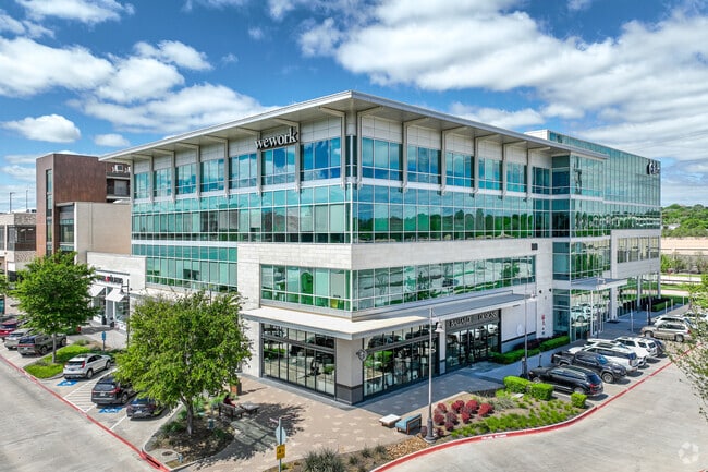
Property Record
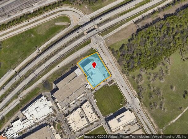
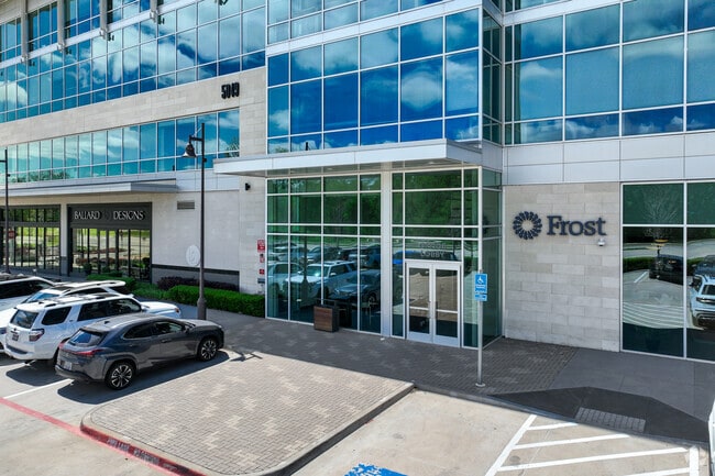
5033 Edwards Ranch Rd, Fort Worth, TX 76109

Current Lease Availabilities
NEARBY LISTINGS FOR SALE OR LEASE
Property Detail
5033 Edwards Ranch Rd
Dallas-Fort Worth-Arlington, TX
Edwards Ranch Clearfork Addn
42175532
EDWARDS RANCH CLEARFORK ADDN BLOCK NW-6 LOT 2R
Commercialnec
Tarrant
X
Texas
48439C0285L
2r
2024
1.66 AC
2025
West Southwest Ft Worth
105405
Dallas/Ft Worth
93,060 SF
DEMOGRAPHICS near 5033 Edwards Ranch Rd
1 Mile
3 Mile
5 Mile
2024 Total Population
11,564
103,955
297,809
2029 Population
12,468
110,176
315,919
Pop Growth 2024-2029
+ 7.82%
+ 5.98%
+ 6.08%
Average Age
38
38
38
2024 Total Households
5,411
45,630
121,189
HH Growth 2024-2029
+ 8.37%
+ 6.30%
+ 6.36%
Median Household Inc
$67,684
$66,300
$60,431
Avg Household Size
2.10
2.10
2.30
2024 Avg HH Vehicles
2.00
2.00
2.00
Median Home Value
$350,531
$390,850
$276,370
Median Year Built
1990
1976
1976
Nearby Places
- Restaurants
- Banks
- Shops
- Fitness
- Groceries
PUBLIC TRANSPORTATION
COMMUTER RAIL
Texas And Pacific (T&P) (Trinity Railway Express - Dallas Area Rapid Transit (DART))
DRIVE
WALK
Distance
Texas And Pacific (T&P) (Trinity Railway Express - Dallas Area Rapid Transit (DART))
10 min
5.4 mi
Fort Worth (Heartland Flyer - Amtrak, Texas Eagle - Amtrak)
DRIVE
WALK
Distance
Fort Worth (Heartland Flyer - Amtrak, Texas Eagle - Amtrak)
11 min
5.8 mi
AIRPORT
Dallas-Fort Worth International
DRIVE
WALK
Distance
Dallas-Fort Worth International
41 min
30.3 mi
Freight Ports
Port of Shreveport
DRIVE
WALK
Distance
Port of Shreveport
254 min
235.0 mi
Nearby Properties
Address
Land Use
TOTAL SIZE
Lot Size
Zoning
Address
Land Use
TOTAL SIZE
Lot Size
Zoning
802,865 SF
17.38 AC
Address
Land Use
TOTAL SIZE
Lot Size
Zoning
505,069 SF
6.49 AC
Address
Land Use
TOTAL SIZE
Lot Size
Zoning
438,943 SF
3.77 AC
Address
Land Use
TOTAL SIZE
Lot Size
Zoning
477,907 SF
11.83 AC
Address
Land Use
TOTAL SIZE
Lot Size
Zoning
346,920 SF
9.88 AC
Address
Land Use
TOTAL SIZE
Lot Size
Zoning
1,259,660 SF
52.13 AC
Address
Land Use
TOTAL SIZE
Lot Size
Zoning
482,938 SF
22.22 AC
Address
Land Use
TOTAL SIZE
Lot Size
Zoning
509,560 SF
3.06 AC
Address
Land Use
TOTAL SIZE
Lot Size
Zoning
323,685 SF
19.61 AC
Address
Land Use
TOTAL SIZE
Lot Size
Zoning
353,842 SF
101.26 AC
Address
Land Use
TOTAL SIZE
Lot Size
Zoning
348,025 SF
26.33 AC
Address
Land Use
TOTAL SIZE
Lot Size
Zoning
382,376 SF
21.61 AC
Address
Land Use
TOTAL SIZE
Lot Size
Zoning
492,130 SF
6.55 AC
Address
Land Use
TOTAL SIZE
Lot Size
Zoning
437,641 SF
6.60 AC
Address
Land Use
TOTAL SIZE
Lot Size
Zoning
525,051 SF
6.87 AC
Address
Land Use
TOTAL SIZE
Lot Size
Zoning
373,138 SF
15 AC
Address
Land Use
TOTAL SIZE
Lot Size
Zoning
283,106 SF
11.17 AC
Address
Land Use
TOTAL SIZE
Lot Size
Zoning
446,116 SF
12.50 AC
Address
Land Use
TOTAL SIZE
Lot Size
Zoning
642,632 SF
27.73 AC
Address
Land Use
TOTAL SIZE
Lot Size
Zoning
355,125 SF
21.29 AC
Address
Land Use
TOTAL SIZE
Lot Size
Zoning
350,654 SF
21.29 AC
Address
Land Use
TOTAL SIZE
Lot Size
Zoning
296,664 SF
14.71 AC
Address
Land Use
TOTAL SIZE
Lot Size
Zoning
347,423 SF
7.32 AC
Address
Land Use
TOTAL SIZE
Lot Size
Zoning
294,193 SF
59.09 AC
Address
Land Use
TOTAL SIZE
Lot Size
Zoning
312,709 SF
16.26 AC
Address
Land Use
TOTAL SIZE
Lot Size
Zoning
292,450 SF
8.17 AC
Address
Land Use
TOTAL SIZE
Lot Size
Zoning
267,098 SF
14.06 AC
Address
Land Use
TOTAL SIZE
Lot Size
Zoning
183,899 SF
9.23 AC
Address
Land Use
TOTAL SIZE
Lot Size
Zoning
348,210 SF
5.02 AC
Address
Land Use
TOTAL SIZE
Lot Size
Zoning
166,474 SF
12.60 AC
The World's #1 Commercial Real Estate Marketplace
Connect with us
© 2025 CoStar Group
The information above has been obtained from sources believed reliable. While we do not doubt its accuracy we have not verified it and make no guarantee, warranty or representation about it. It is your responsibility to independently confirm its accuracy and completeness. Any projections, opinions, assumptions, or estimates used are for example only and do not represent the current or future performance of the property. The value of this transaction to you depends on tax and other factors which should be evaluated by your tax, financial, and legal advisors. You and your advisors should conduct a careful, independent investigation of the property to determine to your satisfaction the suitability of the property for your needs.