Property Record
5039 Cundiff Ct, Decatur, IL 62526


NEARBY LISTINGS FOR SALE OR LEASE
Property Detail
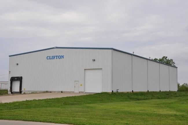
5039 Cundiff Ct
Decatur, IL
H.S.H.Industrial Second Add
18-08-20-301-017
SECTION 20-17-3E~H.S.H.INDUSTRIAL SECOND ADD~LT 4
Warehouse
Macon
X
Illinois
17115C0195E
4
2024
1.50 AC
2024
Springfield/Decatur
002200
Other Market Areas
DEMOGRAPHICS near 5039 Cundiff Ct
1 Mile
3 Mile
5 Mile
2024 Total Population
112
6,818
31,674
2029 Population
108
6,520
30,705
Pop Growth 2024-2029
(3.57%)
(4.37%)
(3.06%)
Average Age
46
39
42
2024 Total Households
47
2,914
14,085
HH Growth 2024-2029
(4.26%)
(4.46%)
(3.15%)
Median Household Inc
$72,856
$43,685
$43,384
Avg Household Size
2.40
2.10
2.10
2024 Avg HH Vehicles
2.00
2.00
2.00
Median Home Value
$199,999
$99,456
$109,215
Median Year Built
1972
1972
1971
Nearby Places
Map Layers
Map Styles
 Street
 Aerial
- Restaurants
- Banks
- Shops
- Fitness
- Groceries
Nearby Properties
Address
Land Use
TOTAL SIZE
Lot Size
Zoning
Address
Land Use
TOTAL SIZE
Lot Size
Zoning
10 AC
MUNICIPAL
Address
Land Use
TOTAL SIZE
Lot Size
Zoning
38.36 AC
MUNICIPAL
Address
Land Use
TOTAL SIZE
Lot Size
Zoning
107.54 AC
MUNICIPAL
Address
Land Use
TOTAL SIZE
Lot Size
Zoning
76.02 AC
MUNICIPAL
Address
Land Use
TOTAL SIZE
Lot Size
Zoning
12.21 AC
MUNICIPAL
Address
Land Use
TOTAL SIZE
Lot Size
Zoning
13.75 AC
MUNICIPAL
Address
Land Use
TOTAL SIZE
Lot Size
Zoning
17.82 AC
MUNICIPAL
Address
Land Use
TOTAL SIZE
Lot Size
Zoning
23.56 AC
MUNICIPAL
Address
Land Use
TOTAL SIZE
Lot Size
Zoning
3.55 AC
MUNICIPAL
Address
Land Use
TOTAL SIZE
Lot Size
Zoning
14.66 AC
MUNICIPAL
Address
Land Use
TOTAL SIZE
Lot Size
Zoning
13.04 AC
MUNICIPAL
Address
Land Use
TOTAL SIZE
Lot Size
Zoning
20 AC
MUNICIPAL
Address
Land Use
TOTAL SIZE
Lot Size
Zoning
61.42 AC
MUNICIPAL
Address
Land Use
TOTAL SIZE
Lot Size
Zoning
9.53 AC
MUNICIPAL
Address
Land Use
TOTAL SIZE
Lot Size
Zoning
14.73 AC
MUNICIPAL
Address
Land Use
TOTAL SIZE
Lot Size
Zoning
10.16 AC
MUNICIPAL
Address
Land Use
TOTAL SIZE
Lot Size
Zoning
15.93 AC
M-1
Address
Land Use
TOTAL SIZE
Lot Size
Zoning
7.38 AC
MUNICIPAL
Address
Land Use
TOTAL SIZE
Lot Size
Zoning
16.42 AC
MUNICIPAL
Address
Land Use
TOTAL SIZE
Lot Size
Zoning
4,000 SF
5.18 AC
MUNICIPAL
Address
Land Use
TOTAL SIZE
Lot Size
Zoning
7 AC
MUNICIPAL
Address
Land Use
TOTAL SIZE
Lot Size
Zoning
3.10 AC
MUNICIPAL
Address
Land Use
TOTAL SIZE
Lot Size
Zoning
12.24 AC
MUNICIPAL
Address
Land Use
TOTAL SIZE
Lot Size
Zoning
1.69 AC
MUNICIPAL
Address
Land Use
TOTAL SIZE
Lot Size
Zoning
11.28 AC
MUNICIPAL
Address
Land Use
TOTAL SIZE
Lot Size
Zoning
4.08 AC
MUNICIPAL
Address
Land Use
TOTAL SIZE
Lot Size
Zoning
5.69 AC
MUNICIPAL
The World's #1 Commercial Real Estate Marketplace
Connect with us
© 2025 CoStar Group
The information above has been obtained from sources believed reliable. While we do not doubt its accuracy we have not verified it and make no guarantee, warranty or representation about it. It is your responsibility to independently confirm its accuracy and completeness. Any projections, opinions, assumptions, or estimates used are for example only and do not represent the current or future performance of the property. The value of this transaction to you depends on tax and other factors which should be evaluated by your tax, financial, and legal advisors. You and your advisors should conduct a careful, independent investigation of the property to determine to your satisfaction the suitability of the property for your needs.