Property Record
504 E Fairway Rd, Henderson, NV 89015
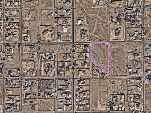


Property Detail
504 E Fairway Rd
179-04-701-002
PT NW4 SE4 SEC 4-22-63
Vacantlandnec
CLARK
RS1
Nevada
C and X Area of minimal flood hazard, usually depicted on FIRMs as above the 500-year flood level.
3.25 AC
2026
SE Las Vegas/Henderson
2026
Las Vegas
005422
Las Vegas-Henderson-North Las Vegas, NV
NEARBY LISTINGS FOR SALE OR LEASE
DEMOGRAPHICS near 504 E Fairway Rd
1 mile
3 mile
5 mile
2024 Total Population
4,538
56,811
134,859
2029 Population
4,974
62,833
146,328
Pop Growth 2024-2029
+ 9.61%
+ 10.60%
+ 8.50%
Average Age
45
42
41
2024 Total Households
1,560
21,559
51,704
HH Growth 2024-2029
+ 9.87%
+ 10.80%
+ 8.67%
Median Household Inc
$66,649
$76,342
$76,019
Avg Household Size
2.60
2.50
2.50
2024 Avg HH Vehicles
2.00
2.00
2.00
Median Home Value
$480,494
$403,894
$384,986
Median Year Built
1999
2003
2000
Nearby Places
Map Layers
Map Styles
 Street
 Aerial
Transit
 Traffic
 Biking
Places
Listings with unknown addresses are not visible on the map
- Restaurants
- Banks
- Shops
- Fitness
- Groceries
PUBLIC TRANSPORTATION
AIRPORT
Boulder City Municipal
Drive
Walk
Distance
Boulder City Municipal
23 min
12.1 mi
Harry Reid International
Drive
Walk
Distance
Harry Reid International
24 min
16.8 mi
Freight Ports
Port of Long Beach
Drive
Walk
Distance
Port of Long Beach
322 min
285.4 mi
Nearby Properties
Address
Land Use
TOTAL SIZE
Lot Size
Zoning
Address
Land Use
TOTAL SIZE
Lot Size
Zoning
Address
Land Use
TOTAL SIZE
Lot Size
Zoning
31,463 SF
191.46 AC
PS
Address
Land Use
TOTAL SIZE
Lot Size
Zoning
9,493 SF
15.37 AC
Address
Land Use
TOTAL SIZE
Lot Size
Zoning
350.47 AC
PS
Address
Land Use
TOTAL SIZE
Lot Size
Zoning
10.50 AC
Address
Land Use
TOTAL SIZE
Lot Size
Zoning
81,485 SF
160.06 AC
PS
Address
Land Use
TOTAL SIZE
Lot Size
Zoning
1,635 SF
13.84 AC
CT
Address
Land Use
TOTAL SIZE
Lot Size
Zoning
387,990 SF
22.04 AC
Address
Land Use
TOTAL SIZE
Lot Size
Zoning
40,031 SF
21.25 AC
Address
Land Use
TOTAL SIZE
Lot Size
Zoning
78,760 SF
1.23 AC
Address
Land Use
TOTAL SIZE
Lot Size
Zoning
71,133 SF
7.56 AC
DP
Address
Land Use
TOTAL SIZE
Lot Size
Zoning
19,753 SF
10.21 AC
DP
Address
Land Use
TOTAL SIZE
Lot Size
Zoning
213,472 SF
7.46 AC
Address
Land Use
TOTAL SIZE
Lot Size
Zoning
3,664 SF
16.09 AC
RH20
Address
Land Use
TOTAL SIZE
Lot Size
Zoning
14,463 SF
19.48 AC
Address
Land Use
TOTAL SIZE
Lot Size
Zoning
320 AC
PS
Address
Land Use
TOTAL SIZE
Lot Size
Zoning
170,646 SF
18.16 AC
H:IG-RD
Address
Land Use
TOTAL SIZE
Lot Size
Zoning
3,085 SF
2.51 AC
Address
Land Use
TOTAL SIZE
Lot Size
Zoning
124,900 SF
5.45 AC
Address
Land Use
TOTAL SIZE
Lot Size
Zoning
83,313 SF
7.79 AC
Address
Land Use
TOTAL SIZE
Lot Size
Zoning
144,330 SF
19.22 AC
Address
Land Use
TOTAL SIZE
Lot Size
Zoning
45.08 AC
Address
Land Use
TOTAL SIZE
Lot Size
Zoning
16,240 SF
28.09 AC
Address
Land Use
TOTAL SIZE
Lot Size
Zoning
320 AC
DH
Address
Land Use
TOTAL SIZE
Lot Size
Zoning
123,673 SF
12.23 AC
Address
Land Use
TOTAL SIZE
Lot Size
Zoning
48,511 SF
13.98 AC
Address
Land Use
TOTAL SIZE
Lot Size
Zoning
46,996 SF
43.78 AC
M2
The World's #1 Commercial Real Estate Marketplace
Connect with us
© 2026 CoStar Group
The information above has been obtained from sources believed reliable. While we do not doubt its accuracy we have not verified it and make no guarantee, warranty or representation about it. It is your responsibility to independently confirm its accuracy and completeness. Any projections, opinions, assumptions, or estimates used are for example only and do not represent the current or future performance of the property. The value of this transaction to you depends on tax and other factors which should be evaluated by your tax, financial, and legal advisors. You and your advisors should conduct a careful, independent investigation of the property to determine to your satisfaction the suitability of the property for your needs.