Property Record
504 E Graham Ave, Pryor, OK 74361


Save to a Folder
{{folder.Name}}
{{folder.ListingIds.length}} Properties
{{folder.ListingIds.length}} Property
Create a New Folder
Property Detail
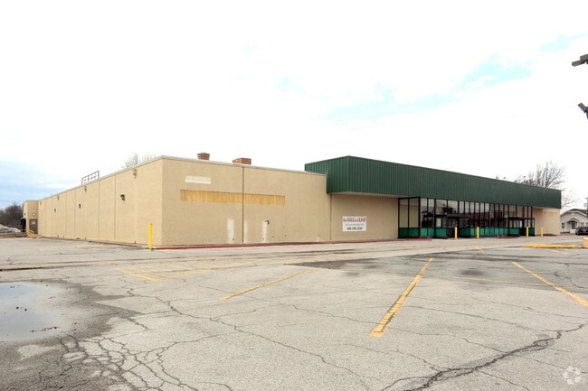
504 E Graham Ave
1001-00-039-001-0-001-00
PRYOR ORIG CITY OF PRYOR PD/FD BLK 39 LOTS 1,2,3,4,6,7, N 66' LOT 5, N 54' LOT 10, W 10' OF ALLEY, N 10' OF VACATED ALLEY ADJ
Governmentalpublicusegeneral
Mayes
B and X Area of moderate flood hazard, usually the area between the limits of the 100-year and 500-year floods.
Oklahoma
0
1-7,10
2025
2.09 AC
040100
Oklahoma East Area
24,470 SF
Other Market Areas
NEARBY LISTINGS FOR SALE OR LEASE
-
-
View all Pryor listings for sale on LoopNet.com
DEMOGRAPHICS near 504 E Graham Ave
1 mile
3 mile
5 mile
2025 Total Population
5,846
11,122
13,322
2030 Population
6,018
11,362
13,627
Pop Growth 2025-2030
+ 2.94%
+ 2.16%
+ 2.29%
Average Age
38
38
39
2025 Total Households
2,257
4,329
5,151
HH Growth 2025-2030
+ 2.97%
+ 2.19%
+ 2.33%
Median Household Inc
$37,190
$46,197
$50,777
Avg Household Size
2.40
2.50
2.50
2025 Avg HH Vehicles
2.00
2.00
2.00
Median Home Value
$135,421
$170,449
$184,457
Median Year Built
1968
1974
1976
Nearby Places
Map Layers
Map Styles
 Street
 Aerial
Layers
 Traffic
 Biking
Places
Listings with unknown addresses are not visible on the map
- Restaurants
- Banks
- Shops
- Fitness
- Groceries
PUBLIC TRANSPORTATION
AIRPORT
Tulsa International
Drive
Walk
Distance
Tulsa International
50 min
37.3 mi
Freight Ports
Drive
Walk
Distance
36 min
25.8 mi
SALE & LEASE HISTORY
LISTING DATE
SALE/LEASE

Sep 23, 2016
For Sale
Feb 13, 2018
For Sale
Nearby Properties
Address
Land Use
TOTAL SIZE
Lot Size
Zoning
Address
Land Use
TOTAL SIZE
Lot Size
Zoning
4,926 SF
10 AC
Address
Land Use
TOTAL SIZE
Lot Size
Zoning
11,790 SF
9 AC
Address
Land Use
TOTAL SIZE
Lot Size
Zoning
28,440 SF
11.50 AC
Address
Land Use
TOTAL SIZE
Lot Size
Zoning
8,242 SF
8.28 AC
Address
Land Use
TOTAL SIZE
Lot Size
Zoning
8,550 SF
0.34 AC
Address
Land Use
TOTAL SIZE
Lot Size
Zoning
89,982 SF
7.43 AC
Address
Land Use
TOTAL SIZE
Lot Size
Zoning
46,665 SF
10 AC
Address
Land Use
TOTAL SIZE
Lot Size
Zoning
11,192 SF
0.40 AC
Address
Land Use
TOTAL SIZE
Lot Size
Zoning
8,400 SF
0.45 AC
Address
Land Use
TOTAL SIZE
Lot Size
Zoning
3,910 SF
3.89 AC
Address
Land Use
TOTAL SIZE
Lot Size
Zoning
5,562 SF
0.44 AC
Address
Land Use
TOTAL SIZE
Lot Size
Zoning
10,442 SF
0.34 AC
Address
Land Use
TOTAL SIZE
Lot Size
Zoning
3,680 SF
0.98 AC
Address
Land Use
TOTAL SIZE
Lot Size
Zoning
6,288 SF
20.45 AC
TM
Address
Land Use
TOTAL SIZE
Lot Size
Zoning
3,264 SF
2.86 AC
Address
Land Use
TOTAL SIZE
Lot Size
Zoning
4,410 SF
0.26 AC
Address
Land Use
TOTAL SIZE
Lot Size
Zoning
1,060 SF
7.42 AC
Address
Land Use
TOTAL SIZE
Lot Size
Zoning
5,000 SF
0.68 AC
Address
Land Use
TOTAL SIZE
Lot Size
Zoning
81,116 SF
6.53 AC
Address
Land Use
TOTAL SIZE
Lot Size
Zoning
11,704 SF
0.34 AC
Address
Land Use
TOTAL SIZE
Lot Size
Zoning
24,113 SF
5.84 AC
Address
Land Use
TOTAL SIZE
Lot Size
Zoning
3,444 SF
0.77 AC
Address
Land Use
TOTAL SIZE
Lot Size
Zoning
4,500 SF
0.60 AC
Address
Land Use
TOTAL SIZE
Lot Size
Zoning
14,636 SF
2.09 AC
The World's #1 Commercial Real Estate Marketplace
Connect with us
© 2026 CoStar Group
The information above has been obtained from sources believed reliable. While we do not doubt its accuracy we have not verified it and make no guarantee, warranty or representation about it. It is your responsibility to independently confirm its accuracy and completeness. Any projections, opinions, assumptions, or estimates used are for example only and do not represent the current or future performance of the property. The value of this transaction to you depends on tax and other factors which should be evaluated by your tax, financial, and legal advisors. You and your advisors should conduct a careful, independent investigation of the property to determine to your satisfaction the suitability of the property for your needs.