Property Record
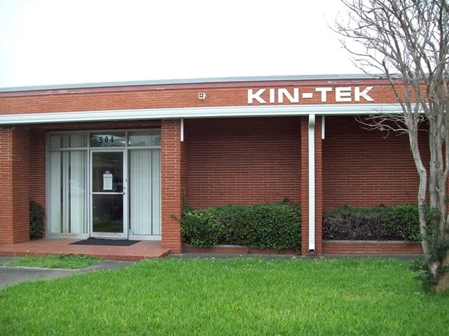
504 Laurel St, La Marque, TX 77568

Property Detail
504 Laurel St
Houston-Pasadena-The Woodlands, TX
ABST 150 J D MOORE SUR PTS OF BLK 2 & BLK 3 (200-5) DIV D COOK & STEWART SUB
2775-0004-0200-005
Galveston
Commercialnec
Texas
2024
510
2025
0.57 AC
722800
East-Southeast Far
7,257 SF
Houston
NEARBY LISTINGS FOR SALE OR LEASE
DEMOGRAPHICS near 504 Laurel St
1 mile
3 mile
5 mile
2025 Total Population
9,258
38,934
78,180
2030 Population
9,718
40,511
81,333
Pop Growth 2025-2030
+ 4.97%
+ 4.05%
+ 4.03%
Average Age
39
40
39
2025 Total Households
3,506
14,917
29,545
HH Growth 2025-2030
+ 4.93%
+ 3.93%
+ 3.98%
Median Household Inc
$53,647
$56,550
$67,396
Avg Household Size
2.60
2.50
2.60
2025 Avg HH Vehicles
2.00
2.00
2.00
Median Home Value
$149,157
$172,198
$207,789
Median Year Built
1971
1979
1979
Nearby Places
Map Layers
Map Styles
 Street
 Aerial
Layers
 Traffic
 Biking
Places
Listings with unknown addresses are not visible on the map
- Restaurants
- Banks
- Shops
- Fitness
- Groceries
PUBLIC TRANSPORTATION
AIRPORT
William P Hobby
Drive
Walk
Distance
William P Hobby
42 min
28.5 mi
SALE & LEASE HISTORY
LISTING DATE
SALE/LEASE

Sep 24, 2016
For Sale
Nearby Properties
Address
Land Use
TOTAL SIZE
Lot Size
Zoning
Address
Land Use
TOTAL SIZE
Lot Size
Zoning
Address
Land Use
TOTAL SIZE
Lot Size
Zoning
396,204 SF
81.22 AC
Address
Land Use
TOTAL SIZE
Lot Size
Zoning
330,000 SF
42.77 AC
Address
Land Use
TOTAL SIZE
Lot Size
Zoning
305,340 SF
15.90 AC
Address
Land Use
TOTAL SIZE
Lot Size
Zoning
186,880 SF
46.80 AC
Address
Land Use
TOTAL SIZE
Lot Size
Zoning
200,000 SF
19.31 AC
A
Address
Land Use
TOTAL SIZE
Lot Size
Zoning
Address
Land Use
TOTAL SIZE
Lot Size
Zoning
107,300 SF
25.86 AC
Address
Land Use
TOTAL SIZE
Lot Size
Zoning
206,560 SF
7.08 AC
Address
Land Use
TOTAL SIZE
Lot Size
Zoning
197,584 SF
11.85 AC
Address
Land Use
TOTAL SIZE
Lot Size
Zoning
191,320 SF
9.16 AC
Address
Land Use
TOTAL SIZE
Lot Size
Zoning
205,260 SF
10.38 AC
Address
Land Use
TOTAL SIZE
Lot Size
Zoning
243,492 SF
10.27 AC
Address
Land Use
TOTAL SIZE
Lot Size
Zoning
303,433 SF
24.37 AC
Address
Land Use
TOTAL SIZE
Lot Size
Zoning
171,099 SF
9.99 AC
Address
Land Use
TOTAL SIZE
Lot Size
Zoning
161,960 SF
8.32 AC
Address
Land Use
TOTAL SIZE
Lot Size
Zoning
Address
Land Use
TOTAL SIZE
Lot Size
Zoning
319,685 SF
28.84 AC
Address
Land Use
TOTAL SIZE
Lot Size
Zoning
162,050 SF
9.14 AC
Address
Land Use
TOTAL SIZE
Lot Size
Zoning
60,288 SF
4.96 AC
Address
Land Use
TOTAL SIZE
Lot Size
Zoning
158,388 SF
16.52 AC
Address
Land Use
TOTAL SIZE
Lot Size
Zoning
99,550 SF
9.34 AC
E
Address
Land Use
TOTAL SIZE
Lot Size
Zoning
97,358 SF
6.43 AC
Address
Land Use
TOTAL SIZE
Lot Size
Zoning
114,410 SF
55.31 AC
Address
Land Use
TOTAL SIZE
Lot Size
Zoning
267,588 SF
15.68 AC
Address
Land Use
TOTAL SIZE
Lot Size
Zoning
86,894 SF
9.38 AC
A
Address
Land Use
TOTAL SIZE
Lot Size
Zoning
120,396 SF
7 AC
Address
Land Use
TOTAL SIZE
Lot Size
Zoning
141,440 SF
6.55 AC
C
Address
Land Use
TOTAL SIZE
Lot Size
Zoning
105,810 SF
9.07 AC
Address
Land Use
TOTAL SIZE
Lot Size
Zoning
91,210 SF
11.64 AC
The World's #1 Commercial Real Estate Marketplace
Connect with us
© 2026 CoStar Group
The information above has been obtained from sources believed reliable. While we do not doubt its accuracy we have not verified it and make no guarantee, warranty or representation about it. It is your responsibility to independently confirm its accuracy and completeness. Any projections, opinions, assumptions, or estimates used are for example only and do not represent the current or future performance of the property. The value of this transaction to you depends on tax and other factors which should be evaluated by your tax, financial, and legal advisors. You and your advisors should conduct a careful, independent investigation of the property to determine to your satisfaction the suitability of the property for your needs.