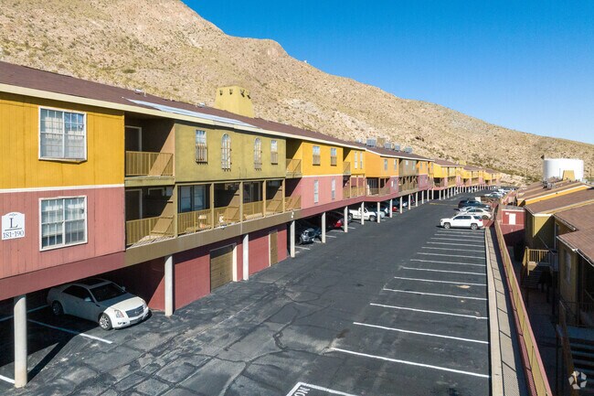
Property Record
5041 Alabama St, El Paso, TX 79930


NEARBY LISTINGS FOR SALE OR LEASE
Property Detail
5041 Alabama St
El Paso, TX
Tsp 2 Sec 10 T & P Surv
X581-999-2220-0256
81 TSP 2 SEC 22 T & P SURV TR 2-D (10.022 AC) & TR 2-E-3 (0.092 AC) (10.114 AC)
Apartment
El Paso
2024
Texas
2025
10.11 AC
000401
Franklin Mountains
254,768 SF
El Paso
DEMOGRAPHICS near 5041 Alabama St
1 Mile
3 Mile
5 Mile
2024 Total Population
8,641
70,211
193,119
2029 Population
9,052
71,844
196,927
Pop Growth 2024-2029
+ 4.76%
+ 2.33%
+ 1.97%
Average Age
37
37
38
2024 Total Households
3,666
27,690
75,014
HH Growth 2024-2029
+ 5.18%
+ 2.31%
+ 1.98%
Median Household Inc
$45,775
$44,076
$38,842
Avg Household Size
2.30
2.50
2.40
2024 Avg HH Vehicles
2.00
2.00
2.00
Median Home Value
$144,763
$148,288
$157,891
Median Year Built
1979
1969
1969
Nearby Places
Map Layers
Map Styles
 Street
 Aerial
- Restaurants
- Banks
- Shops
- Fitness
- Groceries
PUBLIC TRANSPORTATION
AIRPORT
El Paso International
DRIVE
WALK
Distance
El Paso International
17 min
8.7 mi
Freight Ports
Port of Corpus Christi
DRIVE
WALK
Distance
Port of Corpus Christi
684 min
696.5 mi
Nearby Properties
Address
Land Use
TOTAL SIZE
Lot Size
Zoning
Address
Land Use
TOTAL SIZE
Lot Size
Zoning
89,935 SF
7.01 AC
PMD
Address
Land Use
TOTAL SIZE
Lot Size
Zoning
289,146 SF
11.87 AC
C1S
Address
Land Use
TOTAL SIZE
Lot Size
Zoning
164,712 SF
4.68 AC
GM
Address
Land Use
TOTAL SIZE
Lot Size
Zoning
226,548 SF
18.50 AC
PR2
Address
Land Use
TOTAL SIZE
Lot Size
Zoning
177.87 AC
Address
Land Use
TOTAL SIZE
Lot Size
Zoning
142,858 SF
0.17 AC
R3H
Address
Land Use
TOTAL SIZE
Lot Size
Zoning
229,821 SF
10.18 AC
A2
Address
Land Use
TOTAL SIZE
Lot Size
Zoning
164,884 SF
14.65 AC
C4
Address
Land Use
TOTAL SIZE
Lot Size
Zoning
141,711 SF
4.50 AC
C2
Address
Land Use
TOTAL SIZE
Lot Size
Zoning
103,164 SF
4.05 AC
GMU
Address
Land Use
TOTAL SIZE
Lot Size
Zoning
167,620 SF
9.01 AC
A2S
Address
Land Use
TOTAL SIZE
Lot Size
Zoning
113,523 SF
7.29 AC
A3O
Address
Land Use
TOTAL SIZE
Lot Size
Zoning
152,722 SF
8.34 AC
A2
Address
Land Use
TOTAL SIZE
Lot Size
Zoning
177,756 SF
9.84 AC
A2
Address
Land Use
TOTAL SIZE
Lot Size
Zoning
270,022 SF
12.73 AC
A2
Address
Land Use
TOTAL SIZE
Lot Size
Zoning
44,342 SF
4.80 AC
C3S
Address
Land Use
TOTAL SIZE
Lot Size
Zoning
44,178 SF
1.03 AC
A1C
Address
Land Use
TOTAL SIZE
Lot Size
Zoning
75,000 SF
6.15 AC
R4H
Address
Land Use
TOTAL SIZE
Lot Size
Zoning
99,324 SF
5.86 AC
A3
Address
Land Use
TOTAL SIZE
Lot Size
Zoning
139,428 SF
3.51 AC
R4
Address
Land Use
TOTAL SIZE
Lot Size
Zoning
30,546 SF
2.48 AC
C3S
Address
Land Use
TOTAL SIZE
Lot Size
Zoning
141,621 SF
8.93 AC
A2
Address
Land Use
TOTAL SIZE
Lot Size
Zoning
68,431 SF
2.41 AC
R4
Address
Land Use
TOTAL SIZE
Lot Size
Zoning
70,767 SF
2.76 AC
C4S
Address
Land Use
TOTAL SIZE
Lot Size
Zoning
69,785 SF
2.45 AC
R4
Address
Land Use
TOTAL SIZE
Lot Size
Zoning
82,692 SF
5.32 AC
R4H
Address
Land Use
TOTAL SIZE
Lot Size
Zoning
136,791 SF
8.92 AC
C3
Address
Land Use
TOTAL SIZE
Lot Size
Zoning
154,597 SF
5.41 AC
A2
Address
Land Use
TOTAL SIZE
Lot Size
Zoning
45,814 SF
0.68 AC
SDS
The World's #1 Commercial Real Estate Marketplace
Connect with us
© 2026 CoStar Group
The information above has been obtained from sources believed reliable. While we do not doubt its accuracy we have not verified it and make no guarantee, warranty or representation about it. It is your responsibility to independently confirm its accuracy and completeness. Any projections, opinions, assumptions, or estimates used are for example only and do not represent the current or future performance of the property. The value of this transaction to you depends on tax and other factors which should be evaluated by your tax, financial, and legal advisors. You and your advisors should conduct a careful, independent investigation of the property to determine to your satisfaction the suitability of the property for your needs.