Property Record
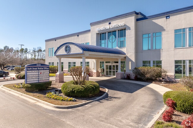
5046 Highway 17 Byp S, Myrtle Beach, SC 29588


NEARBY LISTINGS FOR SALE OR LEASE
Property Detail
5046 Highway 17 Byp S
44702020014
Strand Medical
Medicalbuilding
W OF HWY 17 BYPASS; S STRAND MEDICAL CTR
X
Horry
45051C0711K
South Carolina
2025
0.72 AC
2024
Socastee/Red Hill
051502
Myrtle Beach/Conway
30,000 SF
Myrtle Beach-Conway-North Myrtle Beach, SC
DEMOGRAPHICS near 5046 Highway 17 Byp S
1 Mile
3 Mile
5 Mile
2024 Total Population
7,774
48,404
102,689
2029 Population
9,366
58,746
125,091
Pop Growth 2024-2029
+ 20.48%
+ 21.37%
+ 21.82%
Average Age
45
45
45
2024 Total Households
3,415
20,828
44,064
HH Growth 2024-2029
+ 19.24%
+ 20.16%
+ 20.65%
Median Household Inc
$50,172
$55,727
$54,719
Avg Household Size
2.20
2.20
2.20
2024 Avg HH Vehicles
2.00
2.00
2.00
Median Home Value
$260,884
$235,838
$235,141
Median Year Built
2002
1998
1996
Nearby Places
Map Layers
Map Styles
 Street
 Aerial
- Restaurants
- Banks
- Shops
- Fitness
- Groceries
PUBLIC TRANSPORTATION
AIRPORT
Myrtle Beach International
DRIVE
WALK
Distance
Myrtle Beach International
14 min
6.7 mi
SALE & LEASE HISTORY
LISTING DATE
SALE/LEASE

Jan 07, 2019
For Lease
Nearby Properties
Address
Land Use
TOTAL SIZE
Lot Size
Zoning
Address
Land Use
TOTAL SIZE
Lot Size
Zoning
17,640 SF
240.91 AC
Address
Land Use
TOTAL SIZE
Lot Size
Zoning
304.73 AC
Address
Land Use
TOTAL SIZE
Lot Size
Zoning
146,900 SF
26.59 AC
Address
Land Use
TOTAL SIZE
Lot Size
Zoning
9,190 SF
85.15 AC
Address
Land Use
TOTAL SIZE
Lot Size
Zoning
17,600 SF
66.09 AC
Address
Land Use
TOTAL SIZE
Lot Size
Zoning
74,274 SF
17.09 AC
Address
Land Use
TOTAL SIZE
Lot Size
Zoning
30,786 SF
18.78 AC
Address
Land Use
TOTAL SIZE
Lot Size
Zoning
19,452 SF
20.97 AC
Address
Land Use
TOTAL SIZE
Lot Size
Zoning
28,959 SF
31.56 AC
Address
Land Use
TOTAL SIZE
Lot Size
Zoning
28,056 SF
28.69 AC
Address
Land Use
TOTAL SIZE
Lot Size
Zoning
496.81 AC
Address
Land Use
TOTAL SIZE
Lot Size
Zoning
49,002 SF
16.92 AC
Address
Land Use
TOTAL SIZE
Lot Size
Zoning
27,579 SF
25.33 AC
Address
Land Use
TOTAL SIZE
Lot Size
Zoning
8,540 SF
41.73 AC
Address
Land Use
TOTAL SIZE
Lot Size
Zoning
28,920 SF
9.21 AC
Address
Land Use
TOTAL SIZE
Lot Size
Zoning
636.82 AC
Address
Land Use
TOTAL SIZE
Lot Size
Zoning
66,579 SF
3.92 AC
Address
Land Use
TOTAL SIZE
Lot Size
Zoning
39,275 SF
14.37 AC
Address
Land Use
TOTAL SIZE
Lot Size
Zoning
51,321 SF
1,047.85 AC
Address
Land Use
TOTAL SIZE
Lot Size
Zoning
24,948 SF
14.45 AC
Address
Land Use
TOTAL SIZE
Lot Size
Zoning
146.05 AC
Address
Land Use
TOTAL SIZE
Lot Size
Zoning
194,035 SF
26.79 AC
Address
Land Use
TOTAL SIZE
Lot Size
Zoning
2,720 SF
150.97 AC
Address
Land Use
TOTAL SIZE
Lot Size
Zoning
92,277 SF
8.84 AC
Address
Land Use
TOTAL SIZE
Lot Size
Zoning
30,656 SF
29.24 AC
Address
Land Use
TOTAL SIZE
Lot Size
Zoning
58,370 SF
20.41 AC
The World's #1 Commercial Real Estate Marketplace
Connect with us
© 2026 CoStar Group
The information above has been obtained from sources believed reliable. While we do not doubt its accuracy we have not verified it and make no guarantee, warranty or representation about it. It is your responsibility to independently confirm its accuracy and completeness. Any projections, opinions, assumptions, or estimates used are for example only and do not represent the current or future performance of the property. The value of this transaction to you depends on tax and other factors which should be evaluated by your tax, financial, and legal advisors. You and your advisors should conduct a careful, independent investigation of the property to determine to your satisfaction the suitability of the property for your needs.