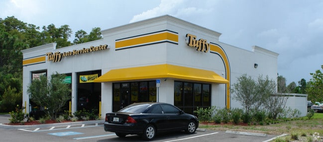
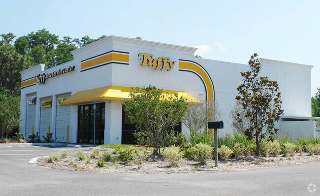
Property Record
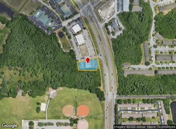
5049 Little Rd, New Port Richey, FL 34655
NEARBY LISTINGS FOR SALE OR LEASE
Property Detail
5049 Little Rd
Tampa-St. Petersburg-Clearwater, FL
Tampa And Tarpon Springs Land Co.
11-26-16-0020-04400-0010
TAMPA TARPON SPRINGS LAND CO PB 1 PG 69 POR OF TRS 43 & 44 DESC AS: COM SE COR OF SEC TH N89DEG 28 24W 60 FT TH 347.60 FT ALG ARC OF CV LEFT RAD 1940.26 FT CHD N04DEG 26 45W 347.20 FT TH N89DEG28 24W 74.64 FT TO POB TH N89DEG 2824W 215.23 FT TO CV L
Commercialnec
Pasco
X
Florida
12101C0356G
1
2024
0.73 AC
2025
Pasco County
031705
Tampa/St Petersburg
4,620 SF
DEMOGRAPHICS near 5049 Little Rd
1 Mile
3 Mile
5 Mile
2024 Total Population
8,787
59,020
166,061
2029 Population
10,480
70,799
199,381
Pop Growth 2024-2029
+ 19.27%
+ 19.96%
+ 20.06%
Average Age
50
45
44
2024 Total Households
4,015
25,607
70,014
HH Growth 2024-2029
+ 19.35%
+ 19.89%
+ 20.03%
Median Household Inc
$60,472
$53,424
$53,856
Avg Household Size
2.10
2.20
2.30
2024 Avg HH Vehicles
2.00
2.00
2.00
Median Home Value
$224,079
$207,001
$218,054
Median Year Built
1988
1985
1984
Nearby Places
Map Layers
Map Styles
 Street
 Aerial
- Restaurants
- Banks
- Shops
- Fitness
- Groceries
PUBLIC TRANSPORTATION
AIRPORT
St Pete-Clearwater International
DRIVE
WALK
Distance
St Pete-Clearwater International
51 min
29.0 mi
Tampa International
DRIVE
WALK
Distance
Tampa International
43 min
29.8 mi
Freight Ports
Port of Tampa Bay
DRIVE
WALK
Distance
Port of Tampa Bay
56 min
35.3 mi
Nearby Properties
Address
Land Use
TOTAL SIZE
Lot Size
Zoning
Address
Land Use
TOTAL SIZE
Lot Size
Zoning
403,054 SF
117.69 AC
MPUD
Address
Land Use
TOTAL SIZE
Lot Size
Zoning
799,241 SF
88.92 AC
PUD
Address
Land Use
TOTAL SIZE
Lot Size
Zoning
203,571 SF
13.82 AC
C2
Address
Land Use
TOTAL SIZE
Lot Size
Zoning
229,050 SF
36.13 AC
MPUD
Address
Land Use
TOTAL SIZE
Lot Size
Zoning
143,332 SF
17.40 AC
C2
Address
Land Use
TOTAL SIZE
Lot Size
Zoning
416,037 SF
50.65 AC
C1
Address
Land Use
TOTAL SIZE
Lot Size
Zoning
113,034 SF
15.21 AC
MPUD
Address
Land Use
TOTAL SIZE
Lot Size
Zoning
141,740 SF
22.84 AC
PO1
Address
Land Use
TOTAL SIZE
Lot Size
Zoning
162,716 SF
16.56 AC
MF1
Address
Land Use
TOTAL SIZE
Lot Size
Zoning
171,378 SF
17.35 AC
MF1
Address
Land Use
TOTAL SIZE
Lot Size
Zoning
193,971 SF
4.50 AC
C1
Address
Land Use
TOTAL SIZE
Lot Size
Zoning
191,812 SF
17.61 AC
MPUD
Address
Land Use
TOTAL SIZE
Lot Size
Zoning
114,831 SF
7.98 AC
MF2
Address
Land Use
TOTAL SIZE
Lot Size
Zoning
116,607 SF
3.88 AC
MPUD
Address
Land Use
TOTAL SIZE
Lot Size
Zoning
135,600 SF
13.34 AC
MF1
Address
Land Use
TOTAL SIZE
Lot Size
Zoning
217,376 SF
22.12 AC
C2
Address
Land Use
TOTAL SIZE
Lot Size
Zoning
112,703 SF
8.43 AC
C2
Address
Land Use
TOTAL SIZE
Lot Size
Zoning
85,547 SF
16.13 AC
MPUD
Address
Land Use
TOTAL SIZE
Lot Size
Zoning
142,856 SF
20 AC
C
Address
Land Use
TOTAL SIZE
Lot Size
Zoning
89,308 SF
0.58 AC
C2
Address
Land Use
TOTAL SIZE
Lot Size
Zoning
75,844 SF
2.75 AC
C2
Address
Land Use
TOTAL SIZE
Lot Size
Zoning
90,231 SF
14.67 AC
C2
Address
Land Use
TOTAL SIZE
Lot Size
Zoning
93,304 SF
18.82 AC
MF1
Address
Land Use
TOTAL SIZE
Lot Size
Zoning
133,304 SF
13.48 AC
C2
Address
Land Use
TOTAL SIZE
Lot Size
Zoning
81,272 SF
47.25 AC
MF2
Address
Land Use
TOTAL SIZE
Lot Size
Zoning
53,055 SF
5.71 AC
C2
Address
Land Use
TOTAL SIZE
Lot Size
Zoning
52,696 SF
5.64 AC
C2
Address
Land Use
TOTAL SIZE
Lot Size
Zoning
55,165 SF
8.90 AC
C2
Address
Land Use
TOTAL SIZE
Lot Size
Zoning
37,391 SF
3.54 AC
C2
The World's #1 Commercial Real Estate Marketplace
Connect with us
© 2025 CoStar Group
The information above has been obtained from sources believed reliable. While we do not doubt its accuracy we have not verified it and make no guarantee, warranty or representation about it. It is your responsibility to independently confirm its accuracy and completeness. Any projections, opinions, assumptions, or estimates used are for example only and do not represent the current or future performance of the property. The value of this transaction to you depends on tax and other factors which should be evaluated by your tax, financial, and legal advisors. You and your advisors should conduct a careful, independent investigation of the property to determine to your satisfaction the suitability of the property for your needs.