Property Record
505 E Santa Clara St, San Jose, CA 95112
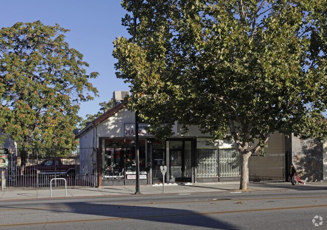


Property Detail
505 E Santa Clara St
Multifamilydwelling
Santa Clara
CP(PD
California
D Areas with possible but undetermined flood hazards.
0.63 AC
2024
Downtown San Jose
2025
South Bay/San Jose
501200
San Jose-Sunnyvale-Santa Clara, CA
78,878 SF
467-16-100
NEARBY LISTINGS FOR SALE OR LEASE
DEMOGRAPHICS near 505 E Santa Clara St
1 mile
3 mile
5 mile
2025 Total Population
49,962
275,962
652,372
2030 Population
51,629
281,871
665,256
Pop Growth 2025-2030
+ 3.34%
+ 2.14%
+ 1.97%
Average Age
37
38
39
2025 Total Households
18,311
89,690
210,052
HH Growth 2025-2030
+ 4.04%
+ 2.43%
+ 2.21%
Median Household Inc
$94,803
$108,711
$125,835
Avg Household Size
2.40
2.80
2.90
2025 Avg HH Vehicles
2.00
2.00
2.00
Median Home Value
$1,029,025
$1,015,816
$1,054,284
Median Year Built
1971
1976
1974
Nearby Places
Map Layers
Map Styles
 Street
 Aerial
Layers
 Traffic
 Biking
Places
Listings with unknown addresses are not visible on the map
- Restaurants
- Banks
- Shops
- Fitness
- Groceries
PUBLIC TRANSPORTATION
TRANSIT/SUBWAY
Santa Clara Station southbound (Alum Rock - Santa Teresa Line - Santa Clara VTA Light Rail, Mountain View - Winchester Line - Santa Clara VTA Light Rail)
Drive
Walk
Distance
Santa Clara Station southbound (Alum Rock - Santa Teresa Line - Santa Clara VTA Light Rail, Mountain View - Winchester Line - Santa Clara VTA Light Rail)
3 min
13 min
0.7 mi
St. James Station southbound (Alum Rock - Santa Teresa Line - Santa Clara VTA Light Rail, Mountain View - Winchester Line - Santa Clara VTA Light Rail)
Drive
Walk
Distance
St. James Station southbound (Alum Rock - Santa Teresa Line - Santa Clara VTA Light Rail, Mountain View - Winchester Line - Santa Clara VTA Light Rail)
3 min
14 min
0.7 mi
Santa Clara Station northbound (Alum Rock - Santa Teresa Line - Santa Clara VTA Light Rail, Mountain View - Winchester Line - Santa Clara VTA Light Rail)
Drive
Walk
Distance
Santa Clara Station northbound (Alum Rock - Santa Teresa Line - Santa Clara VTA Light Rail, Mountain View - Winchester Line - Santa Clara VTA Light Rail)
3 min
15 min
0.8 mi
St. James Station northbound (Alum Rock - Santa Teresa Line - Santa Clara VTA Light Rail, Mountain View - Winchester Line - Santa Clara VTA Light Rail)
Drive
Walk
Distance
St. James Station northbound (Alum Rock - Santa Teresa Line - Santa Clara VTA Light Rail, Mountain View - Winchester Line - Santa Clara VTA Light Rail)
3 min
16 min
0.8 mi
Paseo de San Antonio Station northbound (Alum Rock - Santa Teresa Line - Santa Clara VTA Light Rail, Mountain View - Winchester Line - Santa Clara VTA Light Rail)
Drive
Walk
Distance
Paseo de San Antonio Station northbound (Alum Rock - Santa Teresa Line - Santa Clara VTA Light Rail, Mountain View - Winchester Line - Santa Clara VTA Light Rail)
4 min
18 min
1.0 mi
COMMUTER RAIL
Drive
Walk
Distance
5 min
1.8 mi
Drive
Walk
Distance
5 min
1.8 mi
AIRPORT
Norman Y Mineta San Jose International
Drive
Walk
Distance
Norman Y Mineta San Jose International
9 min
4.0 mi
Metro Oakland International
Drive
Walk
Distance
Metro Oakland International
46 min
35.5 mi
San Francisco International
Drive
Walk
Distance
San Francisco International
46 min
36.4 mi
Freight Ports
Port of Redwood City
Drive
Walk
Distance
Port of Redwood City
32 min
23.2 mi
The World's #1 Commercial Real Estate Marketplace
Connect with us
© 2026 CoStar Group
The information above has been obtained from sources believed reliable. While we do not doubt its accuracy we have not verified it and make no guarantee, warranty or representation about it. It is your responsibility to independently confirm its accuracy and completeness. Any projections, opinions, assumptions, or estimates used are for example only and do not represent the current or future performance of the property. The value of this transaction to you depends on tax and other factors which should be evaluated by your tax, financial, and legal advisors. You and your advisors should conduct a careful, independent investigation of the property to determine to your satisfaction the suitability of the property for your needs.