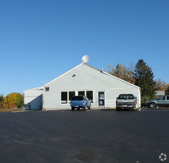
Property Record
505 Fairview Ave, Hudson, NY 12534


NEARBY LISTINGS FOR SALE OR LEASE
Property Detail
505 Fairview Ave
Hudson, NY
Columbia
104000-100-002-0001-004-100-0000
New York
Servicestationmarket
4.100
2025
1.60 AC
2024
Columbia County
001100
Albany/Schenectady/Troy
5,550 SF
DEMOGRAPHICS near 505 Fairview Ave
1 Mile
3 Mile
5 Mile
2024 Total Population
1,341
13,556
20,708
2029 Population
1,311
13,497
20,676
Pop Growth 2024-2029
(2.24%)
(0.44%)
(0.15%)
Average Age
44
44
45
2024 Total Households
590
6,125
9,204
HH Growth 2024-2029
(2.20%)
(0.41%)
(0.15%)
Median Household Inc
$65,333
$58,439
$64,277
Avg Household Size
2.20
2.10
2.10
2024 Avg HH Vehicles
2.00
2.00
2.00
Median Home Value
$172,981
$225,978
$234,377
Median Year Built
1964
1958
1966
Nearby Places
Map Layers
Map Styles
 Street
 Aerial
- Restaurants
- Banks
- Shops
- Fitness
- Groceries
PUBLIC TRANSPORTATION
COMMUTER RAIL
Hudson Amtrak Station (Adirondack - Amtrak, Empire Service - Amtrak, Ethan Allen Express - Amtrak, Maple Leaf - Amtrak)
DRIVE
WALK
Distance
Hudson Amtrak Station (Adirondack - Amtrak, Empire Service - Amtrak, Ethan Allen Express - Amtrak, Maple Leaf - Amtrak)
9 min
4.4 mi
Hudson (Toronto - New York - VIA Rail)
DRIVE
WALK
Distance
Hudson (Toronto - New York - VIA Rail)
10 min
4.6 mi
Freight Ports
Albany, NY Port
DRIVE
WALK
Distance
Albany, NY Port
48 min
32.8 mi
Nearby Properties
Address
Land Use
TOTAL SIZE
Lot Size
Zoning
Address
Land Use
TOTAL SIZE
Lot Size
Zoning
177,400 SF
6.30 AC
R5
Address
Land Use
TOTAL SIZE
Lot Size
Zoning
204,480 SF
20.37 AC
402
Address
Land Use
TOTAL SIZE
Lot Size
Zoning
132,945 SF
21.60 AC
R1
Address
Land Use
TOTAL SIZE
Lot Size
Zoning
72,014 SF
1.30 AC
R5
Address
Land Use
TOTAL SIZE
Lot Size
Zoning
60,741 SF
7.75 AC
06 - INDUS
Address
Land Use
TOTAL SIZE
Lot Size
Zoning
63,446 SF
9.40 AC
402
Address
Land Use
TOTAL SIZE
Lot Size
Zoning
153,801 SF
24.87 AC
0402
Address
Land Use
TOTAL SIZE
Lot Size
Zoning
Address
Land Use
TOTAL SIZE
Lot Size
Zoning
Address
Land Use
TOTAL SIZE
Lot Size
Zoning
110,000 SF
17.67 AC
402
Address
Land Use
TOTAL SIZE
Lot Size
Zoning
Address
Land Use
TOTAL SIZE
Lot Size
Zoning
136,833 SF
18.34 AC
402
Address
Land Use
TOTAL SIZE
Lot Size
Zoning
41,454 SF
0.76 AC
CC
Address
Land Use
TOTAL SIZE
Lot Size
Zoning
107,088 SF
11.90 AC
BP C
Address
Land Use
TOTAL SIZE
Lot Size
Zoning
26,048 SF
5.51 AC
07 - MIXED
Address
Land Use
TOTAL SIZE
Lot Size
Zoning
102,761 SF
10.07 AC
0402
Address
Land Use
TOTAL SIZE
Lot Size
Zoning
74,072 SF
5.30 AC
R1
Address
Land Use
TOTAL SIZE
Lot Size
Zoning
103,366 SF
1.30 AC
R5
Address
Land Use
TOTAL SIZE
Lot Size
Zoning
21,960 SF
11.36 AC
08 - GOVER
Address
Land Use
TOTAL SIZE
Lot Size
Zoning
57,865 SF
6.20 AC
402
Address
Land Use
TOTAL SIZE
Lot Size
Zoning
Address
Land Use
TOTAL SIZE
Lot Size
Zoning
7,176 SF
2.50 AC
R4
Address
Land Use
TOTAL SIZE
Lot Size
Zoning
19,896 SF
3.90 AC
07 - MIXED
Address
Land Use
TOTAL SIZE
Lot Size
Zoning
107,268 SF
4.43 AC
GC
Address
Land Use
TOTAL SIZE
Lot Size
Zoning
76,750 SF
1.20 AC
GC
Address
Land Use
TOTAL SIZE
Lot Size
Zoning
23,512 SF
0.41 AC
I1
Address
Land Use
TOTAL SIZE
Lot Size
Zoning
27,772 SF
15.11 AC
402
Address
Land Use
TOTAL SIZE
Lot Size
Zoning
75,946 SF
7.40 AC
06 - INDUS
Address
Land Use
TOTAL SIZE
Lot Size
Zoning
14,744 SF
0.21 AC
CC
Address
Land Use
TOTAL SIZE
Lot Size
Zoning
3,000 SF
90.03 AC
07 - MIXED
The World's #1 Commercial Real Estate Marketplace
Connect with us
© 2026 CoStar Group
The information above has been obtained from sources believed reliable. While we do not doubt its accuracy we have not verified it and make no guarantee, warranty or representation about it. It is your responsibility to independently confirm its accuracy and completeness. Any projections, opinions, assumptions, or estimates used are for example only and do not represent the current or future performance of the property. The value of this transaction to you depends on tax and other factors which should be evaluated by your tax, financial, and legal advisors. You and your advisors should conduct a careful, independent investigation of the property to determine to your satisfaction the suitability of the property for your needs.