Property Record
505 Nashua Rd, Dracut, MA 01826
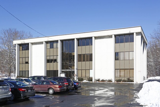

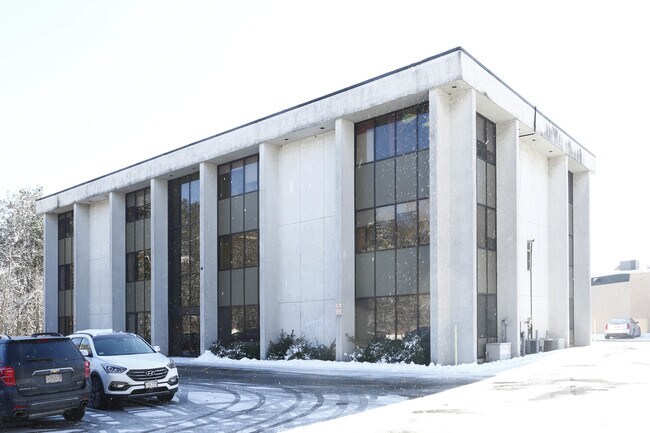
Property Detail
505 Nashua Rd
DRAC-000031-000010-000003-000001
Middlesex
Officecondo
Massachusetts
A Areas with a 1% annual chance of flooding and a 26% chance of flooding over the life of a 30-year mortgage.
3.1
2025
Groton/Townsend
2025
Boston
314101
Boston-Cambridge-Newton, MA-NH
1,057 SF
NEARBY LISTINGS FOR SALE OR LEASE
DEMOGRAPHICS near 505 Nashua Rd
1 mile
3 mile
5 mile
2025 Total Population
8,081
54,234
181,334
2030 Population
8,369
55,899
186,865
Pop Growth 2025-2030
+ 3.56%
+ 3.07%
+ 3.05%
Average Age
42
41
40
2025 Total Households
3,001
20,124
66,631
HH Growth 2025-2030
+ 3.67%
+ 3.17%
+ 3.20%
Median Household Inc
$112,460
$102,162
$92,891
Avg Household Size
2.60
2.60
2.60
2025 Avg HH Vehicles
2.00
2.00
2.00
Median Home Value
$476,567
$463,391
$474,515
Median Year Built
1981
1976
1966
Nearby Places
Map Layers
Map Styles
 Street
 Aerial
Layers
 Traffic
 Biking
Places
Listings with unknown addresses are not visible on the map
- Restaurants
- Banks
- Shops
- Fitness
- Groceries
PUBLIC TRANSPORTATION
COMMUTER RAIL
Lowell (Lowell Line - Massachusetts Bay Transportation Authority Commuter Rail (Purple Line))
Drive
Walk
Distance
Lowell (Lowell Line - Massachusetts Bay Transportation Authority Commuter Rail (Purple Line))
9 min
4.4 mi
North Billerica (Lowell Line - Massachusetts Bay Transportation Authority Commuter Rail (Purple Line))
Drive
Walk
Distance
North Billerica (Lowell Line - Massachusetts Bay Transportation Authority Commuter Rail (Purple Line))
18 min
8.6 mi
AIRPORT
Manchester Boston Regional
Drive
Walk
Distance
Manchester Boston Regional
40 min
24.4 mi
General Edward Lawrence Logan International
Drive
Walk
Distance
General Edward Lawrence Logan International
54 min
34.6 mi
SALE & LEASE HISTORY
LISTING DATE
SALE/LEASE

Jun 19, 2020
For Sale
Nearby Properties
Address
Land Use
TOTAL SIZE
Lot Size
Zoning
Address
Land Use
TOTAL SIZE
Lot Size
Zoning
70.20 AC
R3
Address
Land Use
TOTAL SIZE
Lot Size
Zoning
30,744 SF
31.28 AC
INST
Address
Land Use
TOTAL SIZE
Lot Size
Zoning
23,251 SF
18.20 AC
SMF
Address
Land Use
TOTAL SIZE
Lot Size
Zoning
2.15 AC
INST
Address
Land Use
TOTAL SIZE
Lot Size
Zoning
59.09 AC
SSF
Address
Land Use
TOTAL SIZE
Lot Size
Zoning
68.15 AC
R1
Address
Land Use
TOTAL SIZE
Lot Size
Zoning
10.48 AC
INST
Address
Land Use
TOTAL SIZE
Lot Size
Zoning
2.62 AC
INST
Address
Land Use
TOTAL SIZE
Lot Size
Zoning
7.25 AC
INST
Address
Land Use
TOTAL SIZE
Lot Size
Zoning
63,768 SF
8.83 AC
SMU
Address
Land Use
TOTAL SIZE
Lot Size
Zoning
33.01 AC
R3
Address
Land Use
TOTAL SIZE
Lot Size
Zoning
44.39 AC
SMU
Address
Land Use
TOTAL SIZE
Lot Size
Zoning
45.10 AC
R1
Address
Land Use
TOTAL SIZE
Lot Size
Zoning
8.30 AC
B3
Address
Land Use
TOTAL SIZE
Lot Size
Zoning
119,372 SF
1.74 AC
INST
Address
Land Use
TOTAL SIZE
Lot Size
Zoning
73,965 SF
1.33 AC
TTF
Address
Land Use
TOTAL SIZE
Lot Size
Zoning
3,822 SF
1.88 AC
INST
Address
Land Use
TOTAL SIZE
Lot Size
Zoning
177.27 AC
R1
Address
Land Use
TOTAL SIZE
Lot Size
Zoning
53,811 SF
4.51 AC
TMUOTHR
Address
Land Use
TOTAL SIZE
Lot Size
Zoning
91,202 SF
12.65 AC
SMU
Address
Land Use
TOTAL SIZE
Lot Size
Zoning
4.33 AC
R3
Address
Land Use
TOTAL SIZE
Lot Size
Zoning
42,419 SF
2.80 AC
SSF
Address
Land Use
TOTAL SIZE
Lot Size
Zoning
50,000 SF
33.40 AC
IA
Address
Land Use
TOTAL SIZE
Lot Size
Zoning
8.20 AC
SSF
Address
Land Use
TOTAL SIZE
Lot Size
Zoning
71,911 SF
31.55 AC
SSF
Address
Land Use
TOTAL SIZE
Lot Size
Zoning
4.88 AC
R1
Address
Land Use
TOTAL SIZE
Lot Size
Zoning
3.77 AC
B3
Address
Land Use
TOTAL SIZE
Lot Size
Zoning
82,565 SF
1.54 AC
TMUOTHR
Address
Land Use
TOTAL SIZE
Lot Size
Zoning
171,166 SF
11 AC
I
Address
Land Use
TOTAL SIZE
Lot Size
Zoning
576 SF
19.97 AC
SMU
The World's #1 Commercial Real Estate Marketplace
Connect with us
© 2026 CoStar Group
The information above has been obtained from sources believed reliable. While we do not doubt its accuracy we have not verified it and make no guarantee, warranty or representation about it. It is your responsibility to independently confirm its accuracy and completeness. Any projections, opinions, assumptions, or estimates used are for example only and do not represent the current or future performance of the property. The value of this transaction to you depends on tax and other factors which should be evaluated by your tax, financial, and legal advisors. You and your advisors should conduct a careful, independent investigation of the property to determine to your satisfaction the suitability of the property for your needs.