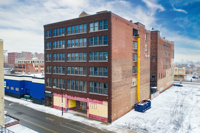
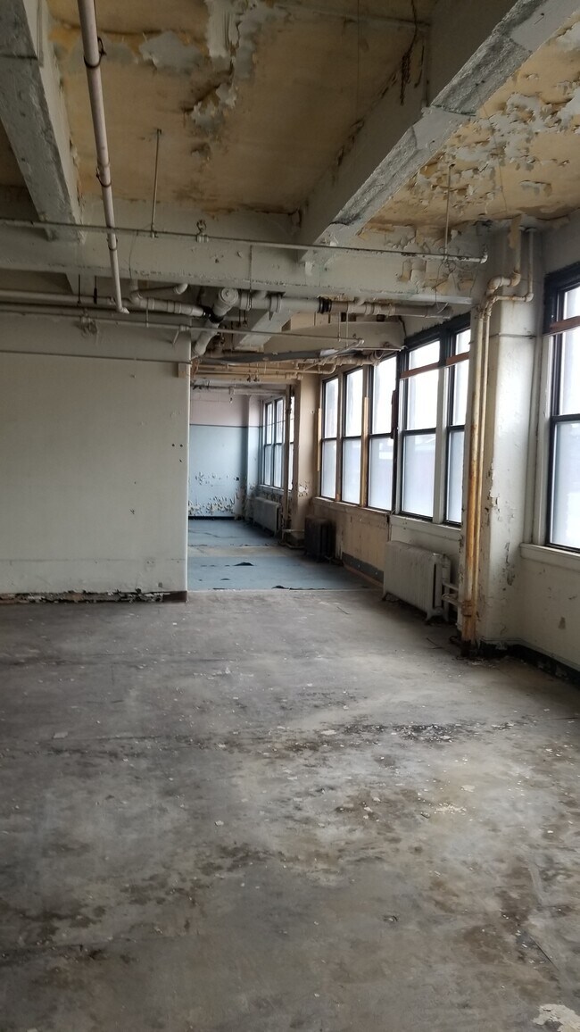
Property Record
505 Pearl St, Buffalo, NY 14202
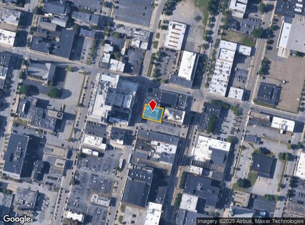
NEARBY LISTINGS FOR SALE OR LEASE
Property Detail
505 Pearl St
140200-111-300-0005-001-000
86.5O S TUPPER
Commercialofficeresidentialmixeduse
Erie
X
New York
36029C0213H
1.000
2025
0.18 AC
2024
Buffalo CBD
016500
Buffalo/Niagara Falls
41,580 SF
Buffalo-Cheektowaga-Niagara Falls, NY
DEMOGRAPHICS near 505 Pearl St
1 Mile
3 Mile
5 Mile
2024 Total Population
25,822
113,797
278,399
2029 Population
25,954
111,867
271,233
Pop Growth 2024-2029
+ 0.51%
(1.70%)
(2.57%)
Average Age
39
37
38
2024 Total Households
13,826
51,257
120,926
HH Growth 2024-2029
+ 0.66%
(1.51%)
(2.53%)
Median Household Inc
$38,118
$39,133
$43,236
Avg Household Size
1.80
2.10
2.20
2024 Avg HH Vehicles
1.00
1.00
1.00
Median Home Value
$258,762
$172,934
$143,153
Median Year Built
1948
1946
1946
Nearby Places
- Restaurants
- Banks
- Shops
- Fitness
- Groceries
PUBLIC TRANSPORTATION
TRANSIT/SUBWAY
Fountain Plaza (Buffalo Metro Rail - Niagara Frontier Transportation Authority Light Rail (Buffalo Metro Rail))
DRIVE
WALK
Distance
Fountain Plaza (Buffalo Metro Rail - Niagara Frontier Transportation Authority Light Rail (Buffalo Metro Rail))
1 min
6 min
0.3 mi
Lafayette Square (Buffalo Metro Rail - Niagara Frontier Transportation Authority Light Rail (Buffalo Metro Rail))
DRIVE
WALK
Distance
Lafayette Square (Buffalo Metro Rail - Niagara Frontier Transportation Authority Light Rail (Buffalo Metro Rail))
2 min
10 min
0.5 mi
Allen/Medical Campus (Buffalo Metro Rail - Niagara Frontier Transportation Authority Light Rail (Buffalo Metro Rail))
DRIVE
WALK
Distance
Allen/Medical Campus (Buffalo Metro Rail - Niagara Frontier Transportation Authority Light Rail (Buffalo Metro Rail))
2 min
11 min
0.5 mi
Church (Buffalo Metro Rail - Niagara Frontier Transportation Authority Light Rail (Buffalo Metro Rail))
DRIVE
WALK
Distance
Church (Buffalo Metro Rail - Niagara Frontier Transportation Authority Light Rail (Buffalo Metro Rail))
3 min
14 min
0.7 mi
COMMUTER RAIL
DRIVE
WALK
Distance
4 min
1.3 mi
AIRPORT
Buffalo Niagara International
DRIVE
WALK
Distance
Buffalo Niagara International
18 min
11.0 mi
Niagara Falls International
DRIVE
WALK
Distance
Niagara Falls International
31 min
20.2 mi
SALE & LEASE HISTORY
LISTING DATE
SALE/LEASE

Oct 15, 2020
For Sale
Jun 02, 2017
For Lease
Dec 30, 2020
For Sale
Nearby Properties
Address
Land Use
TOTAL SIZE
Lot Size
Zoning
Address
Land Use
TOTAL SIZE
Lot Size
Zoning
1,053,391 SF
88.26 AC
D-IL
Address
Land Use
TOTAL SIZE
Lot Size
Zoning
6,120 SF
87.10 AC
D-IL
Address
Land Use
TOTAL SIZE
Lot Size
Zoning
704,072 SF
8.61 AC
N-1C
Address
Land Use
TOTAL SIZE
Lot Size
Zoning
401,805 SF
2.04 AC
D-M
Address
Land Use
TOTAL SIZE
Lot Size
Zoning
166,250 SF
0.59 AC
D-M
Address
Land Use
TOTAL SIZE
Lot Size
Zoning
Address
Land Use
TOTAL SIZE
Lot Size
Zoning
151,371 SF
0.51 AC
D-M
Address
Land Use
TOTAL SIZE
Lot Size
Zoning
8,317 SF
39.03 AC
SPLIT ZONE
Address
Land Use
TOTAL SIZE
Lot Size
Zoning
117,679 SF
0.41 AC
N-1C
Address
Land Use
TOTAL SIZE
Lot Size
Zoning
870,511 SF
4.40 AC
D-M
Address
Land Use
TOTAL SIZE
Lot Size
Zoning
121,015 SF
92.60 AC
D-E
Address
Land Use
TOTAL SIZE
Lot Size
Zoning
686,000 SF
3.62 AC
N-2R
Address
Land Use
TOTAL SIZE
Lot Size
Zoning
240,783 SF
1.63 AC
N-1D
Address
Land Use
TOTAL SIZE
Lot Size
Zoning
288,014 SF
3.68 AC
N-1C
Address
Land Use
TOTAL SIZE
Lot Size
Zoning
561,196 SF
16 AC
D-M
Address
Land Use
TOTAL SIZE
Lot Size
Zoning
658,732 SF
1.83 AC
N-1D
Address
Land Use
TOTAL SIZE
Lot Size
Zoning
251,908 SF
D-M
Address
Land Use
TOTAL SIZE
Lot Size
Zoning
86,825 SF
1.57 AC
D-M
Address
Land Use
TOTAL SIZE
Lot Size
Zoning
74,316 SF
0.25 AC
D-M
Address
Land Use
TOTAL SIZE
Lot Size
Zoning
569,121 SF
1.04 AC
N-1D
Address
Land Use
TOTAL SIZE
Lot Size
Zoning
896,000 SF
3.99 AC
N-1D
Address
Land Use
TOTAL SIZE
Lot Size
Zoning
21,200 SF
20.94 AC
D-IL
Address
Land Use
TOTAL SIZE
Lot Size
Zoning
66,655 SF
0.25 AC
D-M
Address
Land Use
TOTAL SIZE
Lot Size
Zoning
421,249 SF
10.62 AC
N-1D
Address
Land Use
TOTAL SIZE
Lot Size
Zoning
45,033 SF
1.18 AC
N-1C
Address
Land Use
TOTAL SIZE
Lot Size
Zoning
36,325 SF
12.50 AC
D-E
Address
Land Use
TOTAL SIZE
Lot Size
Zoning
611,620 SF
2.20 AC
N-1S
Address
Land Use
TOTAL SIZE
Lot Size
Zoning
321,589 SF
1.95 AC
N-1C
Address
Land Use
TOTAL SIZE
Lot Size
Zoning
465,720 SF
1.98 AC
N-1D
Address
Land Use
TOTAL SIZE
Lot Size
Zoning
12,641 SF
0.56 AC
N-2C
The World's #1 Commercial Real Estate Marketplace
Connect with us
© 2025 CoStar Group
The information above has been obtained from sources believed reliable. While we do not doubt its accuracy we have not verified it and make no guarantee, warranty or representation about it. It is your responsibility to independently confirm its accuracy and completeness. Any projections, opinions, assumptions, or estimates used are for example only and do not represent the current or future performance of the property. The value of this transaction to you depends on tax and other factors which should be evaluated by your tax, financial, and legal advisors. You and your advisors should conduct a careful, independent investigation of the property to determine to your satisfaction the suitability of the property for your needs.