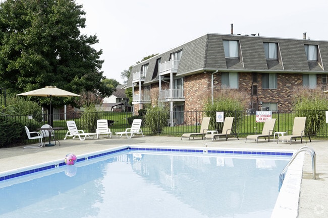
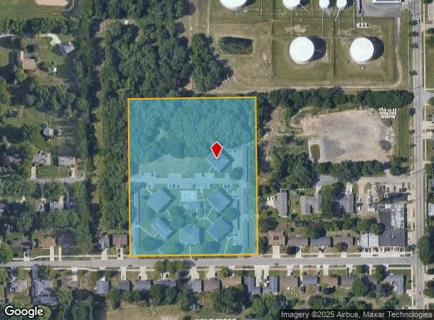
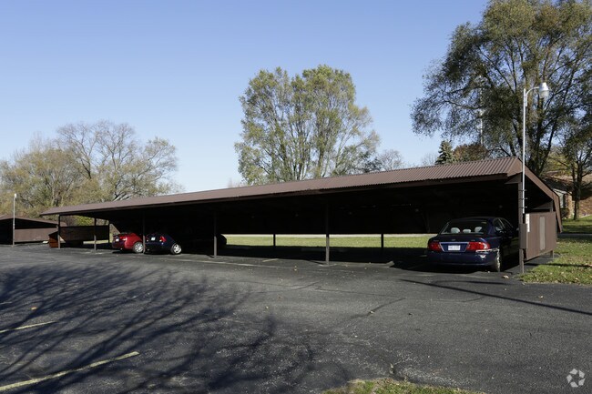
Property Record
505 W 30Th St, Holland, MI 49423
NEARBY LISTINGS FOR SALE OR LEASE
Property Detail
505 W 30Th St
70-16-31-300-044
Sandy Sub
Multifamilydwelling
ALL THAT PART OF W 1/2 SW 1/4 SW 1/4 COM ON N LI OF 30TH ST, 153 FT E OF E LI OF SANDY SUB #1 TH N 627 FT E 51631 FT, S 6 27
X
Ottawa
26005C0020G
Michigan
2025
7.42 AC
2025
Downtown Holland
025700
West Michigan
76,437 SF
Grand Rapids-Wyoming, MI
DEMOGRAPHICS near 505 W 30Th St
1 Mile
3 Mile
5 Mile
2024 Total Population
9,222
45,659
85,597
2029 Population
9,530
47,498
89,362
Pop Growth 2024-2029
+ 3.34%
+ 4.03%
+ 4.40%
Average Age
39
39
40
2024 Total Households
3,559
17,154
32,308
HH Growth 2024-2029
+ 3.26%
+ 4.14%
+ 4.54%
Median Household Inc
$64,636
$70,723
$73,202
Avg Household Size
2.50
2.50
2.50
2024 Avg HH Vehicles
2.00
2.00
2.00
Median Home Value
$206,735
$233,090
$245,499
Median Year Built
1958
1970
1981
Nearby Places
Map Layers
Map Styles
 Street
 Aerial
- Restaurants
- Banks
- Shops
- Fitness
- Groceries
PUBLIC TRANSPORTATION
COMMUTER RAIL
Holland Amtrak Station (Pere Marquette - Amtrak)
DRIVE
WALK
Distance
Holland Amtrak Station (Pere Marquette - Amtrak)
8 min
3.2 mi
Freight Ports
Port Milwaukee
DRIVE
WALK
Distance
Port Milwaukee
276 min
234.6 mi
Nearby Properties
Address
Land Use
TOTAL SIZE
Lot Size
Zoning
Address
Land Use
TOTAL SIZE
Lot Size
Zoning
572,832 SF
10.89 AC
PUD
Address
Land Use
TOTAL SIZE
Lot Size
Zoning
1,788,352 SF
173.33 AC
Address
Land Use
TOTAL SIZE
Lot Size
Zoning
682,378 SF
99.60 AC
NA
Address
Land Use
TOTAL SIZE
Lot Size
Zoning
198,712 SF
Address
Land Use
TOTAL SIZE
Lot Size
Zoning
556,819 SF
85.45 AC
Address
Land Use
TOTAL SIZE
Lot Size
Zoning
660,002 SF
32.13 AC
I-2
Address
Land Use
TOTAL SIZE
Lot Size
Zoning
329,784 SF
38.51 AC
I-2
Address
Land Use
TOTAL SIZE
Lot Size
Zoning
674,052 SF
79.30 AC
Address
Land Use
TOTAL SIZE
Lot Size
Zoning
154,107 SF
Address
Land Use
TOTAL SIZE
Lot Size
Zoning
239,465 SF
Address
Land Use
TOTAL SIZE
Lot Size
Zoning
589,649 SF
92.65 AC
Address
Land Use
TOTAL SIZE
Lot Size
Zoning
94,790 SF
1.74 AC
C-2
Address
Land Use
TOTAL SIZE
Lot Size
Zoning
177,800 SF
12.34 AC
I-2
Address
Land Use
TOTAL SIZE
Lot Size
Zoning
114,088 SF
10.79 AC
PRD
Address
Land Use
TOTAL SIZE
Lot Size
Zoning
181,754 SF
13.44 AC
R3
Address
Land Use
TOTAL SIZE
Lot Size
Zoning
228,876 SF
49.31 AC
GMU
Address
Land Use
TOTAL SIZE
Lot Size
Zoning
372,017 SF
17.60 AC
R-2
Address
Land Use
TOTAL SIZE
Lot Size
Zoning
73,700 SF
Address
Land Use
TOTAL SIZE
Lot Size
Zoning
397,258 SF
36.66 AC
I2
Address
Land Use
TOTAL SIZE
Lot Size
Zoning
158,661 SF
17.28 AC
Address
Land Use
TOTAL SIZE
Lot Size
Zoning
122,026 SF
15.03 AC
R3
Address
Land Use
TOTAL SIZE
Lot Size
Zoning
146,357 SF
20.04 AC
Address
Land Use
TOTAL SIZE
Lot Size
Zoning
22,344 SF
8.16 AC
R-3
Address
Land Use
TOTAL SIZE
Lot Size
Zoning
73,663 SF
4.66 AC
Address
Land Use
TOTAL SIZE
Lot Size
Zoning
152,926 SF
8.83 AC
I-2
Address
Land Use
TOTAL SIZE
Lot Size
Zoning
386,644 SF
22.74 AC
I
Address
Land Use
TOTAL SIZE
Lot Size
Zoning
201,907 SF
15.96 AC
I-2
Address
Land Use
TOTAL SIZE
Lot Size
Zoning
132,108 SF
9.97 AC
I-1
Address
Land Use
TOTAL SIZE
Lot Size
Zoning
124,176 SF
7.88 AC
I
Address
Land Use
TOTAL SIZE
Lot Size
Zoning
55,088 SF
The World's #1 Commercial Real Estate Marketplace
Connect with us
© 2026 CoStar Group
The information above has been obtained from sources believed reliable. While we do not doubt its accuracy we have not verified it and make no guarantee, warranty or representation about it. It is your responsibility to independently confirm its accuracy and completeness. Any projections, opinions, assumptions, or estimates used are for example only and do not represent the current or future performance of the property. The value of this transaction to you depends on tax and other factors which should be evaluated by your tax, financial, and legal advisors. You and your advisors should conduct a careful, independent investigation of the property to determine to your satisfaction the suitability of the property for your needs.