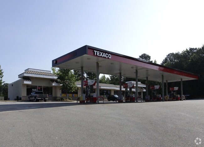
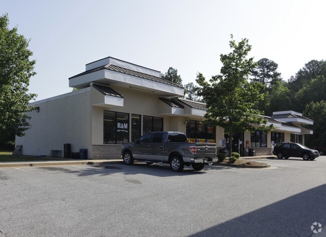
Property Record
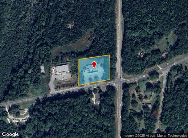
505 W Highway 34 W, Newnan, GA 30263

NEARBY LISTINGS FOR SALE OR LEASE
Property Detail
505 W Highway 34 W
Atlanta-Sandy Springs-Roswell, GA
Commonwealth Land Title Ins Co
048-5034-001A
CONVENIENCE STORE/2.00 AC HWY 34 WEST LL 34 5
Storebuilding
Coweta
X
Georgia
13077C0140D
34
2025
2 AC
2025
Coweta County
170702
Atlanta
5,642 SF
DEMOGRAPHICS near 505 W Highway 34 W
1 Mile
3 Mile
5 Mile
2024 Total Population
963
16,940
46,146
2029 Population
1,071
18,845
51,406
Pop Growth 2024-2029
+ 11.21%
+ 11.25%
+ 11.40%
Average Age
40
40
39
2024 Total Households
351
6,326
17,585
HH Growth 2024-2029
+ 11.40%
+ 11.32%
+ 11.45%
Median Household Inc
$67,727
$73,017
$66,561
Avg Household Size
2.60
2.60
2.60
2024 Avg HH Vehicles
2.00
2.00
2.00
Median Home Value
$223,636
$230,568
$233,438
Median Year Built
1985
1981
1990
Nearby Places
Map Layers
Map Styles
 Street
 Aerial
- Restaurants
- Banks
- Shops
- Fitness
- Groceries
Nearby Properties
Address
Land Use
TOTAL SIZE
Lot Size
Zoning
Address
Land Use
TOTAL SIZE
Lot Size
Zoning
205,636 SF
32 AC
R1
Address
Land Use
TOTAL SIZE
Lot Size
Zoning
136,343 SF
19.77 AC
R2
Address
Land Use
TOTAL SIZE
Lot Size
Zoning
71,484 SF
45.43 AC
R1
Address
Land Use
TOTAL SIZE
Lot Size
Zoning
128,510 SF
25.10 AC
R1
Address
Land Use
TOTAL SIZE
Lot Size
Zoning
89,435 SF
43.29 AC
R1
Address
Land Use
TOTAL SIZE
Lot Size
Zoning
50,536 SF
12.60 AC
R1S
Address
Land Use
TOTAL SIZE
Lot Size
Zoning
79,486 SF
6.13 AC
PS
Address
Land Use
TOTAL SIZE
Lot Size
Zoning
56,320 SF
1.33 AC
C1
Address
Land Use
TOTAL SIZE
Lot Size
Zoning
69,685 SF
4.93 AC
R2
Address
Land Use
TOTAL SIZE
Lot Size
Zoning
43,005 SF
854 AC
R1
Address
Land Use
TOTAL SIZE
Lot Size
Zoning
44,029 SF
78.69 AC
PS
Address
Land Use
TOTAL SIZE
Lot Size
Zoning
151,532 SF
12.25 AC
R1
Address
Land Use
TOTAL SIZE
Lot Size
Zoning
86,796 SF
22.04 AC
C
Address
Land Use
TOTAL SIZE
Lot Size
Zoning
56,715 SF
12 AC
R1
Address
Land Use
TOTAL SIZE
Lot Size
Zoning
53,250 SF
11.15 AC
R1
Address
Land Use
TOTAL SIZE
Lot Size
Zoning
32,964 SF
1.21 AC
001
Address
Land Use
TOTAL SIZE
Lot Size
Zoning
50,176 SF
12.41 AC
RFA
Address
Land Use
TOTAL SIZE
Lot Size
Zoning
28,188 SF
10.73 AC
M
Address
Land Use
TOTAL SIZE
Lot Size
Zoning
135,965 SF
41.37 AC
PS
Address
Land Use
TOTAL SIZE
Lot Size
Zoning
38,987 SF
7.40 AC
R1
Address
Land Use
TOTAL SIZE
Lot Size
Zoning
199.99 AC
R1
Address
Land Use
TOTAL SIZE
Lot Size
Zoning
43,198 SF
14.53 AC
R1
Address
Land Use
TOTAL SIZE
Lot Size
Zoning
42,904 SF
6 AC
R1S
Address
Land Use
TOTAL SIZE
Lot Size
Zoning
23,290 SF
5.37 AC
PS
Address
Land Use
TOTAL SIZE
Lot Size
Zoning
441,820 SF
37 AC
M
Address
Land Use
TOTAL SIZE
Lot Size
Zoning
35.49 AC
R1
Address
Land Use
TOTAL SIZE
Lot Size
Zoning
24,950 SF
7.82 AC
R1
Address
Land Use
TOTAL SIZE
Lot Size
Zoning
117,960 SF
5.93 AC
001
Address
Land Use
TOTAL SIZE
Lot Size
Zoning
22,773 SF
23.79 AC
M
Address
Land Use
TOTAL SIZE
Lot Size
Zoning
38,880 SF
9.85 AC
R2
The World's #1 Commercial Real Estate Marketplace
Connect with us
© 2025 CoStar Group
The information above has been obtained from sources believed reliable. While we do not doubt its accuracy we have not verified it and make no guarantee, warranty or representation about it. It is your responsibility to independently confirm its accuracy and completeness. Any projections, opinions, assumptions, or estimates used are for example only and do not represent the current or future performance of the property. The value of this transaction to you depends on tax and other factors which should be evaluated by your tax, financial, and legal advisors. You and your advisors should conduct a careful, independent investigation of the property to determine to your satisfaction the suitability of the property for your needs.