Property Record
505 Walnut St, Hammonton, NJ 08037
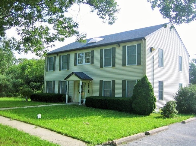

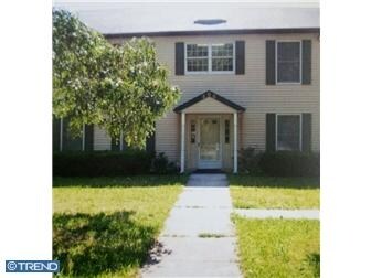
Property Detail
505 Walnut St
13-01803-0000-00016
B132L12-A
Vacantlandnec
Atlantic
R-3
New Jersey
B and X Area of moderate flood hazard, usually the area between the limits of the 100-year and 500-year floods.
16
2024
1.15 AC
2025
Atlantic City/Hammonton
010800
Philadelphia
2,928 SF
Atlantic City-Hammonton, NJ
NEARBY LISTINGS FOR SALE OR LEASE
DEMOGRAPHICS near 505 Walnut St
1 mile
3 mile
5 mile
2025 Total Population
2,641
13,922
19,408
2030 Population
2,579
13,726
19,215
Pop Growth 2025-2030
(2.35%)
(1.41%)
(0.99%)
Average Age
43
42
42
2025 Total Households
961
5,121
6,968
HH Growth 2025-2030
(3.33%)
(2.05%)
(1.59%)
Median Household Inc
$77,759
$80,430
$83,685
Avg Household Size
2.50
2.60
2.60
2025 Avg HH Vehicles
2.00
2.00
2.00
Median Home Value
$341,021
$332,874
$329,321
Median Year Built
1974
1971
1971
Nearby Places
Map Layers
Map Styles
 Street
 Aerial
Transit
 Traffic
 Biking
Places
Listings with unknown addresses are not visible on the map
- Restaurants
- Banks
- Shops
- Fitness
- Groceries
PUBLIC TRANSPORTATION
COMMUTER RAIL
Hammonton (Atlantic City Line - NJ Transit Commuter Rail (NJ Transit))
Drive
Walk
Distance
Hammonton (Atlantic City Line - NJ Transit Commuter Rail (NJ Transit))
6 min
2.1 mi
AIRPORT
Atlantic City International
Drive
Walk
Distance
Atlantic City International
51 min
22.9 mi
Philadelphia International
Drive
Walk
Distance
Philadelphia International
53 min
36.2 mi
Freight Ports
Broadway Terminal - Pier 5
Drive
Walk
Distance
Broadway Terminal - Pier 5
37 min
27.7 mi
Nearby Properties
Address
Land Use
TOTAL SIZE
Lot Size
Zoning
Address
Land Use
TOTAL SIZE
Lot Size
Zoning
50.38 AC
Address
Land Use
TOTAL SIZE
Lot Size
Zoning
55.80 AC
Address
Land Use
TOTAL SIZE
Lot Size
Zoning
35.12 AC
Address
Land Use
TOTAL SIZE
Lot Size
Zoning
28.33 AC
R-3
Address
Land Use
TOTAL SIZE
Lot Size
Zoning
43.26 AC
R-1
Address
Land Use
TOTAL SIZE
Lot Size
Zoning
3,500 SF
4.77 AC
Address
Land Use
TOTAL SIZE
Lot Size
Zoning
Address
Land Use
TOTAL SIZE
Lot Size
Zoning
2,528 SF
21.85 AC
Address
Land Use
TOTAL SIZE
Lot Size
Zoning
Address
Land Use
TOTAL SIZE
Lot Size
Zoning
Address
Land Use
TOTAL SIZE
Lot Size
Zoning
14.85 AC
Address
Land Use
TOTAL SIZE
Lot Size
Zoning
Address
Land Use
TOTAL SIZE
Lot Size
Zoning
16.92 AC
Address
Land Use
TOTAL SIZE
Lot Size
Zoning
67,563 SF
13.73 AC
Address
Land Use
TOTAL SIZE
Lot Size
Zoning
0.92 AC
Address
Land Use
TOTAL SIZE
Lot Size
Zoning
27.35 AC
PA
Address
Land Use
TOTAL SIZE
Lot Size
Zoning
Address
Land Use
TOTAL SIZE
Lot Size
Zoning
43,282 SF
1.58 AC
Address
Land Use
TOTAL SIZE
Lot Size
Zoning
26,277 SF
1 AC
Address
Land Use
TOTAL SIZE
Lot Size
Zoning
2,190 SF
7.20 AC
Address
Land Use
TOTAL SIZE
Lot Size
Zoning
11.87 AC
RM
Address
Land Use
TOTAL SIZE
Lot Size
Zoning
Address
Land Use
TOTAL SIZE
Lot Size
Zoning
10.91 AC
Address
Land Use
TOTAL SIZE
Lot Size
Zoning
10,520 SF
7.76 AC
Address
Land Use
TOTAL SIZE
Lot Size
Zoning
Address
Land Use
TOTAL SIZE
Lot Size
Zoning
7.14 AC
R-1
Address
Land Use
TOTAL SIZE
Lot Size
Zoning
1.50 AC
PR4
Address
Land Use
TOTAL SIZE
Lot Size
Zoning
Address
Land Use
TOTAL SIZE
Lot Size
Zoning
22.49 AC
Address
Land Use
TOTAL SIZE
Lot Size
Zoning
81.61 AC
The World's #1 Commercial Real Estate Marketplace
Connect with us
© 2026 CoStar Group
The information above has been obtained from sources believed reliable. While we do not doubt its accuracy we have not verified it and make no guarantee, warranty or representation about it. It is your responsibility to independently confirm its accuracy and completeness. Any projections, opinions, assumptions, or estimates used are for example only and do not represent the current or future performance of the property. The value of this transaction to you depends on tax and other factors which should be evaluated by your tax, financial, and legal advisors. You and your advisors should conduct a careful, independent investigation of the property to determine to your satisfaction the suitability of the property for your needs.