Property Record
5050 N Highway 17, Awendaw, SC 29429
NEARBY LISTINGS FOR SALE OR LEASE
-
-
View all Awendaw listings for sale on LoopNet.com
Property Detail
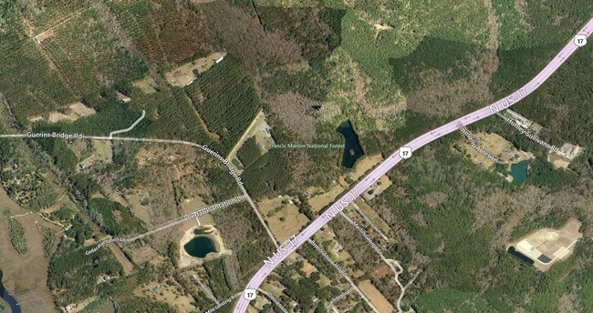
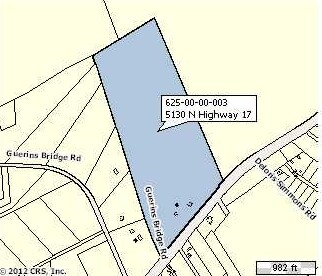
5050 N Highway 17
Charleston-North Charleston, SC
Two Ceder Plantation
629-00-00-206
MAPPLATB L23 MAPPLATP 0347 SUBDIVISIONNAME AWENDAW
Commercialacreage
Charleston
X
South Carolina
45019C0355K
11.99 AC
2025
E Charleston County
2024
Charleston/N Charleston
005001
DEMOGRAPHICS near 5050 N Highway 17
1 Mile
3 Mile
5 Mile
2024 Total Population
254
934
8,937
2029 Population
280
1,027
9,730
Pop Growth 2024-2029
+ 10.24%
+ 9.96%
+ 8.87%
Average Age
44
45
41
2024 Total Households
95
359
3,165
HH Growth 2024-2029
+ 9.47%
+ 10.03%
+ 8.85%
Median Household Inc
$70,499
$68,289
$109,726
Avg Household Size
2.70
2.60
2.80
2024 Avg HH Vehicles
2.00
2.00
2.00
Median Home Value
$523,256
$493,589
$569,779
Median Year Built
2007
2002
2010
Nearby Places
Map Layers
Map Styles
 Street
 Aerial
- Restaurants
- Banks
- Shops
- Fitness
- Groceries
PUBLIC TRANSPORTATION
AIRPORT
Charleston AFB/International
DRIVE
WALK
Distance
Charleston AFB/International
41 min
28.9 mi
Freight Ports
Wando Welch Terminal
DRIVE
WALK
Distance
Wando Welch Terminal
20 min
13.5 mi
SALE & LEASE HISTORY
LISTING DATE
SALE/LEASE

Sep 24, 2016
For Sale
Nearby Properties
Address
Land Use
TOTAL SIZE
Lot Size
Zoning
Address
Land Use
TOTAL SIZE
Lot Size
Zoning
1,140.98 AC
Address
Land Use
TOTAL SIZE
Lot Size
Zoning
355.34 AC
Address
Land Use
TOTAL SIZE
Lot Size
Zoning
32.65 AC
Address
Land Use
TOTAL SIZE
Lot Size
Zoning
6,250 SF
1.64 AC
Address
Land Use
TOTAL SIZE
Lot Size
Zoning
6,300 SF
360.79 AC
Address
Land Use
TOTAL SIZE
Lot Size
Zoning
18,730 SF
3.58 AC
Address
Land Use
TOTAL SIZE
Lot Size
Zoning
61.13 AC
Address
Land Use
TOTAL SIZE
Lot Size
Zoning
10,282 SF
1.96 AC
Address
Land Use
TOTAL SIZE
Lot Size
Zoning
9,152 SF
1.14 AC
Address
Land Use
TOTAL SIZE
Lot Size
Zoning
1,530 SF
2.91 AC
Address
Land Use
TOTAL SIZE
Lot Size
Zoning
28.17 AC
Address
Land Use
TOTAL SIZE
Lot Size
Zoning
0.99 AC
Address
Land Use
TOTAL SIZE
Lot Size
Zoning
11.98 AC
Address
Land Use
TOTAL SIZE
Lot Size
Zoning
2,624 SF
8.22 AC
Address
Land Use
TOTAL SIZE
Lot Size
Zoning
2,856 SF
4.01 AC
Address
Land Use
TOTAL SIZE
Lot Size
Zoning
Address
Land Use
TOTAL SIZE
Lot Size
Zoning
1.34 AC
Address
Land Use
TOTAL SIZE
Lot Size
Zoning
3.93 AC
Address
Land Use
TOTAL SIZE
Lot Size
Zoning
116.80 AC
Address
Land Use
TOTAL SIZE
Lot Size
Zoning
7.74 AC
Address
Land Use
TOTAL SIZE
Lot Size
Zoning
2,103 SF
2.83 AC
Address
Land Use
TOTAL SIZE
Lot Size
Zoning
2.48 AC
Address
Land Use
TOTAL SIZE
Lot Size
Zoning
3.67 AC
Address
Land Use
TOTAL SIZE
Lot Size
Zoning
4.76 AC
Address
Land Use
TOTAL SIZE
Lot Size
Zoning
9.89 AC
Address
Land Use
TOTAL SIZE
Lot Size
Zoning
504 SF
4 AC
Address
Land Use
TOTAL SIZE
Lot Size
Zoning
1,568 SF
4.97 AC
Address
Land Use
TOTAL SIZE
Lot Size
Zoning
3.63 AC
Address
Land Use
TOTAL SIZE
Lot Size
Zoning
10.45 AC
The World's #1 Commercial Real Estate Marketplace
Connect with us
© 2026 CoStar Group
The information above has been obtained from sources believed reliable. While we do not doubt its accuracy we have not verified it and make no guarantee, warranty or representation about it. It is your responsibility to independently confirm its accuracy and completeness. Any projections, opinions, assumptions, or estimates used are for example only and do not represent the current or future performance of the property. The value of this transaction to you depends on tax and other factors which should be evaluated by your tax, financial, and legal advisors. You and your advisors should conduct a careful, independent investigation of the property to determine to your satisfaction the suitability of the property for your needs.