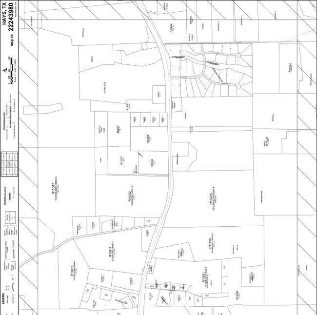
Property Record
5051 W Highway 290, Dripping Springs, TX 78620
NEARBY LISTINGS FOR SALE OR LEASE
-
-
View all Dripping Springs listings for sale on LoopNet.com
Property Detail
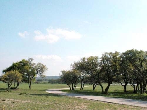
5051 W Highway 290
R10936
William H Haggard Survey
Vacantlandnec
ABS 8 W H HAGGARD SURVEY 2.00 AC GEO#90400019
X
Hays
48209C0085F
Texas
2024
2 AC
2025
Hays County
010817
Austin
5,138 SF
Austin-Round Rock, TX
DEMOGRAPHICS near 5051 W Highway 290
1 Mile
3 Mile
5 Mile
2024 Total Population
151
1,594
6,664
2029 Population
195
2,075
8,814
Pop Growth 2024-2029
+ 29.14%
+ 30.18%
+ 32.26%
Average Age
43
43
42
2024 Total Households
58
601
2,432
HH Growth 2024-2029
+ 31.03%
+ 31.11%
+ 33.10%
Median Household Inc
$110,227
$114,180
$120,443
Avg Household Size
2.60
2.70
2.70
2024 Avg HH Vehicles
2.00
2.00
2.00
Median Home Value
$625,000
$639,846
$679,060
Median Year Built
1998
1999
2002
Nearby Places
- Restaurants
- Banks
- Shops
- Fitness
- Groceries
Nearby Properties
Address
Land Use
TOTAL SIZE
Lot Size
Zoning
Address
Land Use
TOTAL SIZE
Lot Size
Zoning
16,274 SF
22.16 AC
Address
Land Use
TOTAL SIZE
Lot Size
Zoning
888 SF
5.93 AC
Address
Land Use
TOTAL SIZE
Lot Size
Zoning
6,298 SF
4.16 AC
Address
Land Use
TOTAL SIZE
Lot Size
Zoning
60,980 SF
36.80 AC
Address
Land Use
TOTAL SIZE
Lot Size
Zoning
3,000 SF
10.40 AC
Address
Land Use
TOTAL SIZE
Lot Size
Zoning
9,077 SF
94.33 AC
Address
Land Use
TOTAL SIZE
Lot Size
Zoning
8,018 SF
112.96 AC
Address
Land Use
TOTAL SIZE
Lot Size
Zoning
344,392 SF
18.21 AC
Address
Land Use
TOTAL SIZE
Lot Size
Zoning
4,646 SF
95.67 AC
Address
Land Use
TOTAL SIZE
Lot Size
Zoning
1,200 SF
16.24 AC
Address
Land Use
TOTAL SIZE
Lot Size
Zoning
19,069 SF
104.04 AC
Address
Land Use
TOTAL SIZE
Lot Size
Zoning
Address
Land Use
TOTAL SIZE
Lot Size
Zoning
2,398 SF
10.20 AC
Address
Land Use
TOTAL SIZE
Lot Size
Zoning
4,490 SF
10.01 AC
Address
Land Use
TOTAL SIZE
Lot Size
Zoning
5,000 SF
28.01 AC
Address
Land Use
TOTAL SIZE
Lot Size
Zoning
4,630 SF
3.50 AC
Address
Land Use
TOTAL SIZE
Lot Size
Zoning
6,456 SF
7.36 AC
Address
Land Use
TOTAL SIZE
Lot Size
Zoning
14,990 SF
2.84 AC
Address
Land Use
TOTAL SIZE
Lot Size
Zoning
4,378 SF
34.77 AC
Address
Land Use
TOTAL SIZE
Lot Size
Zoning
4,160 SF
59.64 AC
Address
Land Use
TOTAL SIZE
Lot Size
Zoning
2,592 SF
7.50 AC
Address
Land Use
TOTAL SIZE
Lot Size
Zoning
11.45 AC
Address
Land Use
TOTAL SIZE
Lot Size
Zoning
3,200 SF
11.50 AC
Address
Land Use
TOTAL SIZE
Lot Size
Zoning
5,384 SF
56.60 AC
Address
Land Use
TOTAL SIZE
Lot Size
Zoning
2,226 SF
5.01 AC
Address
Land Use
TOTAL SIZE
Lot Size
Zoning
Address
Land Use
TOTAL SIZE
Lot Size
Zoning
8,960 SF
4.04 AC
Address
Land Use
TOTAL SIZE
Lot Size
Zoning
9,000 SF
1.29 AC
Address
Land Use
TOTAL SIZE
Lot Size
Zoning
4,294 SF
11.63 AC
Address
Land Use
TOTAL SIZE
Lot Size
Zoning
3,667 SF
10.06 AC
The World's #1 Commercial Real Estate Marketplace
Connect with us
© 2025 CoStar Group
The information above has been obtained from sources believed reliable. While we do not doubt its accuracy we have not verified it and make no guarantee, warranty or representation about it. It is your responsibility to independently confirm its accuracy and completeness. Any projections, opinions, assumptions, or estimates used are for example only and do not represent the current or future performance of the property. The value of this transaction to you depends on tax and other factors which should be evaluated by your tax, financial, and legal advisors. You and your advisors should conduct a careful, independent investigation of the property to determine to your satisfaction the suitability of the property for your needs.