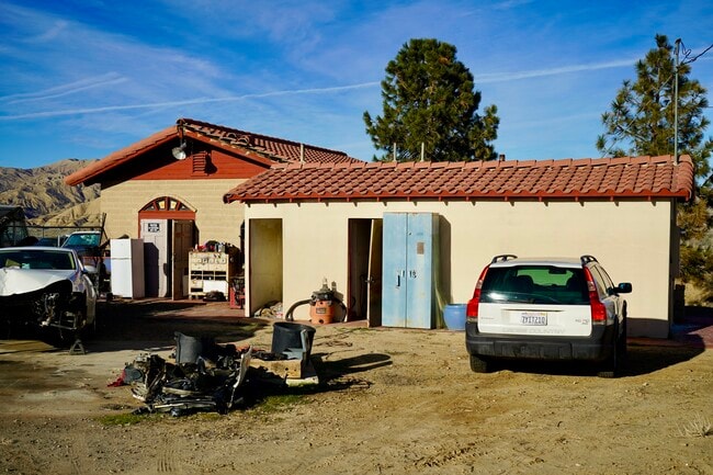
Property Record
5053 Highway 166, New Cuyama, CA 93254


NEARBY LISTINGS FOR SALE OR LEASE
Property Detail
5053 Highway 166
Santa Maria-Santa Barbara, CA
Cuyama Rho 02
149-320-004
M1A OF RO CUYAMA 2 SUB 4
Vacantlandnec
Santa Barbara
AO
California
06083C0329G
2.11 AC
2024
Outlying Sta Barbara Cnty
2025
Santa Barbara/Sta Maria/Goleta
001800
DEMOGRAPHICS near 5053 Highway 166
1 Mile
3 Mile
5 Mile
2024 Total Population
306
333
379
2029 Population
279
304
347
Pop Growth 2024-2029
(8.82%)
(8.71%)
(8.44%)
Average Age
41
41
42
2024 Total Households
115
125
142
HH Growth 2024-2029
(8.70%)
(8.80%)
(8.45%)
Median Household Inc
$52,500
$53,889
$54,091
Avg Household Size
2.70
2.70
2.70
2024 Avg HH Vehicles
2.00
2.00
2.00
Median Home Value
$192,592
$191,378
$190,908
Median Year Built
1958
1958
1958
Nearby Places
Map Layers
Map Styles
 Street
 Aerial
- Restaurants
- Banks
- Shops
- Fitness
- Groceries
SALE & LEASE HISTORY
LISTING DATE
SALE/LEASE

Mar 21, 2023
For Sale
Nearby Properties
Address
Land Use
TOTAL SIZE
Lot Size
Zoning
Address
Land Use
TOTAL SIZE
Lot Size
Zoning
2,134 SF
191.28 AC
AGII100
Address
Land Use
TOTAL SIZE
Lot Size
Zoning
2,040 SF
100 AC
Address
Land Use
TOTAL SIZE
Lot Size
Zoning
2,482 SF
100 AC
AGII100
Address
Land Use
TOTAL SIZE
Lot Size
Zoning
1.60 AC
CH
Address
Land Use
TOTAL SIZE
Lot Size
Zoning
1,778 SF
130.91 AC
AGII100
Address
Land Use
TOTAL SIZE
Lot Size
Zoning
22,655 SF
24.83 AC
MRP
Address
Land Use
TOTAL SIZE
Lot Size
Zoning
7,500 SF
0.33 AC
C2
Address
Land Use
TOTAL SIZE
Lot Size
Zoning
81 AC
AGI10
Address
Land Use
TOTAL SIZE
Lot Size
Zoning
0.75 AC
C2
Address
Land Use
TOTAL SIZE
Lot Size
Zoning
2,541 SF
0.27 AC
8R1
Address
Land Use
TOTAL SIZE
Lot Size
Zoning
1,558 SF
1.30 AC
AGI10
Address
Land Use
TOTAL SIZE
Lot Size
Zoning
2,400 SF
0.46 AC
10R1
Address
Land Use
TOTAL SIZE
Lot Size
Zoning
4,298 SF
0.46 AC
8R1
Address
Land Use
TOTAL SIZE
Lot Size
Zoning
19.18 AC
U
Address
Land Use
TOTAL SIZE
Lot Size
Zoning
1.09 AC
C2
Address
Land Use
TOTAL SIZE
Lot Size
Zoning
Address
Land Use
TOTAL SIZE
Lot Size
Zoning
3,860 SF
0.55 AC
8R1
Address
Land Use
TOTAL SIZE
Lot Size
Zoning
0.25 AC
8R1
Address
Land Use
TOTAL SIZE
Lot Size
Zoning
0.26 AC
8R1
Address
Land Use
TOTAL SIZE
Lot Size
Zoning
0.20 AC
CH
Address
Land Use
TOTAL SIZE
Lot Size
Zoning
0.43 AC
U
Address
Land Use
TOTAL SIZE
Lot Size
Zoning
615 AC
Address
Land Use
TOTAL SIZE
Lot Size
Zoning
17,424 SF
0.40 AC
C2
Address
Land Use
TOTAL SIZE
Lot Size
Zoning
20 AC
RL
The World's #1 Commercial Real Estate Marketplace
Connect with us
© 2025 CoStar Group
The information above has been obtained from sources believed reliable. While we do not doubt its accuracy we have not verified it and make no guarantee, warranty or representation about it. It is your responsibility to independently confirm its accuracy and completeness. Any projections, opinions, assumptions, or estimates used are for example only and do not represent the current or future performance of the property. The value of this transaction to you depends on tax and other factors which should be evaluated by your tax, financial, and legal advisors. You and your advisors should conduct a careful, independent investigation of the property to determine to your satisfaction the suitability of the property for your needs.