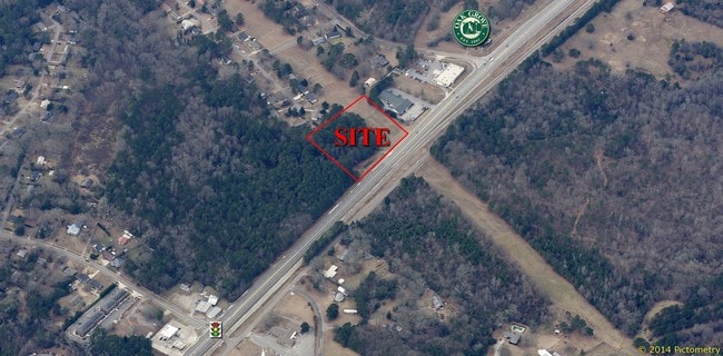
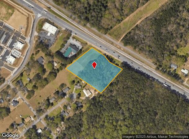
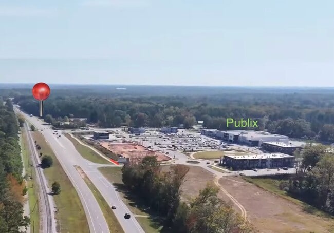
Property Record
5055 Jefferson Rd, Athens, GA 30607
NEARBY LISTINGS FOR SALE OR LEASE
Property Detail
5055 Jefferson Rd
Athens-Clarke County, GA
Com-St-060->00-03
062-016-A
DEEDED ACS: 3.253
Commercialacreage
Clarke
X
Georgia
13059C0014E
3.26 AC
2025
Westside Athens
2025
Other Market Areas
010602
DEMOGRAPHICS near 5055 Jefferson Rd
1 Mile
3 Mile
5 Mile
2024 Total Population
4,854
23,553
82,462
2029 Population
4,866
23,852
83,709
Pop Growth 2024-2029
+ 0.25%
+ 1.27%
+ 1.51%
Average Age
38
38
35
2024 Total Households
1,807
9,266
31,836
HH Growth 2024-2029
+ 0.39%
+ 1.27%
+ 1.38%
Median Household Inc
$69,193
$61,279
$50,472
Avg Household Size
2.60
2.40
2.20
2024 Avg HH Vehicles
2.00
2.00
2.00
Median Home Value
$229,438
$250,192
$277,211
Median Year Built
1984
1980
1985
Nearby Places
Map Layers
Map Styles
 Street
 Aerial
- Restaurants
- Banks
- Shops
- Fitness
- Groceries
SALE & LEASE HISTORY
LISTING DATE
SALE/LEASE

Sep 24, 2016
For Sale
May 03, 2023
For Sale
Nearby Properties
Address
Land Use
TOTAL SIZE
Lot Size
Zoning
Address
Land Use
TOTAL SIZE
Lot Size
Zoning
11.36 AC
G
Address
Land Use
TOTAL SIZE
Lot Size
Zoning
85,608 SF
63.75 AC
RM-2
Address
Land Use
TOTAL SIZE
Lot Size
Zoning
56.15 AC
G
Address
Land Use
TOTAL SIZE
Lot Size
Zoning
112,071 SF
5.27 AC
E-O
Address
Land Use
TOTAL SIZE
Lot Size
Zoning
77,919 SF
8 AC
E-I
Address
Land Use
TOTAL SIZE
Lot Size
Zoning
9,956 SF
7.20 AC
E-O(PD)
Address
Land Use
TOTAL SIZE
Lot Size
Zoning
49.58 AC
G
Address
Land Use
TOTAL SIZE
Lot Size
Zoning
58,706 SF
12.86 AC
C-G
Address
Land Use
TOTAL SIZE
Lot Size
Zoning
26.86 AC
G
Address
Land Use
TOTAL SIZE
Lot Size
Zoning
3,223 SF
17.81 AC
RS-5
Address
Land Use
TOTAL SIZE
Lot Size
Zoning
19.21 AC
G
Address
Land Use
TOTAL SIZE
Lot Size
Zoning
4,148 SF
7.04 AC
RM-1
Address
Land Use
TOTAL SIZE
Lot Size
Zoning
664,513 SF
84.46 AC
I
Address
Land Use
TOTAL SIZE
Lot Size
Zoning
106,760 SF
10.38 AC
E-O
Address
Land Use
TOTAL SIZE
Lot Size
Zoning
8.27 AC
G
Address
Land Use
TOTAL SIZE
Lot Size
Zoning
1.25 AC
G
Address
Land Use
TOTAL SIZE
Lot Size
Zoning
39.94 AC
C-O
Address
Land Use
TOTAL SIZE
Lot Size
Zoning
33,669 SF
1.32 AC
C-N
Address
Land Use
TOTAL SIZE
Lot Size
Zoning
121,382 SF
16.01 AC
C-G
Address
Land Use
TOTAL SIZE
Lot Size
Zoning
2,100 SF
7.14 AC
RM-1
Address
Land Use
TOTAL SIZE
Lot Size
Zoning
31,067 SF
5.05 AC
C-O
Address
Land Use
TOTAL SIZE
Lot Size
Zoning
1,378 SF
21.13 AC
RM-1
Address
Land Use
TOTAL SIZE
Lot Size
Zoning
1.78 AC
G
Address
Land Use
TOTAL SIZE
Lot Size
Zoning
36,878 SF
1.33 AC
C-N
Address
Land Use
TOTAL SIZE
Lot Size
Zoning
62,856 SF
37 AC
I
Address
Land Use
TOTAL SIZE
Lot Size
Zoning
42,548 SF
5.34 AC
C-O
Address
Land Use
TOTAL SIZE
Lot Size
Zoning
50,400 SF
3.29 AC
C-G
Address
Land Use
TOTAL SIZE
Lot Size
Zoning
10,651 SF
0.26 AC
C-N
Address
Land Use
TOTAL SIZE
Lot Size
Zoning
Address
Land Use
TOTAL SIZE
Lot Size
Zoning
129,424 SF
109.82 AC
I
The World's #1 Commercial Real Estate Marketplace
Connect with us
© 2025 CoStar Group
The information above has been obtained from sources believed reliable. While we do not doubt its accuracy we have not verified it and make no guarantee, warranty or representation about it. It is your responsibility to independently confirm its accuracy and completeness. Any projections, opinions, assumptions, or estimates used are for example only and do not represent the current or future performance of the property. The value of this transaction to you depends on tax and other factors which should be evaluated by your tax, financial, and legal advisors. You and your advisors should conduct a careful, independent investigation of the property to determine to your satisfaction the suitability of the property for your needs.