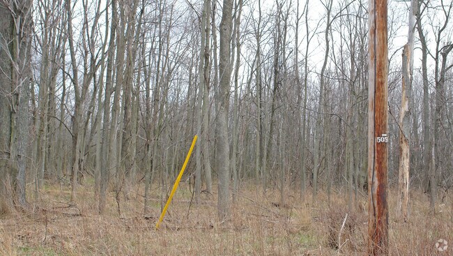
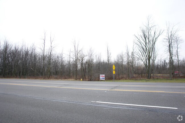
Property Record
5055 Millersport Hwy, East Amherst, NY 14051

NEARBY LISTINGS FOR SALE OR LEASE
Property Detail
5055 Millersport Hwy
Buffalo-Cheektowaga-Niagara Falls, NY
58 13 7
142289-016-000-0005-014-000
Erie
Residentialacreage
New York
AE
14.000
36029C0079H
17.40 AC
2025
North
2024
Buffalo/Niagara Falls
009010
DEMOGRAPHICS near 5055 Millersport Hwy
1 Mile
3 Mile
5 Mile
2024 Total Population
1,511
15,285
61,401
2029 Population
1,504
15,185
61,154
Pop Growth 2024-2029
(0.46%)
(0.65%)
(0.40%)
Average Age
43
43
43
2024 Total Households
674
6,231
23,979
HH Growth 2024-2029
(0.59%)
(0.80%)
(0.52%)
Median Household Inc
$96,578
$98,186
$103,660
Avg Household Size
2.20
2.40
2.50
2024 Avg HH Vehicles
2.00
2.00
2.00
Median Home Value
$318,182
$278,615
$317,061
Median Year Built
1994
1987
1986
Nearby Places
- Restaurants
- Banks
- Shops
- Fitness
- Groceries
PUBLIC TRANSPORTATION
AIRPORT
Buffalo Niagara International
DRIVE
WALK
Distance
Buffalo Niagara International
18 min
11.9 mi
Niagara Falls International
DRIVE
WALK
Distance
Niagara Falls International
26 min
15.6 mi
Freight Ports
Albany, NY Port
DRIVE
WALK
Distance
Albany, NY Port
338 min
288.2 mi
SALE & LEASE HISTORY
LISTING DATE
SALE/LEASE

Sep 24, 2016
For Sale
Mar 03, 2017
For Sale
Nearby Properties
Address
Land Use
TOTAL SIZE
Lot Size
Zoning
Address
Land Use
TOTAL SIZE
Lot Size
Zoning
5,364 SF
56.45 AC
Address
Land Use
TOTAL SIZE
Lot Size
Zoning
7,080 SF
21.40 AC
MFR-5
Address
Land Use
TOTAL SIZE
Lot Size
Zoning
4,436 SF
18.51 AC
Address
Land Use
TOTAL SIZE
Lot Size
Zoning
154,296 SF
7.90 AC
RD
Address
Land Use
TOTAL SIZE
Lot Size
Zoning
87,718 SF
1.26 AC
RD
Address
Land Use
TOTAL SIZE
Lot Size
Zoning
75,448 SF
8.82 AC
Address
Land Use
TOTAL SIZE
Lot Size
Zoning
9,338 SF
6.20 AC
Address
Land Use
TOTAL SIZE
Lot Size
Zoning
106,676 SF
8.90 AC
RD
Address
Land Use
TOTAL SIZE
Lot Size
Zoning
131,200 SF
16.90 AC
Address
Land Use
TOTAL SIZE
Lot Size
Zoning
131,128 SF
15.48 AC
RD
Address
Land Use
TOTAL SIZE
Lot Size
Zoning
92,368 SF
0.75 AC
RD
Address
Land Use
TOTAL SIZE
Lot Size
Zoning
91,035 SF
20.40 AC
Address
Land Use
TOTAL SIZE
Lot Size
Zoning
44,085 SF
7.34 AC
RD
Address
Land Use
TOTAL SIZE
Lot Size
Zoning
280 SF
31 AC
Address
Land Use
TOTAL SIZE
Lot Size
Zoning
25,866 SF
8.18 AC
Address
Land Use
TOTAL SIZE
Lot Size
Zoning
37,183 SF
62.32 AC
RC
Address
Land Use
TOTAL SIZE
Lot Size
Zoning
38,032 SF
7.90 AC
Address
Land Use
TOTAL SIZE
Lot Size
Zoning
51,125 SF
12.20 AC
Address
Land Use
TOTAL SIZE
Lot Size
Zoning
11,858 SF
5.30 AC
Address
Land Use
TOTAL SIZE
Lot Size
Zoning
15,969 SF
2.86 AC
Address
Land Use
TOTAL SIZE
Lot Size
Zoning
6,072 SF
6.46 AC
TND
Address
Land Use
TOTAL SIZE
Lot Size
Zoning
30,208 SF
9.20 AC
RD
Address
Land Use
TOTAL SIZE
Lot Size
Zoning
16.08 AC
RD
Address
Land Use
TOTAL SIZE
Lot Size
Zoning
26,080 SF
16.71 AC
RD
Address
Land Use
TOTAL SIZE
Lot Size
Zoning
21,216 SF
3.90 AC
Address
Land Use
TOTAL SIZE
Lot Size
Zoning
14,736 SF
3.13 AC
Address
Land Use
TOTAL SIZE
Lot Size
Zoning
36,725 SF
7 AC
B-2
Address
Land Use
TOTAL SIZE
Lot Size
Zoning
5,000 SF
2.60 AC
Address
Land Use
TOTAL SIZE
Lot Size
Zoning
25,000 SF
2.87 AC
GB
Address
Land Use
TOTAL SIZE
Lot Size
Zoning
43,739 SF
2.62 AC
RD
The World's #1 Commercial Real Estate Marketplace
Connect with us
© 2025 CoStar Group
The information above has been obtained from sources believed reliable. While we do not doubt its accuracy we have not verified it and make no guarantee, warranty or representation about it. It is your responsibility to independently confirm its accuracy and completeness. Any projections, opinions, assumptions, or estimates used are for example only and do not represent the current or future performance of the property. The value of this transaction to you depends on tax and other factors which should be evaluated by your tax, financial, and legal advisors. You and your advisors should conduct a careful, independent investigation of the property to determine to your satisfaction the suitability of the property for your needs.