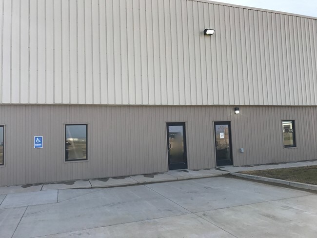
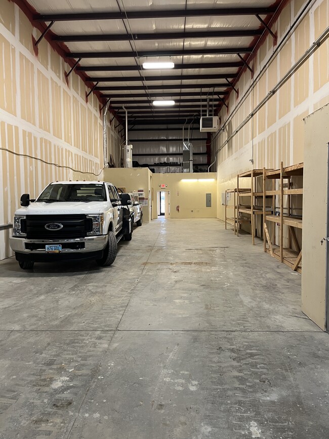
Property Record
5056 Bennett Loop, Williston, ND 58801

Property Detail
5056 Bennett Loop
Other Market Areas
WILLISTON TOWNSHIP BENNETT INDUSTRIAL PARK SECOND L 3 B 2
Williston, ND
Williams
45-154-01-19-02-015
North Dakota
Commercialnec
3
2025
4.84 AC
2025
North Dakota Area
953702
NEARBY LISTINGS FOR SALE OR LEASE
DEMOGRAPHICS near 5056 Bennett Loop
1 mile
3 mile
5 mile
2025 Total Population
155
6,482
26,055
2030 Population
167
7,026
27,841
Pop Growth 2025-2030
+ 7.74%
+ 8.39%
+ 6.85%
Average Age
32
31
34
2025 Total Households
57
2,478
10,314
HH Growth 2025-2030
+ 8.77%
+ 8.64%
+ 7.02%
Median Household Inc
$118,749
$88,696
$87,371
Avg Household Size
2.70
2.50
2.40
2025 Avg HH Vehicles
3.00
2.00
2.00
Median Home Value
$359,090
$348,955
$287,489
Median Year Built
2010
2011
2007
Nearby Places
Map Layers
Map Styles
 Street
 Aerial
Transit
 Traffic
 Biking
Places
Listings with unknown addresses are not visible on the map
- Restaurants
- Banks
- Shops
- Fitness
- Groceries
PUBLIC TRANSPORTATION
COMMUTER RAIL
Williston Amtrak Station (Empire Builder - Amtrak)
Drive
Walk
Distance
Williston Amtrak Station (Empire Builder - Amtrak)
9 min
5.8 mi
AIRPORT
Williston Basin International
Drive
Walk
Distance
Williston Basin International
19 min
11.6 mi
Freight Ports
Port Milwaukee
Drive
Walk
Distance
Port Milwaukee
1,065 min
987.3 mi
SALE & LEASE HISTORY
LISTING DATE
SALE/LEASE

Oct 20, 2020
For Lease
May 08, 2017
For Lease
Jul 13, 2017
For Lease
Jan 07, 2022
For Lease
Aug 29, 2017
For Lease
Nearby Properties
Address
Land Use
TOTAL SIZE
Lot Size
Zoning
Address
Land Use
TOTAL SIZE
Lot Size
Zoning
4.28 AC
Address
Land Use
TOTAL SIZE
Lot Size
Zoning
18.91 AC
Address
Land Use
TOTAL SIZE
Lot Size
Zoning
18.39 AC
Address
Land Use
TOTAL SIZE
Lot Size
Zoning
29.97 AC
Address
Land Use
TOTAL SIZE
Lot Size
Zoning
12.23 AC
Address
Land Use
TOTAL SIZE
Lot Size
Zoning
5.03 AC
Address
Land Use
TOTAL SIZE
Lot Size
Zoning
9.70 AC
Address
Land Use
TOTAL SIZE
Lot Size
Zoning
Address
Land Use
TOTAL SIZE
Lot Size
Zoning
12.03 AC
Address
Land Use
TOTAL SIZE
Lot Size
Zoning
7.16 AC
Address
Land Use
TOTAL SIZE
Lot Size
Zoning
33.64 AC
Address
Land Use
TOTAL SIZE
Lot Size
Zoning
22.20 AC
Address
Land Use
TOTAL SIZE
Lot Size
Zoning
50.98 AC
Address
Land Use
TOTAL SIZE
Lot Size
Zoning
10.05 AC
Address
Land Use
TOTAL SIZE
Lot Size
Zoning
Address
Land Use
TOTAL SIZE
Lot Size
Zoning
Address
Land Use
TOTAL SIZE
Lot Size
Zoning
Address
Land Use
TOTAL SIZE
Lot Size
Zoning
63.16 AC
Address
Land Use
TOTAL SIZE
Lot Size
Zoning
Address
Land Use
TOTAL SIZE
Lot Size
Zoning
Address
Land Use
TOTAL SIZE
Lot Size
Zoning
Address
Land Use
TOTAL SIZE
Lot Size
Zoning
Address
Land Use
TOTAL SIZE
Lot Size
Zoning
4.19 AC
Address
Land Use
TOTAL SIZE
Lot Size
Zoning
3.91 AC
Address
Land Use
TOTAL SIZE
Lot Size
Zoning
3.56 AC
Address
Land Use
TOTAL SIZE
Lot Size
Zoning
2.30 AC
Address
Land Use
TOTAL SIZE
Lot Size
Zoning
11.49 AC
Address
Land Use
TOTAL SIZE
Lot Size
Zoning
35.46 AC
Address
Land Use
TOTAL SIZE
Lot Size
Zoning
7.67 AC
Address
Land Use
TOTAL SIZE
Lot Size
Zoning
3.85 AC
The World's #1 Commercial Real Estate Marketplace
Connect with us
© 2026 CoStar Group
The information above has been obtained from sources believed reliable. While we do not doubt its accuracy we have not verified it and make no guarantee, warranty or representation about it. It is your responsibility to independently confirm its accuracy and completeness. Any projections, opinions, assumptions, or estimates used are for example only and do not represent the current or future performance of the property. The value of this transaction to you depends on tax and other factors which should be evaluated by your tax, financial, and legal advisors. You and your advisors should conduct a careful, independent investigation of the property to determine to your satisfaction the suitability of the property for your needs.