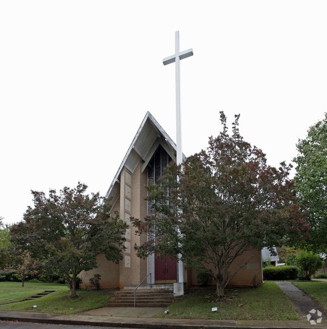
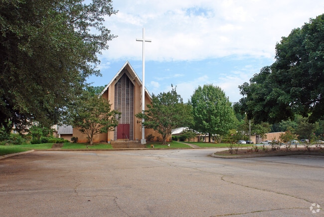
Property Record
506 Edwards Rd, Greenville, SC 29615

NEARBY LISTINGS FOR SALE OR LEASE
Property Detail
506 Edwards Rd
Greenville-Anderson-Mauldin, SC
Survey For Renovation Ministries Inc
0277.00-02-001.04
MAP 0277.00
Religious
Greenville
X
South Carolina
45045C0338E
001.04
2024
6.74 AC
2024
Pelham Road
001805
Greenville/Spartanburg
DEMOGRAPHICS near 506 Edwards Rd
1 Mile
3 Mile
5 Mile
2024 Total Population
7,247
68,439
174,437
2029 Population
7,955
75,198
192,836
Pop Growth 2024-2029
+ 9.77%
+ 9.88%
+ 10.55%
Average Age
40
39
39
2024 Total Households
3,109
29,321
75,083
HH Growth 2024-2029
+ 9.91%
+ 10.10%
+ 10.76%
Median Household Inc
$68,412
$62,898
$65,480
Avg Household Size
2.20
2.20
2.20
2024 Avg HH Vehicles
2.00
2.00
2.00
Median Home Value
$290,409
$272,165
$283,618
Median Year Built
1969
1977
1982
Nearby Places
Map Layers
Map Styles
 Street
 Aerial
- Restaurants
- Banks
- Shops
- Fitness
- Groceries
PUBLIC TRANSPORTATION
COMMUTER RAIL
DRIVE
WALK
Distance
10 min
4.4 mi
AIRPORT
Greenville Spartanburg International
DRIVE
WALK
Distance
Greenville Spartanburg International
20 min
9.9 mi
Nearby Properties
Address
Land Use
TOTAL SIZE
Lot Size
Zoning
Address
Land Use
TOTAL SIZE
Lot Size
Zoning
14.41 AC
RM2
Address
Land Use
TOTAL SIZE
Lot Size
Zoning
11.99 AC
RM2
Address
Land Use
TOTAL SIZE
Lot Size
Zoning
12.11 AC
C2
Address
Land Use
TOTAL SIZE
Lot Size
Zoning
1.43 AC
OD
Address
Land Use
TOTAL SIZE
Lot Size
Zoning
0.73 AC
C3
Address
Land Use
TOTAL SIZE
Lot Size
Zoning
11.82 AC
RM2
Address
Land Use
TOTAL SIZE
Lot Size
Zoning
17.07 AC
S1
Address
Land Use
TOTAL SIZE
Lot Size
Zoning
26.10 AC
C3
Address
Land Use
TOTAL SIZE
Lot Size
Zoning
8.94 AC
RM2
Address
Land Use
TOTAL SIZE
Lot Size
Zoning
1.09 AC
OD
Address
Land Use
TOTAL SIZE
Lot Size
Zoning
0.47 AC
OD
Address
Land Use
TOTAL SIZE
Lot Size
Zoning
9.13 AC
RM2
Address
Land Use
TOTAL SIZE
Lot Size
Zoning
10 AC
RM
Address
Land Use
TOTAL SIZE
Lot Size
Zoning
10.59 AC
RM2
Address
Land Use
TOTAL SIZE
Lot Size
Zoning
28.88 AC
RM
Address
Land Use
TOTAL SIZE
Lot Size
Zoning
6.86 AC
S1
Address
Land Use
TOTAL SIZE
Lot Size
Zoning
5.61 AC
RM2
Address
Land Use
TOTAL SIZE
Lot Size
Zoning
3.06 AC
C2
Address
Land Use
TOTAL SIZE
Lot Size
Zoning
1.92 AC
S1
Address
Land Use
TOTAL SIZE
Lot Size
Zoning
4.95 AC
C1
Address
Land Use
TOTAL SIZE
Lot Size
Zoning
4.67 AC
C3
Address
Land Use
TOTAL SIZE
Lot Size
Zoning
39.84 AC
OD
Address
Land Use
TOTAL SIZE
Lot Size
Zoning
97.93 AC
OD
Address
Land Use
TOTAL SIZE
Lot Size
Zoning
12.12 AC
C3
Address
Land Use
TOTAL SIZE
Lot Size
Zoning
10.68 AC
C2
Address
Land Use
TOTAL SIZE
Lot Size
Zoning
3.89 AC
OD
Address
Land Use
TOTAL SIZE
Lot Size
Zoning
4.18 AC
C2
Address
Land Use
TOTAL SIZE
Lot Size
Zoning
3,247 SF
15.64 AC
R6
Address
Land Use
TOTAL SIZE
Lot Size
Zoning
Address
Land Use
TOTAL SIZE
Lot Size
Zoning
61.73 AC
OD
The World's #1 Commercial Real Estate Marketplace
Connect with us
© 2026 CoStar Group
The information above has been obtained from sources believed reliable. While we do not doubt its accuracy we have not verified it and make no guarantee, warranty or representation about it. It is your responsibility to independently confirm its accuracy and completeness. Any projections, opinions, assumptions, or estimates used are for example only and do not represent the current or future performance of the property. The value of this transaction to you depends on tax and other factors which should be evaluated by your tax, financial, and legal advisors. You and your advisors should conduct a careful, independent investigation of the property to determine to your satisfaction the suitability of the property for your needs.