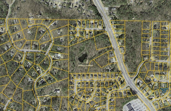
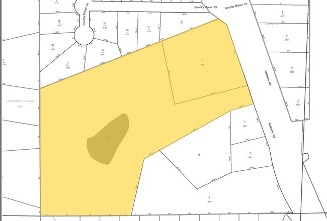
Property Record
5064 Alabama Rd Ne, Roswell, GA 5064
NEARBY LISTINGS FOR SALE OR LEASE
Property Detail
5064 Alabama Rd Ne
Atlanta-Sandy Springs-Roswell, GA
Homesite
16-0034-0-001-0
Cobb
Recreationalacreage
Georgia
X
34
13057C0358E
2.50 AC
2025
East Cobb
2025
Atlanta
030326
DEMOGRAPHICS near 5064 Alabama Rd Ne
1 Mile
3 Mile
5 Mile
2024 Total Population
5,841
54,308
147,408
2029 Population
6,242
57,488
154,784
Pop Growth 2024-2029
+ 6.87%
+ 5.86%
+ 5.00%
Average Age
42
42
41
2024 Total Households
2,111
19,183
52,177
HH Growth 2024-2029
+ 7.48%
+ 6.29%
+ 5.30%
Median Household Inc
$124,570
$139,489
$134,296
Avg Household Size
2.80
2.80
2.80
2024 Avg HH Vehicles
2.00
2.00
2.00
Median Home Value
$462,880
$442,023
$438,316
Median Year Built
1989
1990
1988
Nearby Places
Map Layers
Map Styles
 Street
 Aerial
- Restaurants
- Banks
- Shops
- Fitness
- Groceries
PUBLIC TRANSPORTATION
AIRPORT
Hartsfield - Jackson Atlanta International
DRIVE
WALK
Distance
Hartsfield - Jackson Atlanta International
54 min
37.5 mi
Freight Ports
Georgia Ports - Savannah
DRIVE
WALK
Distance
Georgia Ports - Savannah
317 min
276.8 mi
Nearby Properties
Address
Land Use
TOTAL SIZE
Lot Size
Zoning
Address
Land Use
TOTAL SIZE
Lot Size
Zoning
330,192 SF
20.40 AC
GC
Address
Land Use
TOTAL SIZE
Lot Size
Zoning
264,255 SF
51 AC
E2
Address
Land Use
TOTAL SIZE
Lot Size
Zoning
71,000 SF
48.73 AC
E1
Address
Land Use
TOTAL SIZE
Lot Size
Zoning
179,182 SF
15.06 AC
OI
Address
Land Use
TOTAL SIZE
Lot Size
Zoning
377,080 SF
19.37 AC
E1
Address
Land Use
TOTAL SIZE
Lot Size
Zoning
299,502 SF
19.77 AC
E2
Address
Land Use
TOTAL SIZE
Lot Size
Zoning
134,017 SF
31.50 AC
R-40
Address
Land Use
TOTAL SIZE
Lot Size
Zoning
95,478 SF
3 AC
Address
Land Use
TOTAL SIZE
Lot Size
Zoning
75,560 SF
10.32 AC
E2
Address
Land Use
TOTAL SIZE
Lot Size
Zoning
158,427 SF
11.17 AC
GC
Address
Land Use
TOTAL SIZE
Lot Size
Zoning
25.40 AC
E1
Address
Land Use
TOTAL SIZE
Lot Size
Zoning
50,375 SF
5.77 AC
R-80
Address
Land Use
TOTAL SIZE
Lot Size
Zoning
100,696 SF
9.96 AC
E2
Address
Land Use
TOTAL SIZE
Lot Size
Zoning
82,005 SF
15.82 AC
E1
Address
Land Use
TOTAL SIZE
Lot Size
Zoning
121,240 SF
21.04 AC
R1C
Address
Land Use
TOTAL SIZE
Lot Size
Zoning
59,241 SF
8.98 AC
Address
Land Use
TOTAL SIZE
Lot Size
Zoning
43,403 SF
4.09 AC
OI
Address
Land Use
TOTAL SIZE
Lot Size
Zoning
99,450 SF
14.63 AC
E1
Address
Land Use
TOTAL SIZE
Lot Size
Zoning
43,942 SF
2.95 AC
GC
Address
Land Use
TOTAL SIZE
Lot Size
Zoning
56,868 SF
6.41 AC
CRC
Address
Land Use
TOTAL SIZE
Lot Size
Zoning
34,875 SF
5.35 AC
E2
Address
Land Use
TOTAL SIZE
Lot Size
Zoning
101,452 SF
5.42 AC
PUD
Address
Land Use
TOTAL SIZE
Lot Size
Zoning
35,511 SF
15.74 AC
R1
Address
Land Use
TOTAL SIZE
Lot Size
Zoning
33,478 SF
3.57 AC
E2
Address
Land Use
TOTAL SIZE
Lot Size
Zoning
26,893 SF
1.83 AC
GC
Address
Land Use
TOTAL SIZE
Lot Size
Zoning
50,614 SF
10.47 AC
GC
Address
Land Use
TOTAL SIZE
Lot Size
Zoning
79,905 SF
3.39 AC
NRC
Address
Land Use
TOTAL SIZE
Lot Size
Zoning
56,899 SF
13.85 AC
NRC/R-15
Address
Land Use
TOTAL SIZE
Lot Size
Zoning
65,245 SF
28.15 AC
R-40
Address
Land Use
TOTAL SIZE
Lot Size
Zoning
11,590 SF
2.88 AC
E2
The World's #1 Commercial Real Estate Marketplace
Connect with us
© 2025 CoStar Group
The information above has been obtained from sources believed reliable. While we do not doubt its accuracy we have not verified it and make no guarantee, warranty or representation about it. It is your responsibility to independently confirm its accuracy and completeness. Any projections, opinions, assumptions, or estimates used are for example only and do not represent the current or future performance of the property. The value of this transaction to you depends on tax and other factors which should be evaluated by your tax, financial, and legal advisors. You and your advisors should conduct a careful, independent investigation of the property to determine to your satisfaction the suitability of the property for your needs.