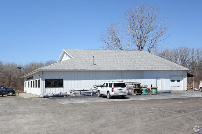
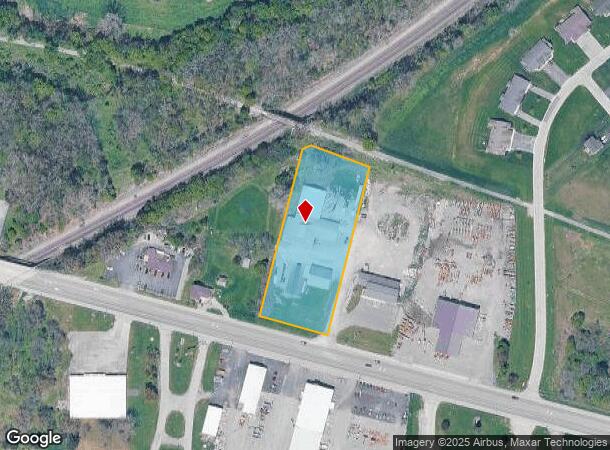
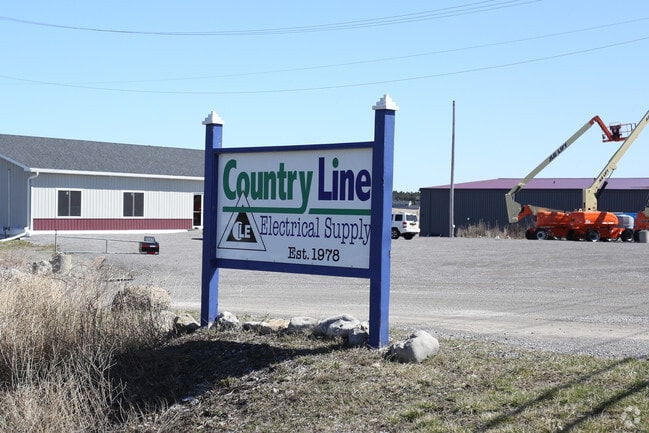
Property Record
5065 E Main Street Rd, Batavia, NY 14020
NEARBY LISTINGS FOR SALE OR LEASE
Property Detail
5065 E Main Street Rd
Batavia, NY
Genesee
182400-013-000-0001-110-002
New York
Storesoffices
110.002
2025
2.40 AC
2024
Rochester Other Areas
950600
Other Market Areas
12,560 SF
DEMOGRAPHICS near 5065 E Main Street Rd
1 Mile
3 Mile
5 Mile
2024 Total Population
2,144
17,733
22,466
2029 Population
2,139
17,397
22,078
Pop Growth 2024-2029
(0.23%)
(1.89%)
(1.73%)
Average Age
44
43
43
2024 Total Households
920
7,663
9,659
HH Growth 2024-2029
(0.22%)
(1.92%)
(1.75%)
Median Household Inc
$63,790
$57,148
$58,320
Avg Household Size
2.10
2.10
2.20
2024 Avg HH Vehicles
2.00
2.00
2.00
Median Home Value
$173,696
$130,830
$137,227
Median Year Built
1979
1950
1954
Nearby Places
- Restaurants
- Banks
- Shops
- Fitness
- Groceries
PUBLIC TRANSPORTATION
AIRPORT
Frederick Douglass/Greater Rochester International
DRIVE
WALK
Distance
Frederick Douglass/Greater Rochester International
42 min
29.9 mi
Buffalo Niagara International
DRIVE
WALK
Distance
Buffalo Niagara International
47 min
34.5 mi
Freight Ports
Albany, NY Port
DRIVE
WALK
Distance
Albany, NY Port
297 min
251.5 mi
Nearby Properties
Address
Land Use
TOTAL SIZE
Lot Size
Zoning
Address
Land Use
TOTAL SIZE
Lot Size
Zoning
136,135 SF
44 AC
Address
Land Use
TOTAL SIZE
Lot Size
Zoning
341,981 SF
81 AC
Address
Land Use
TOTAL SIZE
Lot Size
Zoning
254,672 SF
204.30 AC
Address
Land Use
TOTAL SIZE
Lot Size
Zoning
214,799 SF
34.80 AC
Address
Land Use
TOTAL SIZE
Lot Size
Zoning
147,117 SF
6.49 AC
Address
Land Use
TOTAL SIZE
Lot Size
Zoning
3.12 AC
Address
Land Use
TOTAL SIZE
Lot Size
Zoning
156,578 SF
28.60 AC
Address
Land Use
TOTAL SIZE
Lot Size
Zoning
83,131 SF
1.40 AC
Address
Land Use
TOTAL SIZE
Lot Size
Zoning
79,235 SF
23.40 AC
Address
Land Use
TOTAL SIZE
Lot Size
Zoning
3,731 SF
67.10 AC
1
Address
Land Use
TOTAL SIZE
Lot Size
Zoning
Address
Land Use
TOTAL SIZE
Lot Size
Zoning
97,450 SF
23.60 AC
Address
Land Use
TOTAL SIZE
Lot Size
Zoning
643,014 SF
33.50 AC
Address
Land Use
TOTAL SIZE
Lot Size
Zoning
111,230 SF
2.70 AC
Address
Land Use
TOTAL SIZE
Lot Size
Zoning
98,577 SF
3.80 AC
Address
Land Use
TOTAL SIZE
Lot Size
Zoning
25,514 SF
11.30 AC
Address
Land Use
TOTAL SIZE
Lot Size
Zoning
41,042 SF
10 AC
Address
Land Use
TOTAL SIZE
Lot Size
Zoning
76.11 AC
Address
Land Use
TOTAL SIZE
Lot Size
Zoning
3.29 AC
Address
Land Use
TOTAL SIZE
Lot Size
Zoning
128,620 SF
9.82 AC
Address
Land Use
TOTAL SIZE
Lot Size
Zoning
52,732 SF
3.20 AC
Address
Land Use
TOTAL SIZE
Lot Size
Zoning
696 SF
63.20 AC
Address
Land Use
TOTAL SIZE
Lot Size
Zoning
44,559 SF
27.70 AC
Address
Land Use
TOTAL SIZE
Lot Size
Zoning
79,576 SF
9.60 AC
Address
Land Use
TOTAL SIZE
Lot Size
Zoning
Address
Land Use
TOTAL SIZE
Lot Size
Zoning
Address
Land Use
TOTAL SIZE
Lot Size
Zoning
Address
Land Use
TOTAL SIZE
Lot Size
Zoning
14,160 SF
24 AC
Address
Land Use
TOTAL SIZE
Lot Size
Zoning
4,100 SF
302.20 AC
Address
Land Use
TOTAL SIZE
Lot Size
Zoning
91,360 SF
10.30 AC
08 - GOVER
The World's #1 Commercial Real Estate Marketplace
Connect with us
© 2025 CoStar Group
The information above has been obtained from sources believed reliable. While we do not doubt its accuracy we have not verified it and make no guarantee, warranty or representation about it. It is your responsibility to independently confirm its accuracy and completeness. Any projections, opinions, assumptions, or estimates used are for example only and do not represent the current or future performance of the property. The value of this transaction to you depends on tax and other factors which should be evaluated by your tax, financial, and legal advisors. You and your advisors should conduct a careful, independent investigation of the property to determine to your satisfaction the suitability of the property for your needs.