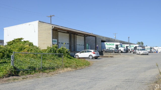
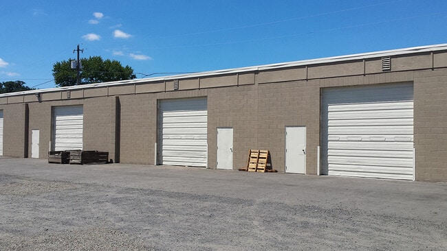
Property Record
5065 State St, Salem, OR 97317


Current Lease Availabilities
Property Detail
5065 State St
523968
ACRES 2.50
Officebuilding
Marion
I
Oregon
B and X Area of moderate flood hazard, usually the area between the limits of the 100-year and 500-year floods.
2.50 AC
2024
Marion County
2025
Portland
001802
Salem, OR
30,528 SF
NEARBY LISTINGS FOR SALE OR LEASE
DEMOGRAPHICS near 5065 State St
1 mile
3 mile
5 mile
2024 Total Population
11,492
66,270
161,373
2029 Population
11,676
67,131
163,692
Pop Growth 2024-2029
+ 1.60%
+ 1.30%
+ 1.44%
Average Age
37
38
38
2024 Total Households
3,768
22,136
56,598
HH Growth 2024-2029
+ 1.73%
+ 1.37%
+ 1.51%
Median Household Inc
$67,524
$56,436
$58,111
Avg Household Size
3.00
2.80
2.60
2024 Avg HH Vehicles
2.00
2.00
2.00
Median Home Value
$269,124
$269,497
$315,430
Median Year Built
1977
1977
1976
Nearby Places
Map Layers
Map Styles
 Street
 Aerial
Transit
 Traffic
 Biking
Places
Listings with unknown addresses are not visible on the map
- Restaurants
- Banks
- Shops
- Fitness
- Groceries
PUBLIC TRANSPORTATION
COMMUTER RAIL
Drive
Walk
Distance
10 min
4.6 mi
Nearby Properties
Address
Land Use
TOTAL SIZE
Lot Size
Zoning
Address
Land Use
TOTAL SIZE
Lot Size
Zoning
1,018,020 SF
61.75 AC
EC
Address
Land Use
TOTAL SIZE
Lot Size
Zoning
257,350 SF
19.78 AC
PH
Address
Land Use
TOTAL SIZE
Lot Size
Zoning
466,506 SF
52.60 AC
EC
Address
Land Use
TOTAL SIZE
Lot Size
Zoning
264,504 SF
28.17 AC
PS
Address
Land Use
TOTAL SIZE
Lot Size
Zoning
393,453 SF
24.18 AC
CR
Address
Land Use
TOTAL SIZE
Lot Size
Zoning
Address
Land Use
TOTAL SIZE
Lot Size
Zoning
341,320 SF
17.85 AC
PH
Address
Land Use
TOTAL SIZE
Lot Size
Zoning
33,560 SF
4.95 AC
CR
Address
Land Use
TOTAL SIZE
Lot Size
Zoning
152,237 SF
8.16 AC
RM2; RM1
Address
Land Use
TOTAL SIZE
Lot Size
Zoning
209,780 SF
19.85 AC
IC
Address
Land Use
TOTAL SIZE
Lot Size
Zoning
253,189 SF
12.83 AC
RM2
Address
Land Use
TOTAL SIZE
Lot Size
Zoning
171,702 SF
16.02 AC
CR
Address
Land Use
TOTAL SIZE
Lot Size
Zoning
115,561 SF
26.70 AC
PE; RA
Address
Land Use
TOTAL SIZE
Lot Size
Zoning
25.68 AC
IG
Address
Land Use
TOTAL SIZE
Lot Size
Zoning
129,850 SF
19.66 AC
IBC
Address
Land Use
TOTAL SIZE
Lot Size
Zoning
85,536 SF
10.25 AC
PS
Address
Land Use
TOTAL SIZE
Lot Size
Zoning
Address
Land Use
TOTAL SIZE
Lot Size
Zoning
187,873 SF
10.34 AC
RM2; IC
Address
Land Use
TOTAL SIZE
Lot Size
Zoning
55,589 SF
6.20 AC
PH
Address
Land Use
TOTAL SIZE
Lot Size
Zoning
136,853 SF
13.32 AC
IC
Address
Land Use
TOTAL SIZE
Lot Size
Zoning
152,896 SF
9.56 AC
CR
Address
Land Use
TOTAL SIZE
Lot Size
Zoning
0.78 AC
PS
Address
Land Use
TOTAL SIZE
Lot Size
Zoning
167,956 SF
8.38 AC
RM2
Address
Land Use
TOTAL SIZE
Lot Size
Zoning
315,606 SF
18.68 AC
PH
Address
Land Use
TOTAL SIZE
Lot Size
Zoning
216,460 SF
CO
Address
Land Use
TOTAL SIZE
Lot Size
Zoning
135,680 SF
166.80 AC
PH
Address
Land Use
TOTAL SIZE
Lot Size
Zoning
77,518 SF
15.90 AC
IP
Address
Land Use
TOTAL SIZE
Lot Size
Zoning
84,546 SF
9.23 AC
IC
Address
Land Use
TOTAL SIZE
Lot Size
Zoning
77,060 SF
8.40 AC
PH
The World's #1 Commercial Real Estate Marketplace
Connect with us
© 2026 CoStar Group
The information above has been obtained from sources believed reliable. While we do not doubt its accuracy we have not verified it and make no guarantee, warranty or representation about it. It is your responsibility to independently confirm its accuracy and completeness. Any projections, opinions, assumptions, or estimates used are for example only and do not represent the current or future performance of the property. The value of this transaction to you depends on tax and other factors which should be evaluated by your tax, financial, and legal advisors. You and your advisors should conduct a careful, independent investigation of the property to determine to your satisfaction the suitability of the property for your needs.