Property Record
5065 Us Highway 17, De Leon Springs, FL 32130
NEARBY LISTINGS FOR SALE OR LEASE
-
-
View all De Leon Springs listings for lease on LoopNet.com
Property Detail
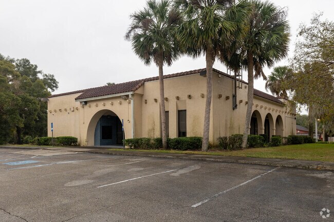
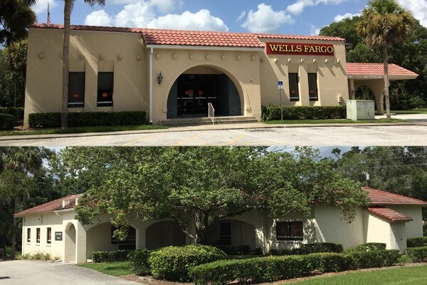
5065 Us Highway 17
6943-01-06-0010
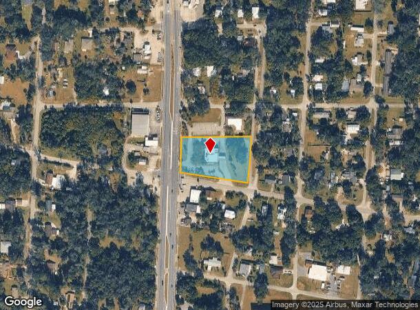
Map Of Deleon Springs
Nightclub
43-16-29 S 175 FT MEAS ON W/L OF US NO 17 & 240 FT ON COMMERCE AVE OF BLK 6 BEARDSLEYS MAP OF DELEON SPRINGS MB 1 PG 37 MB 12 PG 46 PER OR 1774 PG 633 PER OR 7627 PG 4817
X
Volusia
12127C0455H
Florida
2025
1.48 AC
2025
NW Volusia County
090203
Deltona/Daytona Beach
6,124 SF
Deltona-Daytona Beach-Ormond Beach, FL
DEMOGRAPHICS near 5065 Us Highway 17
1 Mile
3 Mile
5 Mile
2024 Total Population
2,387
8,495
17,703
2029 Population
2,621
9,300
19,444
Pop Growth 2024-2029
+ 9.80%
+ 9.48%
+ 9.83%
Average Age
39
45
44
2024 Total Households
781
3,344
7,005
HH Growth 2024-2029
+ 9.99%
+ 9.57%
+ 9.98%
Median Household Inc
$48,333
$61,814
$61,982
Avg Household Size
2.80
2.40
2.40
2024 Avg HH Vehicles
2.00
2.00
2.00
Median Home Value
$188,840
$246,937
$238,401
Median Year Built
1985
1986
1985
Nearby Places
Map Layers
Map Styles
 Street
 Aerial
- Restaurants
- Banks
- Shops
- Fitness
- Groceries
PUBLIC TRANSPORTATION
COMMUTER RAIL
DRIVE
WALK
Distance
16 min
9.1 mi
AIRPORT
Daytona Beach International
DRIVE
WALK
Distance
Daytona Beach International
34 min
23.4 mi
Orlando Sanford International
DRIVE
WALK
Distance
Orlando Sanford International
53 min
33.6 mi
SALE & LEASE HISTORY
LISTING DATE
SALE/LEASE

Feb 27, 2025
For Lease
Nearby Properties
Address
Land Use
TOTAL SIZE
Lot Size
Zoning
Address
Land Use
TOTAL SIZE
Lot Size
Zoning
8,258 SF
18.89 AC
MH7
Address
Land Use
TOTAL SIZE
Lot Size
Zoning
26,000 SF
134.51 AC
A3
Address
Land Use
TOTAL SIZE
Lot Size
Zoning
204,213 SF
36.85 AC
I1
Address
Land Use
TOTAL SIZE
Lot Size
Zoning
2,870 SF
1.50 AC
MH1
Address
Land Use
TOTAL SIZE
Lot Size
Zoning
53,969 SF
16.33 AC
A3
Address
Land Use
TOTAL SIZE
Lot Size
Zoning
3,660 SF
2 AC
MH1
Address
Land Use
TOTAL SIZE
Lot Size
Zoning
3,489 SF
3.09 AC
MH1C
Address
Land Use
TOTAL SIZE
Lot Size
Zoning
215,343 SF
130.48 AC
01PUD
Address
Land Use
TOTAL SIZE
Lot Size
Zoning
16,169 SF
4.25 AC
01B4
Address
Land Use
TOTAL SIZE
Lot Size
Zoning
47,988 SF
7.73 AC
01I1
Address
Land Use
TOTAL SIZE
Lot Size
Zoning
17,558 SF
45.69 AC
C
Address
Land Use
TOTAL SIZE
Lot Size
Zoning
10,643 SF
7.60 AC
01R3
Address
Land Use
TOTAL SIZE
Lot Size
Zoning
6,988 SF
8 AC
R3
Address
Land Use
TOTAL SIZE
Lot Size
Zoning
109,265 SF
15.27 AC
01R4
Address
Land Use
TOTAL SIZE
Lot Size
Zoning
11,944 SF
5.13 AC
01R4
Address
Land Use
TOTAL SIZE
Lot Size
Zoning
13,495 SF
1.48 AC
01R4
Address
Land Use
TOTAL SIZE
Lot Size
Zoning
8,062 SF
3.10 AC
01B1
Address
Land Use
TOTAL SIZE
Lot Size
Zoning
23,024 SF
47.49 AC
A2
Address
Land Use
TOTAL SIZE
Lot Size
Zoning
9,958 SF
1.55 AC
01B4
Address
Land Use
TOTAL SIZE
Lot Size
Zoning
8,476 SF
10.18 AC
A1
Address
Land Use
TOTAL SIZE
Lot Size
Zoning
1,705 SF
8.02 AC
01B4
Address
Land Use
TOTAL SIZE
Lot Size
Zoning
7,540 SF
69.50 AC
P
Address
Land Use
TOTAL SIZE
Lot Size
Zoning
3,625 SF
8.74 AC
A3
Address
Land Use
TOTAL SIZE
Lot Size
Zoning
13,821 SF
4.68 AC
R3
Address
Land Use
TOTAL SIZE
Lot Size
Zoning
4,325 SF
10.23 AC
A3
Address
Land Use
TOTAL SIZE
Lot Size
Zoning
2,462 SF
2.12 AC
PUDC
Address
Land Use
TOTAL SIZE
Lot Size
Zoning
4,303 SF
15.41 AC
01A3
Address
Land Use
TOTAL SIZE
Lot Size
Zoning
9,685 SF
0.59 AC
BPUD
Address
Land Use
TOTAL SIZE
Lot Size
Zoning
4,112 SF
59.60 AC
01A3
Address
Land Use
TOTAL SIZE
Lot Size
Zoning
7,488 SF
0.97 AC
01R4
The World's #1 Commercial Real Estate Marketplace
Connect with us
© 2025 CoStar Group
The information above has been obtained from sources believed reliable. While we do not doubt its accuracy we have not verified it and make no guarantee, warranty or representation about it. It is your responsibility to independently confirm its accuracy and completeness. Any projections, opinions, assumptions, or estimates used are for example only and do not represent the current or future performance of the property. The value of this transaction to you depends on tax and other factors which should be evaluated by your tax, financial, and legal advisors. You and your advisors should conduct a careful, independent investigation of the property to determine to your satisfaction the suitability of the property for your needs.