Property Record
507 Anclote Rd, Tarpon Springs, FL 34689

This Property Is For Sale
NEARBY LISTINGS FOR SALE OR LEASE
Property Detail
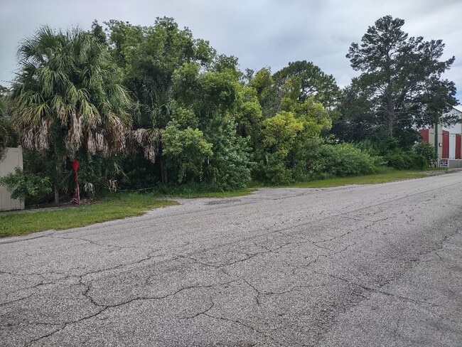
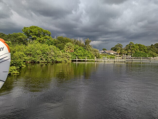
507 Anclote Rd
02-27-15-00000-440-0100
From Se Cor Of Sec 2 Run N
Marinafacility
PT OF SE 1/4 OF SE 1/4 AKA SAIL HARBOR MARINA TRACT 1 DESC AS COM AT NW COR OF SE 1/4 OF SEC TH E 408FT TH S 33FT FOR POB TH E 171.45FT TH S 73FT TH W 23.66FT TH S 170.89FT TH S68DW 97.09FT TH CUR TO LEFT RAD 87FT ARC 103.69FT CB S34DW CB S34DW 97.66
AE
Pinellas
12103C0017H
Florida
2024
2.77 AC
2025
North Pinellas
027308
Tampa/St Petersburg
3,348 SF
Tampa-St. Petersburg-Clearwater, FL
DEMOGRAPHICS near 507 Anclote Rd
1 Mile
3 Mile
5 Mile
2024 Total Population
5,245
58,239
112,572
2029 Population
5,525
64,818
125,800
Pop Growth 2024-2029
+ 5.34%
+ 11.30%
+ 11.75%
Average Age
47
46
45
2024 Total Households
2,195
25,760
48,617
HH Growth 2024-2029
+ 5.28%
+ 11.29%
+ 11.64%
Median Household Inc
$63,896
$47,732
$52,037
Avg Household Size
2.30
2.20
2.30
2024 Avg HH Vehicles
2.00
2.00
2.00
Median Home Value
$304,221
$211,179
$229,306
Median Year Built
1983
1979
1979
Nearby Places
- Restaurants
- Banks
- Shops
- Fitness
- Groceries
PUBLIC TRANSPORTATION
AIRPORT
St Pete-Clearwater International
DRIVE
WALK
Distance
St Pete-Clearwater International
35 min
21.6 mi
Tampa International
DRIVE
WALK
Distance
Tampa International
45 min
25.3 mi
Freight Ports
Port of Tampa Bay
DRIVE
WALK
Distance
Port of Tampa Bay
59 min
33.7 mi
Nearby Properties
Address
Land Use
TOTAL SIZE
Lot Size
Zoning
Address
Land Use
TOTAL SIZE
Lot Size
Zoning
341,775 SF
43.99 AC
Address
Land Use
TOTAL SIZE
Lot Size
Zoning
214,040 SF
8.47 AC
Address
Land Use
TOTAL SIZE
Lot Size
Zoning
286,598 SF
6.56 AC
Address
Land Use
TOTAL SIZE
Lot Size
Zoning
202,954 SF
49.22 AC
AR
Address
Land Use
TOTAL SIZE
Lot Size
Zoning
333,044 SF
25.64 AC
R4
Address
Land Use
TOTAL SIZE
Lot Size
Zoning
154,033 SF
15.86 AC
Address
Land Use
TOTAL SIZE
Lot Size
Zoning
157,476 SF
27.47 AC
MPUD
Address
Land Use
TOTAL SIZE
Lot Size
Zoning
264.64 AC
AC
Address
Land Use
TOTAL SIZE
Lot Size
Zoning
151,825 SF
18.01 AC
Address
Land Use
TOTAL SIZE
Lot Size
Zoning
4,955 SF
135.03 AC
Address
Land Use
TOTAL SIZE
Lot Size
Zoning
131,819 SF
11.24 AC
Address
Land Use
TOTAL SIZE
Lot Size
Zoning
81,053 SF
9.52 AC
Address
Land Use
TOTAL SIZE
Lot Size
Zoning
121,869 SF
4.72 AC
C2
Address
Land Use
TOTAL SIZE
Lot Size
Zoning
141,763 SF
12.96 AC
Address
Land Use
TOTAL SIZE
Lot Size
Zoning
81,045 SF
16.34 AC
PUD
Address
Land Use
TOTAL SIZE
Lot Size
Zoning
67,179 SF
9.52 AC
Address
Land Use
TOTAL SIZE
Lot Size
Zoning
80,212 SF
6.64 AC
Address
Land Use
TOTAL SIZE
Lot Size
Zoning
86,556 SF
7.44 AC
R6
Address
Land Use
TOTAL SIZE
Lot Size
Zoning
77,716 SF
2.54 AC
Address
Land Use
TOTAL SIZE
Lot Size
Zoning
203,135 SF
41.04 AC
C2
Address
Land Use
TOTAL SIZE
Lot Size
Zoning
143,430 SF
8.68 AC
Address
Land Use
TOTAL SIZE
Lot Size
Zoning
87,794 SF
7.97 AC
Address
Land Use
TOTAL SIZE
Lot Size
Zoning
70,901 SF
5.70 AC
Address
Land Use
TOTAL SIZE
Lot Size
Zoning
66.18 AC
RPD5
Address
Land Use
TOTAL SIZE
Lot Size
Zoning
44,321 SF
9.65 AC
Address
Land Use
TOTAL SIZE
Lot Size
Zoning
59,196 SF
4.41 AC
Address
Land Use
TOTAL SIZE
Lot Size
Zoning
56,812 SF
3.52 AC
Address
Land Use
TOTAL SIZE
Lot Size
Zoning
81,575 SF
7.90 AC
C2
Address
Land Use
TOTAL SIZE
Lot Size
Zoning
77,384 SF
6.32 AC
Address
Land Use
TOTAL SIZE
Lot Size
Zoning
90,892 SF
8.80 AC
The World's #1 Commercial Real Estate Marketplace
Connect with us
© 2025 CoStar Group
The information above has been obtained from sources believed reliable. While we do not doubt its accuracy we have not verified it and make no guarantee, warranty or representation about it. It is your responsibility to independently confirm its accuracy and completeness. Any projections, opinions, assumptions, or estimates used are for example only and do not represent the current or future performance of the property. The value of this transaction to you depends on tax and other factors which should be evaluated by your tax, financial, and legal advisors. You and your advisors should conduct a careful, independent investigation of the property to determine to your satisfaction the suitability of the property for your needs.