Property Record
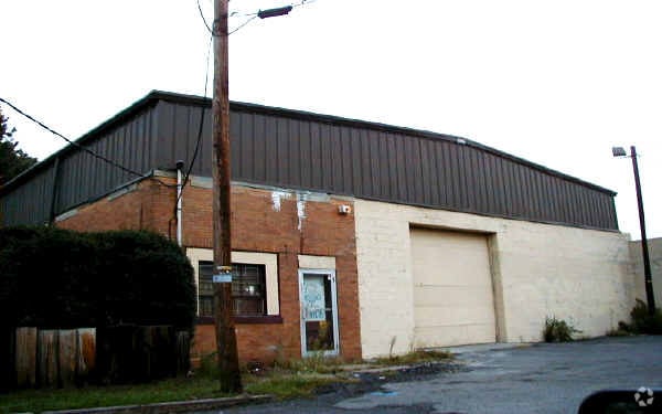
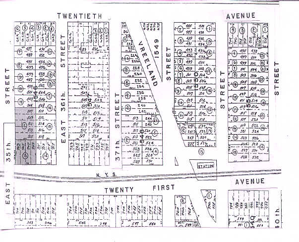
507 E 35Th St, Paterson, NJ 07504

Property Detail
507 E 35Th St
08-07901-0000-00029
Passaic
Industrialgeneral
New Jersey
I-1
29
B and X Area of moderate flood hazard, usually the area between the limits of the 100-year and 500-year floods.
0.29 AC
2024
Paterson
2025
Northern New Jersey
182600
New York-Jersey City-White Plains, NY-NJ
6,440 SF
NEARBY LISTINGS FOR SALE OR LEASE
DEMOGRAPHICS near 507 E 35Th St
1 mile
3 mile
5 mile
2025 Total Population
40,715
323,292
637,485
2030 Population
40,616
324,733
646,633
Pop Growth 2025-2030
(0.24%)
+ 0.45%
+ 1.44%
Average Age
38
38
40
2025 Total Households
12,399
105,876
218,850
HH Growth 2025-2030
(0.32%)
+ 0.46%
+ 1.52%
Median Household Inc
$69,525
$70,624
$85,938
Avg Household Size
3.10
2.90
2.80
2025 Avg HH Vehicles
1.00
1.00
2.00
Median Home Value
$405,139
$447,832
$495,108
Median Year Built
1950
1951
1955
Nearby Places
Map Layers
Map Styles
 Street
 Aerial
Transit
 Traffic
 Biking
Places
Listings with unknown addresses are not visible on the map
- Restaurants
- Banks
- Shops
- Fitness
- Groceries
PUBLIC TRANSPORTATION
COMMUTER RAIL
Paterson (Main/Port Jervis Line - NJ Transit Commuter Rail (NJ Transit))
Drive
Walk
Distance
Paterson (Main/Port Jervis Line - NJ Transit Commuter Rail (NJ Transit))
4 min
1.8 mi
Broadway (Bergen County/Port Jervis Line - NJ Transit Commuter Rail (NJ Transit))
Drive
Walk
Distance
Broadway (Bergen County/Port Jervis Line - NJ Transit Commuter Rail (NJ Transit))
6 min
2.8 mi
AIRPORT
Newark Liberty International
Drive
Walk
Distance
Newark Liberty International
24 min
19.6 mi
LaGuardia
Drive
Walk
Distance
LaGuardia
35 min
23.5 mi
Westchester County
Drive
Walk
Distance
Westchester County
56 min
39.3 mi
Freight Ports
Port Newark Container Terminal
Drive
Walk
Distance
Port Newark Container Terminal
28 min
18.8 mi
Nearby Properties
Address
Land Use
TOTAL SIZE
Lot Size
Zoning
Address
Land Use
TOTAL SIZE
Lot Size
Zoning
8.75 AC
Address
Land Use
TOTAL SIZE
Lot Size
Zoning
7.10 AC
R-3
Address
Land Use
TOTAL SIZE
Lot Size
Zoning
12,506 SF
130 AC
B-2
Address
Land Use
TOTAL SIZE
Lot Size
Zoning
8.66 AC
CH1
Address
Land Use
TOTAL SIZE
Lot Size
Zoning
79,310 SF
2 AC
B-2
Address
Land Use
TOTAL SIZE
Lot Size
Zoning
25.50 AC
B2
Address
Land Use
TOTAL SIZE
Lot Size
Zoning
26,816 SF
25.50 AC
POP
Address
Land Use
TOTAL SIZE
Lot Size
Zoning
9.96 AC
MU
Address
Land Use
TOTAL SIZE
Lot Size
Zoning
Address
Land Use
TOTAL SIZE
Lot Size
Zoning
152,050 SF
1.96 AC
B-1
Address
Land Use
TOTAL SIZE
Lot Size
Zoning
57,680 SF
20.01 AC
CR
Address
Land Use
TOTAL SIZE
Lot Size
Zoning
7.83 AC
Address
Land Use
TOTAL SIZE
Lot Size
Zoning
5.40 AC
RB
Address
Land Use
TOTAL SIZE
Lot Size
Zoning
0.99 AC
Address
Land Use
TOTAL SIZE
Lot Size
Zoning
1.80 AC
Address
Land Use
TOTAL SIZE
Lot Size
Zoning
0.69 AC
I-1
Address
Land Use
TOTAL SIZE
Lot Size
Zoning
1,512 SF
90 AC
Address
Land Use
TOTAL SIZE
Lot Size
Zoning
21.80 AC
R-A3
Address
Land Use
TOTAL SIZE
Lot Size
Zoning
Address
Land Use
TOTAL SIZE
Lot Size
Zoning
648 SF
108.80 AC
Address
Land Use
TOTAL SIZE
Lot Size
Zoning
14,152 SF
23.87 AC
Address
Land Use
TOTAL SIZE
Lot Size
Zoning
6.66 AC
RM
Address
Land Use
TOTAL SIZE
Lot Size
Zoning
0.01 AC
Address
Land Use
TOTAL SIZE
Lot Size
Zoning
16.05 AC
Address
Land Use
TOTAL SIZE
Lot Size
Zoning
764,364 SF
16.60 AC
I-2
Address
Land Use
TOTAL SIZE
Lot Size
Zoning
0.01 AC
Address
Land Use
TOTAL SIZE
Lot Size
Zoning
11.87 AC
Address
Land Use
TOTAL SIZE
Lot Size
Zoning
0.12 AC
Address
Land Use
TOTAL SIZE
Lot Size
Zoning
Address
Land Use
TOTAL SIZE
Lot Size
Zoning
5.87 AC
B2
The World's #1 Commercial Real Estate Marketplace
Connect with us
© 2026 CoStar Group
The information above has been obtained from sources believed reliable. While we do not doubt its accuracy we have not verified it and make no guarantee, warranty or representation about it. It is your responsibility to independently confirm its accuracy and completeness. Any projections, opinions, assumptions, or estimates used are for example only and do not represent the current or future performance of the property. The value of this transaction to you depends on tax and other factors which should be evaluated by your tax, financial, and legal advisors. You and your advisors should conduct a careful, independent investigation of the property to determine to your satisfaction the suitability of the property for your needs.