Property Record
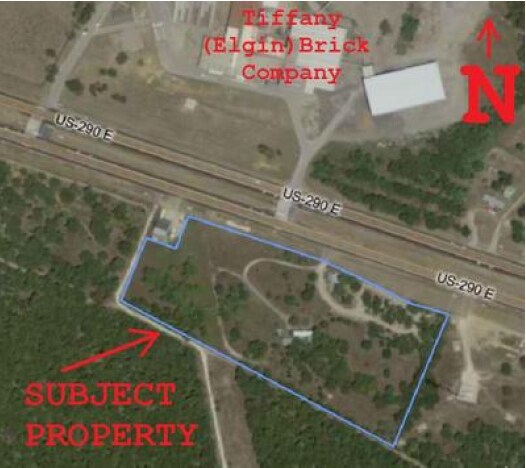
507 E Us 290 E, Elgin, TX 78621

Property Detail
507 E Us 290 E
14065
A303 STOVAL, GEO. H., SERIAL # 16414SL140122, ACRES 8.779
Commercialnec
BASTROP
B and X Area of moderate flood hazard, usually the area between the limits of the 100-year and 500-year floods.
Texas
2024
8.78 AC
2025
Bastrop County
950202
Austin
2,076 SF
Austin-Round Rock-San Marcos, TX
NEARBY LISTINGS FOR SALE OR LEASE
DEMOGRAPHICS near 507 E Us 290 E
1 mile
3 mile
5 mile
2024 Total Population
979
11,172
19,929
2029 Population
1,217
13,889
24,682
Pop Growth 2024-2029
+ 24.31%
+ 24.32%
+ 23.85%
Average Age
38
38
37
2024 Total Households
329
3,783
6,785
HH Growth 2024-2029
+ 25.23%
+ 25.43%
+ 25.06%
Median Household Inc
$121,511
$102,249
$88,012
Avg Household Size
2.80
2.80
2.90
2024 Avg HH Vehicles
2.00
2.00
2.00
Median Home Value
$354,166
$293,042
$253,315
Median Year Built
1998
1990
1991
Nearby Places
Map Layers
Map Styles
 Street
 Aerial
Transit
 Traffic
 Biking
Places
Listings with unknown addresses are not visible on the map
- Restaurants
- Banks
- Shops
- Fitness
- Groceries
PUBLIC TRANSPORTATION
AIRPORT
Austin-Bergstrom International
Drive
Walk
Distance
Austin-Bergstrom International
45 min
32.3 mi
Nearby Properties
Address
Land Use
TOTAL SIZE
Lot Size
Zoning
Address
Land Use
TOTAL SIZE
Lot Size
Zoning
56,011 SF
2.46 AC
Address
Land Use
TOTAL SIZE
Lot Size
Zoning
63,520 SF
5.49 AC
Address
Land Use
TOTAL SIZE
Lot Size
Zoning
45,180 SF
5.35 AC
Address
Land Use
TOTAL SIZE
Lot Size
Zoning
180,171 SF
405.94 AC
Address
Land Use
TOTAL SIZE
Lot Size
Zoning
1 SF
77.20 AC
Address
Land Use
TOTAL SIZE
Lot Size
Zoning
36,451 SF
1.23 AC
Address
Land Use
TOTAL SIZE
Lot Size
Zoning
5,385 SF
46.20 AC
Address
Land Use
TOTAL SIZE
Lot Size
Zoning
18,697 SF
0.79 AC
Address
Land Use
TOTAL SIZE
Lot Size
Zoning
43,931 SF
1.62 AC
Address
Land Use
TOTAL SIZE
Lot Size
Zoning
1,053 SF
15.99 AC
Address
Land Use
TOTAL SIZE
Lot Size
Zoning
20,641 SF
1.75 AC
Address
Land Use
TOTAL SIZE
Lot Size
Zoning
15,901 SF
4.13 AC
Address
Land Use
TOTAL SIZE
Lot Size
Zoning
12,976 SF
0.37 AC
Address
Land Use
TOTAL SIZE
Lot Size
Zoning
63,538 SF
19.18 AC
Address
Land Use
TOTAL SIZE
Lot Size
Zoning
10,376 SF
0.33 AC
Address
Land Use
TOTAL SIZE
Lot Size
Zoning
20,950 SF
1.76 AC
Address
Land Use
TOTAL SIZE
Lot Size
Zoning
57,764 SF
2.45 AC
Address
Land Use
TOTAL SIZE
Lot Size
Zoning
4,345 SF
2.26 AC
Address
Land Use
TOTAL SIZE
Lot Size
Zoning
13,640 SF
0.60 AC
Address
Land Use
TOTAL SIZE
Lot Size
Zoning
11,742 SF
0.13 AC
Address
Land Use
TOTAL SIZE
Lot Size
Zoning
7,995 SF
0.46 AC
Address
Land Use
TOTAL SIZE
Lot Size
Zoning
16,747 SF
1.59 AC
Address
Land Use
TOTAL SIZE
Lot Size
Zoning
11,500 SF
0.13 AC
Address
Land Use
TOTAL SIZE
Lot Size
Zoning
24,264 SF
2.07 AC
Address
Land Use
TOTAL SIZE
Lot Size
Zoning
1 SF
382.40 AC
Address
Land Use
TOTAL SIZE
Lot Size
Zoning
6,260 SF
0.12 AC
Address
Land Use
TOTAL SIZE
Lot Size
Zoning
6,310 SF
0.20 AC
Address
Land Use
TOTAL SIZE
Lot Size
Zoning
10,749 SF
2.68 AC
The World's #1 Commercial Real Estate Marketplace
Connect with us
© 2026 CoStar Group
The information above has been obtained from sources believed reliable. While we do not doubt its accuracy we have not verified it and make no guarantee, warranty or representation about it. It is your responsibility to independently confirm its accuracy and completeness. Any projections, opinions, assumptions, or estimates used are for example only and do not represent the current or future performance of the property. The value of this transaction to you depends on tax and other factors which should be evaluated by your tax, financial, and legal advisors. You and your advisors should conduct a careful, independent investigation of the property to determine to your satisfaction the suitability of the property for your needs.