Property Record
5071 S Preston Hwy, Shepherdsville, KY 40165

NEARBY LISTINGS FOR SALE OR LEASE
Property Detail
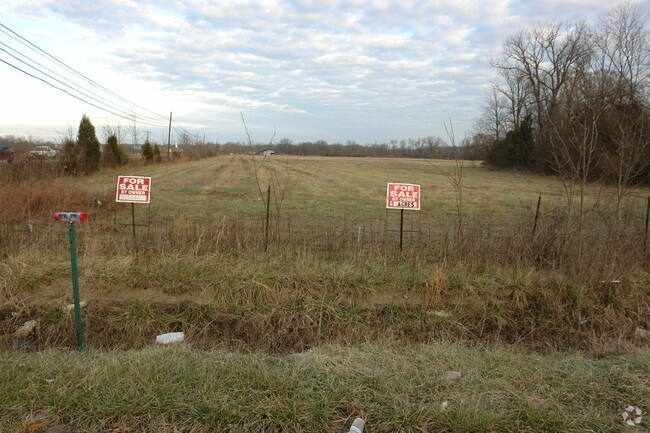
5071 S Preston Hwy
Louisville-Jefferson County, KY-IN
Bourbon Trail Business Pk
415507
113.160 ACRE CONSOLIDATED TRACT _ PLAT ON PAGE 718 OF DB PG 1018-714
Commercialnec
Bullitt
AE
Kentucky
21029C0187G
51 AC
2024
Bullitt County
2024
Louisville
021200
DEMOGRAPHICS near 5071 S Preston Hwy
1 Mile
3 Mile
5 Mile
2024 Total Population
283
2,708
11,291
2029 Population
297
2,835
11,786
Pop Growth 2024-2029
+ 4.95%
+ 4.69%
+ 4.38%
Average Age
44
44
40
2024 Total Households
106
1,017
4,217
HH Growth 2024-2029
+ 4.72%
+ 4.62%
+ 4.32%
Median Household Inc
$49,444
$64,739
$64,208
Avg Household Size
2.60
2.60
2.60
2024 Avg HH Vehicles
2.00
2.00
2.00
Median Home Value
$157,777
$192,384
$173,614
Median Year Built
1982
1987
1992
Nearby Places
Map Layers
Map Styles
 Street
 Aerial
- Restaurants
- Banks
- Shops
- Fitness
- Groceries
PUBLIC TRANSPORTATION
AIRPORT
Louisville Muhammad Ali International
DRIVE
WALK
Distance
Louisville Muhammad Ali International
30 min
21.0 mi
Freight Ports
Port of Toledo
DRIVE
WALK
Distance
Port of Toledo
383 min
328.1 mi
Nearby Properties
Address
Land Use
TOTAL SIZE
Lot Size
Zoning
Address
Land Use
TOTAL SIZE
Lot Size
Zoning
Address
Land Use
TOTAL SIZE
Lot Size
Zoning
Address
Land Use
TOTAL SIZE
Lot Size
Zoning
2,608 SF
287 AC
Address
Land Use
TOTAL SIZE
Lot Size
Zoning
Address
Land Use
TOTAL SIZE
Lot Size
Zoning
2,468 SF
165 AC
Address
Land Use
TOTAL SIZE
Lot Size
Zoning
Address
Land Use
TOTAL SIZE
Lot Size
Zoning
Address
Land Use
TOTAL SIZE
Lot Size
Zoning
Address
Land Use
TOTAL SIZE
Lot Size
Zoning
2.15 AC
Address
Land Use
TOTAL SIZE
Lot Size
Zoning
Address
Land Use
TOTAL SIZE
Lot Size
Zoning
Address
Land Use
TOTAL SIZE
Lot Size
Zoning
Address
Land Use
TOTAL SIZE
Lot Size
Zoning
Address
Land Use
TOTAL SIZE
Lot Size
Zoning
1,595.54 AC
Address
Land Use
TOTAL SIZE
Lot Size
Zoning
Address
Land Use
TOTAL SIZE
Lot Size
Zoning
67.01 AC
Address
Land Use
TOTAL SIZE
Lot Size
Zoning
69.96 AC
Address
Land Use
TOTAL SIZE
Lot Size
Zoning
27.90 AC
Address
Land Use
TOTAL SIZE
Lot Size
Zoning
1,500 SF
1.08 AC
Address
Land Use
TOTAL SIZE
Lot Size
Zoning
9,230 SF
2 AC
Address
Land Use
TOTAL SIZE
Lot Size
Zoning
Address
Land Use
TOTAL SIZE
Lot Size
Zoning
2,556 SF
1.37 AC
Address
Land Use
TOTAL SIZE
Lot Size
Zoning
Address
Land Use
TOTAL SIZE
Lot Size
Zoning
Address
Land Use
TOTAL SIZE
Lot Size
Zoning
4.13 AC
Address
Land Use
TOTAL SIZE
Lot Size
Zoning
40.12 AC
Address
Land Use
TOTAL SIZE
Lot Size
Zoning
Address
Land Use
TOTAL SIZE
Lot Size
Zoning
Address
Land Use
TOTAL SIZE
Lot Size
Zoning
The World's #1 Commercial Real Estate Marketplace
Connect with us
© 2025 CoStar Group
The information above has been obtained from sources believed reliable. While we do not doubt its accuracy we have not verified it and make no guarantee, warranty or representation about it. It is your responsibility to independently confirm its accuracy and completeness. Any projections, opinions, assumptions, or estimates used are for example only and do not represent the current or future performance of the property. The value of this transaction to you depends on tax and other factors which should be evaluated by your tax, financial, and legal advisors. You and your advisors should conduct a careful, independent investigation of the property to determine to your satisfaction the suitability of the property for your needs.