Property Record
5072 N Linder Rd, Meridian, ID 83646

Property Detail
5072 N Linder Rd
R1527290050
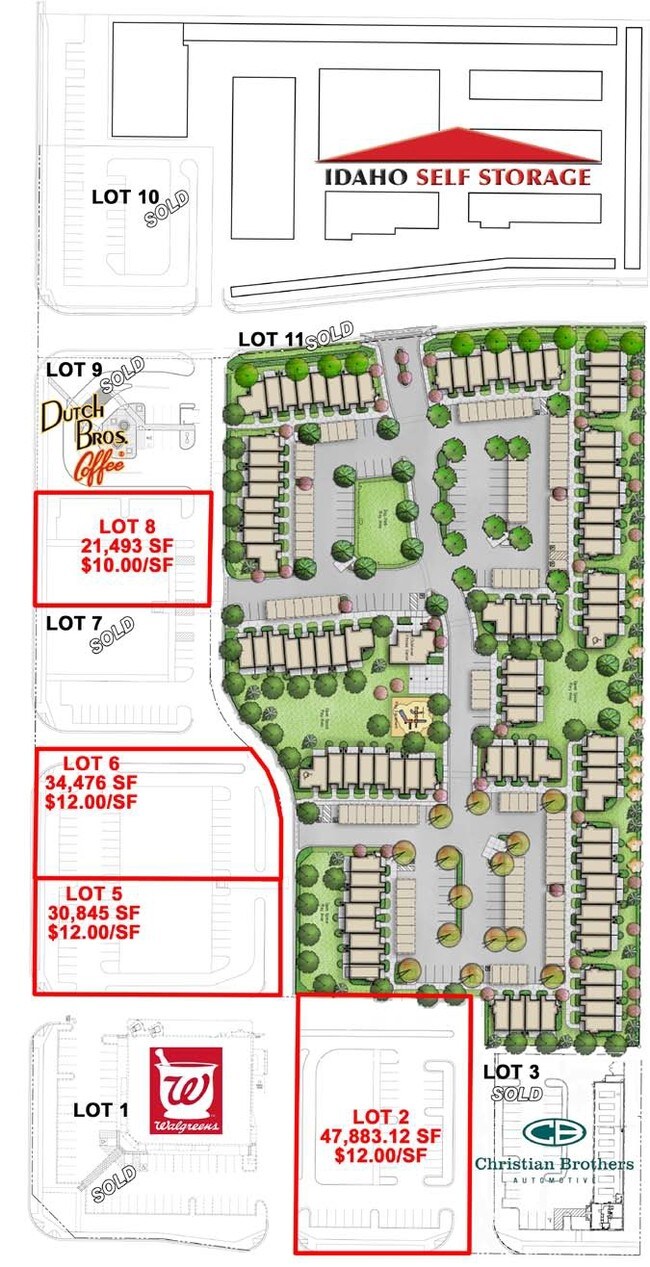
LOT 5 BLK 2 COMMERCIAL SOUTHWEST SUB NO 02
Commercialbuilding
ADA
C-G
Idaho
B and X Area of moderate flood hazard, usually the area between the limits of the 100-year and 500-year floods.
5
2024
0.58 AC
2025
Meridian
010363
Boise City/Nampa
480 SF
Boise City, ID
NEARBY LISTINGS FOR SALE OR LEASE
DEMOGRAPHICS near 5072 N Linder Rd
1 mile
3 mile
5 mile
2025 Total Population
17,614
91,204
172,924
2030 Population
18,282
95,695
182,538
Pop Growth 2025-2030
+ 3.79%
+ 4.92%
+ 5.56%
Average Age
36
39
40
2025 Total Households
5,469
31,741
62,228
HH Growth 2025-2030
+ 4.13%
+ 5.33%
+ 6.02%
Median Household Inc
$118,171
$104,150
$99,114
Avg Household Size
3.20
2.80
2.70
2025 Avg HH Vehicles
2.00
2.00
2.00
Median Home Value
$604,900
$536,932
$574,593
Median Year Built
2009
2005
2004
Nearby Places
Map Layers
Map Styles
 Street
 Aerial
Transit
 Traffic
 Biking
Places
Listings with unknown addresses are not visible on the map
- Restaurants
- Banks
- Shops
- Fitness
- Groceries
PUBLIC TRANSPORTATION
AIRPORT
Boise Air Trml/Gowen Field
Drive
Walk
Distance
Boise Air Trml/Gowen Field
27 min
16.3 mi
Nearby Properties
Address
Land Use
TOTAL SIZE
Lot Size
Zoning
Address
Land Use
TOTAL SIZE
Lot Size
Zoning
342,567 SF
19.16 AC
MU-DA
Address
Land Use
TOTAL SIZE
Lot Size
Zoning
415,710 SF
14.78 AC
R-40
Address
Land Use
TOTAL SIZE
Lot Size
Zoning
17.46 AC
R-15
Address
Land Use
TOTAL SIZE
Lot Size
Zoning
10.44 AC
R-15
Address
Land Use
TOTAL SIZE
Lot Size
Zoning
190,106 SF
10.10 AC
R-4
Address
Land Use
TOTAL SIZE
Lot Size
Zoning
262,845 SF
11.97 AC
R-15
Address
Land Use
TOTAL SIZE
Lot Size
Zoning
126,466 SF
5.29 AC
R-40
Address
Land Use
TOTAL SIZE
Lot Size
Zoning
108,505 SF
6.84 AC
C-G
Address
Land Use
TOTAL SIZE
Lot Size
Zoning
170,333 SF
14.65 AC
C-3-DA
Address
Land Use
TOTAL SIZE
Lot Size
Zoning
187,091 SF
15.46 AC
C-G
Address
Land Use
TOTAL SIZE
Lot Size
Zoning
152,895 SF
14.29 AC
C-G
Address
Land Use
TOTAL SIZE
Lot Size
Zoning
90,035 SF
0.91 AC
O-T
Address
Land Use
TOTAL SIZE
Lot Size
Zoning
164,251 SF
21.52 AC
C-G
Address
Land Use
TOTAL SIZE
Lot Size
Zoning
110,152 SF
6.02 AC
R-40
Address
Land Use
TOTAL SIZE
Lot Size
Zoning
28.08 AC
R-8
Address
Land Use
TOTAL SIZE
Lot Size
Zoning
220,153 SF
11.86 AC
I-L
Address
Land Use
TOTAL SIZE
Lot Size
Zoning
228,384 SF
14.22 AC
C-G
Address
Land Use
TOTAL SIZE
Lot Size
Zoning
81,617 SF
5.09 AC
TN-R
Address
Land Use
TOTAL SIZE
Lot Size
Zoning
80,913 SF
8 AC
C-C
Address
Land Use
TOTAL SIZE
Lot Size
Zoning
167,896 SF
13.41 AC
I-L
Address
Land Use
TOTAL SIZE
Lot Size
Zoning
73,864 SF
7.20 AC
R-15
Address
Land Use
TOTAL SIZE
Lot Size
Zoning
84,426 SF
11.34 AC
L-O
Address
Land Use
TOTAL SIZE
Lot Size
Zoning
75,520 SF
4.64 AC
R-15
Address
Land Use
TOTAL SIZE
Lot Size
Zoning
179,824 SF
9.66 AC
I-L
Address
Land Use
TOTAL SIZE
Lot Size
Zoning
16.42 AC
R-8
Address
Land Use
TOTAL SIZE
Lot Size
Zoning
56,420 SF
10.27 AC
M1
Address
Land Use
TOTAL SIZE
Lot Size
Zoning
90,940 SF
4.53 AC
N-OD
Address
Land Use
TOTAL SIZE
Lot Size
Zoning
45,770 SF
4.29 AC
O-T
Address
Land Use
TOTAL SIZE
Lot Size
Zoning
66,112 SF
4.52 AC
C-C
Address
Land Use
TOTAL SIZE
Lot Size
Zoning
56,382 SF
3.94 AC
C-C
The World's #1 Commercial Real Estate Marketplace
Connect with us
© 2026 CoStar Group
The information above has been obtained from sources believed reliable. While we do not doubt its accuracy we have not verified it and make no guarantee, warranty or representation about it. It is your responsibility to independently confirm its accuracy and completeness. Any projections, opinions, assumptions, or estimates used are for example only and do not represent the current or future performance of the property. The value of this transaction to you depends on tax and other factors which should be evaluated by your tax, financial, and legal advisors. You and your advisors should conduct a careful, independent investigation of the property to determine to your satisfaction the suitability of the property for your needs.