Property Record
50750 Romeo Plank Rd, Macomb, MI 48044


Property Detail
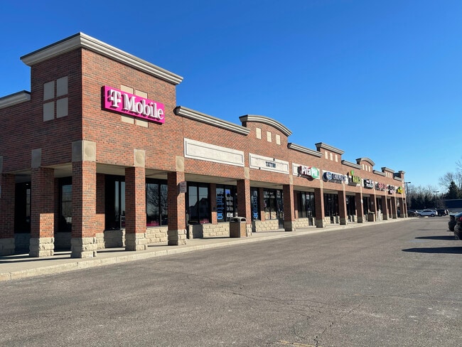
50750 Romeo Plank Rd
20-08-20-200-046
T3N; R13E; SEC 20; COMM AT NE COR SEC 20; TH S89*06'45"W 478.18 FT; TH S17*09'48"E 62.50 FT TO POB; TH S17*09'48"E 25.70 FT;
Commercialnec
Macomb
C2
Michigan
AE The base floodplain where base flood elevations are provided. AE Zones are now used on new format FIRMs instead of A1-A30 Zones.
5.78 AC
2025
Macomb East
2025
Detroit
224001
Detroit-Warren-Dearborn, MI
34,650 SF
NEARBY LISTINGS FOR SALE OR LEASE
DEMOGRAPHICS near 50750 Romeo Plank Rd
1 mile
3 mile
5 mile
2025 Total Population
9,921
88,309
177,937
2030 Population
9,987
89,049
179,698
Pop Growth 2025-2030
+ 0.67%
+ 0.84%
+ 0.99%
Average Age
42
41
42
2025 Total Households
3,391
30,453
67,721
HH Growth 2025-2030
+ 0.68%
+ 0.72%
+ 0.96%
Median Household Inc
$119,414
$115,974
$97,806
Avg Household Size
2.90
2.90
2.60
2025 Avg HH Vehicles
3.00
2.00
2.00
Median Home Value
$391,834
$374,851
$349,050
Median Year Built
1998
1997
1994
Nearby Places
Map Layers
Map Styles
 Street
 Aerial
Layers
 Traffic
 Biking
Places
Listings with unknown addresses are not visible on the map
- Restaurants
- Banks
- Shops
- Fitness
- Groceries
PUBLIC TRANSPORTATION
AIRPORT
Detroit City
Drive
Walk
Distance
Detroit City
42 min
31.8 mi
Freight Ports
Port of Baltimore
Drive
Walk
Distance
Port of Baltimore
1 min
405.9 mi
SALE & LEASE HISTORY
LISTING DATE
SALE/LEASE

Nov 09, 2023
For Lease
Jan 22, 2019
For Lease
Dec 11, 2024
For Lease
Nearby Properties
Address
Land Use
TOTAL SIZE
Lot Size
Zoning
Address
Land Use
TOTAL SIZE
Lot Size
Zoning
20,560 SF
37.09 AC
R2
Address
Land Use
TOTAL SIZE
Lot Size
Zoning
447,434 SF
23.29 AC
LM
Address
Land Use
TOTAL SIZE
Lot Size
Zoning
89,559 SF
44.54 AC
O2
Address
Land Use
TOTAL SIZE
Lot Size
Zoning
118,343 SF
7.33 AC
R1
Address
Land Use
TOTAL SIZE
Lot Size
Zoning
10.29 AC
LM
Address
Land Use
TOTAL SIZE
Lot Size
Zoning
90,185 SF
14.73 AC
C2
Address
Land Use
TOTAL SIZE
Lot Size
Zoning
17.40 AC
CK MAP
Address
Land Use
TOTAL SIZE
Lot Size
Zoning
79,942 SF
4.65 AC
M1
Address
Land Use
TOTAL SIZE
Lot Size
Zoning
120,658 SF
13.97 AC
C-3
Address
Land Use
TOTAL SIZE
Lot Size
Zoning
121,156 SF
9.40 AC
CK MAP
Address
Land Use
TOTAL SIZE
Lot Size
Zoning
293,800 SF
M1
Address
Land Use
TOTAL SIZE
Lot Size
Zoning
115,349 SF
14.39 AC
C3
Address
Land Use
TOTAL SIZE
Lot Size
Zoning
14.46 AC
R-7
Address
Land Use
TOTAL SIZE
Lot Size
Zoning
214,282 SF
22.26 AC
M1
Address
Land Use
TOTAL SIZE
Lot Size
Zoning
150,854 SF
8.50 AC
LM
Address
Land Use
TOTAL SIZE
Lot Size
Zoning
148,438 SF
4.82 AC
LM
Address
Land Use
TOTAL SIZE
Lot Size
Zoning
99,619 SF
8.24 AC
M1
Address
Land Use
TOTAL SIZE
Lot Size
Zoning
37.96 AC
AG
Address
Land Use
TOTAL SIZE
Lot Size
Zoning
58,706 SF
12.87 AC
C4
Address
Land Use
TOTAL SIZE
Lot Size
Zoning
312,087 SF
25.65 AC
M1
Address
Land Use
TOTAL SIZE
Lot Size
Zoning
56,766 SF
5.06 AC
C2
Address
Land Use
TOTAL SIZE
Lot Size
Zoning
99,188 SF
7.99 AC
LM
Address
Land Use
TOTAL SIZE
Lot Size
Zoning
4,064 SF
99.99 AC
R3
Address
Land Use
TOTAL SIZE
Lot Size
Zoning
104,455 SF
15.28 AC
LM
Address
Land Use
TOTAL SIZE
Lot Size
Zoning
74,858 SF
7.84 AC
CK MAP
Address
Land Use
TOTAL SIZE
Lot Size
Zoning
28,746 SF
10.70 AC
C3
Address
Land Use
TOTAL SIZE
Lot Size
Zoning
50,476 SF
7.53 AC
C-2
Address
Land Use
TOTAL SIZE
Lot Size
Zoning
85,339 SF
10.61 AC
C3
Address
Land Use
TOTAL SIZE
Lot Size
Zoning
101,647 SF
5.48 AC
LM
Address
Land Use
TOTAL SIZE
Lot Size
Zoning
99,634 SF
4.75 AC
LM
The World's #1 Commercial Real Estate Marketplace
Connect with us
© 2026 CoStar Group
The information above has been obtained from sources believed reliable. While we do not doubt its accuracy we have not verified it and make no guarantee, warranty or representation about it. It is your responsibility to independently confirm its accuracy and completeness. Any projections, opinions, assumptions, or estimates used are for example only and do not represent the current or future performance of the property. The value of this transaction to you depends on tax and other factors which should be evaluated by your tax, financial, and legal advisors. You and your advisors should conduct a careful, independent investigation of the property to determine to your satisfaction the suitability of the property for your needs.