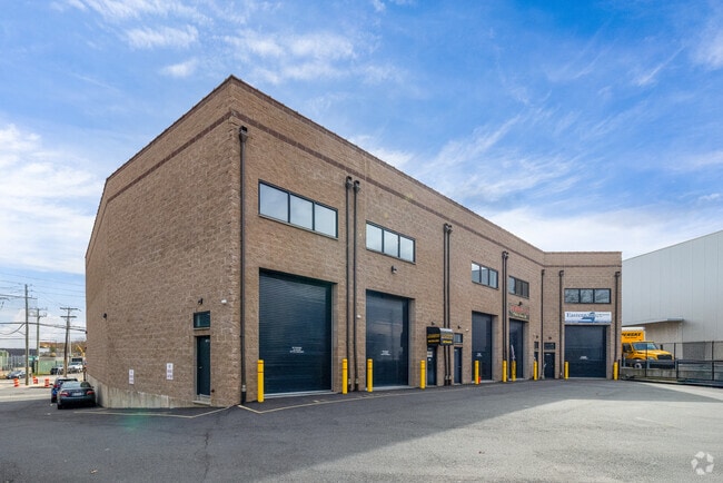
Property Record
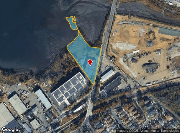
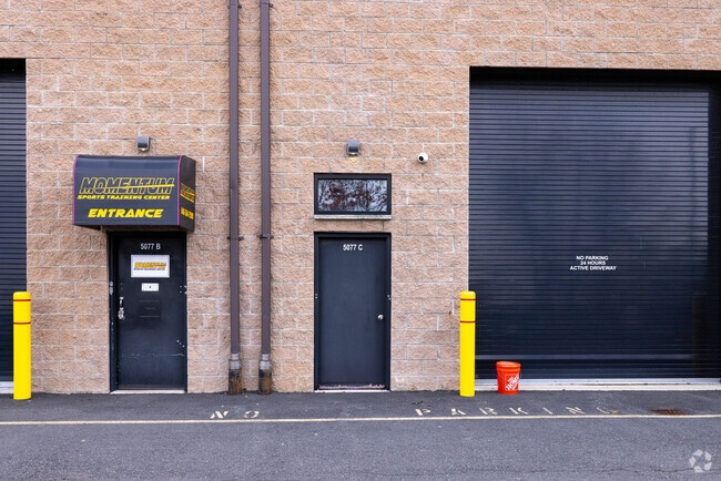
5077 Arthur Kill Rd, Staten Island, NY 10307
NEARBY LISTINGS FOR SALE OR LEASE
Property Detail
5077 Arthur Kill Rd
07983-0016
LAND EASEMENT HELD BY NY STATE PUBLIC SERV
Warehouse
Staten Island
AE
New York
34023C0088F
16
2024
2.73 AC
2025
Staten Island
024800
Long Island (New York)
13,223 SF
New York-Jersey City-White Plains, NY-NJ
DEMOGRAPHICS near 5077 Arthur Kill Rd
1 Mile
3 Mile
5 Mile
2024 Total Population
13,654
108,448
278,935
2029 Population
13,611
105,441
274,063
Pop Growth 2024-2029
(0.31%)
(2.77%)
(1.75%)
Average Age
39
39
40
2024 Total Households
4,712
36,602
98,323
HH Growth 2024-2029
(0.53%)
(2.73%)
(1.75%)
Median Household Inc
$91,502
$76,630
$91,064
Avg Household Size
2.90
2.90
2.80
2024 Avg HH Vehicles
2.00
2.00
2.00
Median Home Value
$745,351
$583,559
$460,746
Median Year Built
1986
1978
1973
Nearby Places
- Restaurants
- Banks
- Shops
- Fitness
- Groceries
PUBLIC TRANSPORTATION
COMMUTER RAIL
Arthur Kill (Staten Island Railway - MTA New York City Transit)
DRIVE
WALK
Distance
Arthur Kill (Staten Island Railway - MTA New York City Transit)
0 min
4 min
0.2 mi
Richmond Valley (Staten Island Railway - New York MTA Subway (The Subway))
DRIVE
WALK
Distance
Richmond Valley (Staten Island Railway - New York MTA Subway (The Subway))
2 min
16 min
0.8 mi
AIRPORT
Newark Liberty International
DRIVE
WALK
Distance
Newark Liberty International
32 min
19.6 mi
LaGuardia
DRIVE
WALK
Distance
LaGuardia
56 min
33.2 mi
John F Kennedy International
DRIVE
WALK
Distance
John F Kennedy International
55 min
35.9 mi
Freight Ports
New York Container Terminal
DRIVE
WALK
Distance
New York Container Terminal
17 min
10.3 mi
SALE & LEASE HISTORY
LISTING DATE
SALE/LEASE

Jul 21, 2020
For Lease
Aug 16, 2018
For Lease
Aug 08, 2022
For Lease
Nearby Properties
Address
Land Use
TOTAL SIZE
Lot Size
Zoning
Address
Land Use
TOTAL SIZE
Lot Size
Zoning
37.32 AC
S-3B
Address
Land Use
TOTAL SIZE
Lot Size
Zoning
Address
Land Use
TOTAL SIZE
Lot Size
Zoning
53.04 AC
S-1F
Address
Land Use
TOTAL SIZE
Lot Size
Zoning
11.63 AC
S-3D
Address
Land Use
TOTAL SIZE
Lot Size
Zoning
411,000 SF
18.54 AC
R3X
Address
Land Use
TOTAL SIZE
Lot Size
Zoning
10.69 AC
R-MM
Address
Land Use
TOTAL SIZE
Lot Size
Zoning
15.15 AC
RMMF
Address
Land Use
TOTAL SIZE
Lot Size
Zoning
71.66 AC
M-3
Address
Land Use
TOTAL SIZE
Lot Size
Zoning
2.51 AC
H
Address
Land Use
TOTAL SIZE
Lot Size
Zoning
28.90 AC
S-3B
Address
Land Use
TOTAL SIZE
Lot Size
Zoning
11,140 SF
170.60 AC
PARK
Address
Land Use
TOTAL SIZE
Lot Size
Zoning
52.97 AC
M-3
Address
Land Use
TOTAL SIZE
Lot Size
Zoning
64.66 AC
S-3A
Address
Land Use
TOTAL SIZE
Lot Size
Zoning
220,240 SF
5.77 AC
R3X
Address
Land Use
TOTAL SIZE
Lot Size
Zoning
6.79 AC
R-50
Address
Land Use
TOTAL SIZE
Lot Size
Zoning
38.58 AC
PARK
Address
Land Use
TOTAL SIZE
Lot Size
Zoning
7.23 AC
S-2A
Address
Land Use
TOTAL SIZE
Lot Size
Zoning
6,822 SF
29.22 AC
S-2C
Address
Land Use
TOTAL SIZE
Lot Size
Zoning
39.14 AC
M-3
Address
Land Use
TOTAL SIZE
Lot Size
Zoning
276 SF
6.59 AC
S-2A
Address
Land Use
TOTAL SIZE
Lot Size
Zoning
23.01 AC
S-1F
Address
Land Use
TOTAL SIZE
Lot Size
Zoning
35.05 AC
M-3
Address
Land Use
TOTAL SIZE
Lot Size
Zoning
15,000 SF
16.63 AC
M1-1
Address
Land Use
TOTAL SIZE
Lot Size
Zoning
30.50 AC
Address
Land Use
TOTAL SIZE
Lot Size
Zoning
64.66 AC
S-3A
Address
Land Use
TOTAL SIZE
Lot Size
Zoning
9.72 AC
M-1
Address
Land Use
TOTAL SIZE
Lot Size
Zoning
135,000 SF
4.54 AC
R3X
Address
Land Use
TOTAL SIZE
Lot Size
Zoning
60.44 AC
S-3A
Address
Land Use
TOTAL SIZE
Lot Size
Zoning
317 SF
11.60 AC
R-MM
Address
Land Use
TOTAL SIZE
Lot Size
Zoning
192,000 SF
5.47 AC
R3X
The World's #1 Commercial Real Estate Marketplace
Connect with us
© 2025 CoStar Group
The information above has been obtained from sources believed reliable. While we do not doubt its accuracy we have not verified it and make no guarantee, warranty or representation about it. It is your responsibility to independently confirm its accuracy and completeness. Any projections, opinions, assumptions, or estimates used are for example only and do not represent the current or future performance of the property. The value of this transaction to you depends on tax and other factors which should be evaluated by your tax, financial, and legal advisors. You and your advisors should conduct a careful, independent investigation of the property to determine to your satisfaction the suitability of the property for your needs.