Property Record
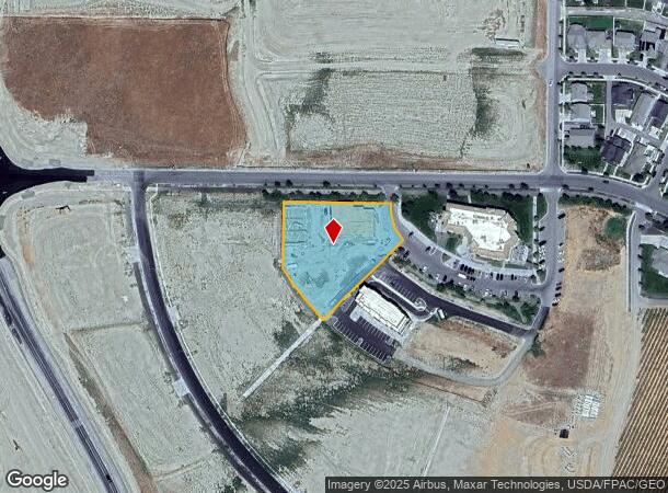
5077 Ava Way, Richland, WA 99352

NEARBY LISTINGS FOR SALE OR LEASE
-
-
View all Richland listings for sale on LoopNet.com
Property Detail
5077 Ava Way
Other Market Areas
LOT 2 OF AMENDED BINDING SITE PLAN FILED FOR RECORD APRIL 18 2016 IN VOLUME 1 OF SURVEYS AT PAGE 4732 UNDER AUDITORS FILE NUMBER 2016-010252 RECORDS OF BENTON COUNTY WASHINGTON. TOGETHER WITH THAT PORTION OF TRACT A OF AMENDED BINDING SITE PLAN FI
Kennewick-Richland, WA
Benton
132982BP4732002
Washington
Storebuilding
2
2024
1.34 AC
2024
Yakima/Kennewick
010811
DEMOGRAPHICS near 5077 Ava Way
1 Mile
3 Mile
5 Mile
2024 Total Population
2,414
17,563
69,894
2029 Population
2,789
20,093
79,478
Pop Growth 2024-2029
+ 15.53%
+ 14.41%
+ 13.71%
Average Age
39
40
39
2024 Total Households
799
5,918
25,925
HH Growth 2024-2029
+ 15.52%
+ 14.40%
+ 13.63%
Median Household Inc
$153,324
$159,064
$108,689
Avg Household Size
3.00
3.00
2.70
2024 Avg HH Vehicles
3.00
3.00
2.00
Median Home Value
$554,296
$564,910
$408,065
Median Year Built
2010
2008
1999
Nearby Places
Map Layers
Map Styles
 Street
 Aerial
- Restaurants
- Banks
- Shops
- Fitness
- Groceries
PUBLIC TRANSPORTATION
AIRPORT
Tri-Cities
DRIVE
WALK
Distance
Tri-Cities
22 min
16.1 mi
Nearby Properties
Address
Land Use
TOTAL SIZE
Lot Size
Zoning
Address
Land Use
TOTAL SIZE
Lot Size
Zoning
183,204 SF
14.94 AC
Address
Land Use
TOTAL SIZE
Lot Size
Zoning
279,107 SF
12.52 AC
Address
Land Use
TOTAL SIZE
Lot Size
Zoning
82,226 SF
40 AC
G.M.A. AGR
Address
Land Use
TOTAL SIZE
Lot Size
Zoning
216,270 SF
22.32 AC
Address
Land Use
TOTAL SIZE
Lot Size
Zoning
113,052 SF
3.32 AC
Address
Land Use
TOTAL SIZE
Lot Size
Zoning
109,517 SF
4.67 AC
Address
Land Use
TOTAL SIZE
Lot Size
Zoning
126,251 SF
7 AC
Address
Land Use
TOTAL SIZE
Lot Size
Zoning
74,089 SF
12.33 AC
Address
Land Use
TOTAL SIZE
Lot Size
Zoning
127,195 SF
9.16 AC
Address
Land Use
TOTAL SIZE
Lot Size
Zoning
66,380 SF
2.98 AC
Address
Land Use
TOTAL SIZE
Lot Size
Zoning
65,207 SF
19.35 AC
RICHLAND -
Address
Land Use
TOTAL SIZE
Lot Size
Zoning
102,189 SF
12.57 AC
Address
Land Use
TOTAL SIZE
Lot Size
Zoning
56,700 SF
6.47 AC
Address
Land Use
TOTAL SIZE
Lot Size
Zoning
71,700 SF
9.33 AC
Address
Land Use
TOTAL SIZE
Lot Size
Zoning
49,048 SF
6.45 AC
Address
Land Use
TOTAL SIZE
Lot Size
Zoning
11,625 SF
29.71 AC
Address
Land Use
TOTAL SIZE
Lot Size
Zoning
56,902 SF
3.69 AC
Address
Land Use
TOTAL SIZE
Lot Size
Zoning
36,011 SF
12.34 AC
Address
Land Use
TOTAL SIZE
Lot Size
Zoning
28.83 AC
Address
Land Use
TOTAL SIZE
Lot Size
Zoning
28.65 AC
Address
Land Use
TOTAL SIZE
Lot Size
Zoning
19,610 SF
2.95 AC
Address
Land Use
TOTAL SIZE
Lot Size
Zoning
32.27 AC
Address
Land Use
TOTAL SIZE
Lot Size
Zoning
27,092 SF
2.05 AC
Address
Land Use
TOTAL SIZE
Lot Size
Zoning
19,264 SF
1.60 AC
Address
Land Use
TOTAL SIZE
Lot Size
Zoning
4,320 SF
732.17 AC
Address
Land Use
TOTAL SIZE
Lot Size
Zoning
24,842 SF
2.14 AC
Address
Land Use
TOTAL SIZE
Lot Size
Zoning
24,604 SF
2.43 AC
Address
Land Use
TOTAL SIZE
Lot Size
Zoning
630 SF
3.66 AC
Address
Land Use
TOTAL SIZE
Lot Size
Zoning
21,804 SF
1.75 AC
Address
Land Use
TOTAL SIZE
Lot Size
Zoning
480 AC
G.M.A. AGR
The World's #1 Commercial Real Estate Marketplace
Connect with us
© 2025 CoStar Group
The information above has been obtained from sources believed reliable. While we do not doubt its accuracy we have not verified it and make no guarantee, warranty or representation about it. It is your responsibility to independently confirm its accuracy and completeness. Any projections, opinions, assumptions, or estimates used are for example only and do not represent the current or future performance of the property. The value of this transaction to you depends on tax and other factors which should be evaluated by your tax, financial, and legal advisors. You and your advisors should conduct a careful, independent investigation of the property to determine to your satisfaction the suitability of the property for your needs.