Property Record
508 Hale Rd, Clarksville, IN 47129
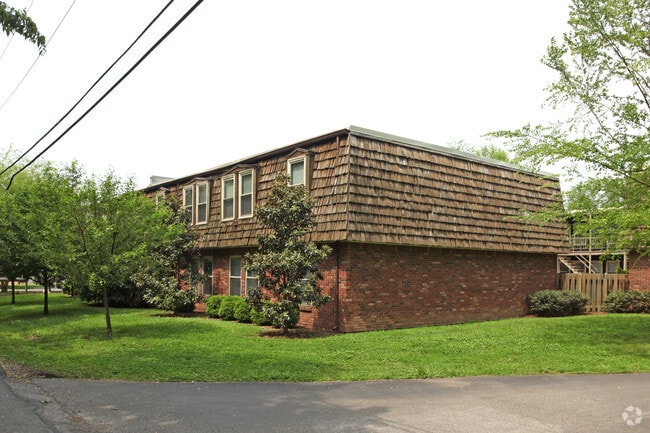

Property Detail
508 Hale Rd
10-24-03-000-249.000-014
GT 30 1.191 AC
Apartment
Clark
B and X Area of moderate flood hazard, usually the area between the limits of the 100-year and 500-year floods.
Indiana
2025
0.91 AC
2025
Clarksville
050505
Louisville
7,060 SF
Louisville/Jefferson County, KY-IN
NEARBY LISTINGS FOR SALE OR LEASE
DEMOGRAPHICS near 508 Hale Rd
1 mile
3 mile
5 mile
2025 Total Population
6,618
67,088
188,196
2030 Population
6,825
69,453
195,870
Pop Growth 2025-2030
+ 3.13%
+ 3.53%
+ 4.08%
Average Age
41
41
40
2025 Total Households
2,776
28,672
80,439
HH Growth 2025-2030
+ 3.31%
+ 3.62%
+ 4.27%
Median Household Inc
$65,029
$56,027
$54,441
Avg Household Size
2.30
2.20
2.20
2025 Avg HH Vehicles
2.00
2.00
1.00
Median Home Value
$182,946
$174,608
$193,659
Median Year Built
1963
1965
1967
Nearby Places
Map Layers
Map Styles
 Street
 Aerial
Layers
 Traffic
 Biking
Places
Listings with unknown addresses are not visible on the map
- Restaurants
- Banks
- Shops
- Fitness
- Groceries
PUBLIC TRANSPORTATION
AIRPORT
Louisville Muhammad Ali International
Drive
Walk
Distance
Louisville Muhammad Ali International
23 min
12.3 mi
Freight Ports
Port of Toledo
Drive
Walk
Distance
Port of Toledo
357 min
307.6 mi
Nearby Properties
Address
Land Use
TOTAL SIZE
Lot Size
Zoning
Address
Land Use
TOTAL SIZE
Lot Size
Zoning
3,452 SF
13.22 AC
Address
Land Use
TOTAL SIZE
Lot Size
Zoning
4,402 SF
9.99 AC
Address
Land Use
TOTAL SIZE
Lot Size
Zoning
2.07 AC
Address
Land Use
TOTAL SIZE
Lot Size
Zoning
1,104 SF
17.70 AC
Address
Land Use
TOTAL SIZE
Lot Size
Zoning
3,116 SF
16.22 AC
Address
Land Use
TOTAL SIZE
Lot Size
Zoning
120,337 SF
18.20 AC
Address
Land Use
TOTAL SIZE
Lot Size
Zoning
175,626 SF
60.10 AC
Address
Land Use
TOTAL SIZE
Lot Size
Zoning
2,208 SF
26.20 AC
Address
Land Use
TOTAL SIZE
Lot Size
Zoning
303,047 SF
7.21 AC
Address
Land Use
TOTAL SIZE
Lot Size
Zoning
2,000 SF
13.11 AC
Address
Land Use
TOTAL SIZE
Lot Size
Zoning
12,270 SF
13.50 AC
Address
Land Use
TOTAL SIZE
Lot Size
Zoning
16,221 SF
2.40 AC
Address
Land Use
TOTAL SIZE
Lot Size
Zoning
136,949 SF
36.89 AC
Address
Land Use
TOTAL SIZE
Lot Size
Zoning
128,269 SF
10.18 AC
Address
Land Use
TOTAL SIZE
Lot Size
Zoning
12,752 SF
13.56 AC
Address
Land Use
TOTAL SIZE
Lot Size
Zoning
56,775 SF
5.30 AC
Address
Land Use
TOTAL SIZE
Lot Size
Zoning
1,377 SF
22.66 AC
Address
Land Use
TOTAL SIZE
Lot Size
Zoning
25,728 SF
10.37 AC
Address
Land Use
TOTAL SIZE
Lot Size
Zoning
1,276 SF
3.78 AC
Address
Land Use
TOTAL SIZE
Lot Size
Zoning
75,560 SF
8.18 AC
Address
Land Use
TOTAL SIZE
Lot Size
Zoning
3,692 SF
15.99 AC
Address
Land Use
TOTAL SIZE
Lot Size
Zoning
173,121 SF
15.82 AC
Address
Land Use
TOTAL SIZE
Lot Size
Zoning
143,700 SF
0.29 AC
Address
Land Use
TOTAL SIZE
Lot Size
Zoning
9,900 SF
11.23 AC
Address
Land Use
TOTAL SIZE
Lot Size
Zoning
34,760 SF
29.13 AC
Address
Land Use
TOTAL SIZE
Lot Size
Zoning
76,929 SF
10.03 AC
Address
Land Use
TOTAL SIZE
Lot Size
Zoning
86,719 SF
7.04 AC
Address
Land Use
TOTAL SIZE
Lot Size
Zoning
81,000 SF
44.74 AC
Address
Land Use
TOTAL SIZE
Lot Size
Zoning
32,850 SF
9.21 AC
Address
Land Use
TOTAL SIZE
Lot Size
Zoning
67,471 SF
7 AC
The World's #1 Commercial Real Estate Marketplace
Connect with us
© 2026 CoStar Group
The information above has been obtained from sources believed reliable. While we do not doubt its accuracy we have not verified it and make no guarantee, warranty or representation about it. It is your responsibility to independently confirm its accuracy and completeness. Any projections, opinions, assumptions, or estimates used are for example only and do not represent the current or future performance of the property. The value of this transaction to you depends on tax and other factors which should be evaluated by your tax, financial, and legal advisors. You and your advisors should conduct a careful, independent investigation of the property to determine to your satisfaction the suitability of the property for your needs.