Property Record
508 Shroyer Rd, Dayton, OH 45419


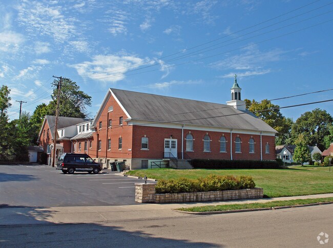
Property Detail
508 Shroyer Rd
Dayton, OH
81232 SHROYER RD BAPTIST CHURCH PLAT
R72-13806-0042
Montgomery
Religious
Ohio
B and X Area of moderate flood hazard, usually the area between the limits of the 100-year and 500-year floods.
42
2024
0.82 AC
2025
South Central Dayton
003201
Cincinnati/Dayton
NEARBY LISTINGS FOR SALE OR LEASE
DEMOGRAPHICS near 508 Shroyer Rd
1 mile
3 mile
5 mile
2024 Total Population
18,450
111,488
229,444
2029 Population
18,464
112,508
232,786
Pop Growth 2024-2029
+ 0.08%
+ 0.91%
+ 1.46%
Average Age
37
38
39
2024 Total Households
7,696
47,587
98,032
HH Growth 2024-2029
+ 0.08%
+ 0.87%
+ 1.45%
Median Household Inc
$67,785
$59,133
$58,145
Avg Household Size
2.10
2.10
2.20
2024 Avg HH Vehicles
2.00
2.00
2.00
Median Home Value
$201,689
$164,114
$175,440
Median Year Built
1949
1952
1956
Nearby Places
Map Layers
Map Styles
 Street
 Aerial
Transit
 Traffic
 Biking
Places
Listings with unknown addresses are not visible on the map
- Restaurants
- Banks
- Shops
- Fitness
- Groceries
PUBLIC TRANSPORTATION
AIRPORT
James M Cox Dayton International
Drive
Walk
Distance
James M Cox Dayton International
26 min
15.5 mi
Nearby Properties
Address
Land Use
TOTAL SIZE
Lot Size
Zoning
Address
Land Use
TOTAL SIZE
Lot Size
Zoning
1,570,433 SF
13.34 AC
Address
Land Use
TOTAL SIZE
Lot Size
Zoning
634,753 SF
54 AC
Address
Land Use
TOTAL SIZE
Lot Size
Zoning
428,925 SF
21.70 AC
Address
Land Use
TOTAL SIZE
Lot Size
Zoning
11.64 AC
Address
Land Use
TOTAL SIZE
Lot Size
Zoning
29,760 SF
5.13 AC
Address
Land Use
TOTAL SIZE
Lot Size
Zoning
767,771 SF
1.32 AC
Address
Land Use
TOTAL SIZE
Lot Size
Zoning
414,094 SF
36.48 AC
Address
Land Use
TOTAL SIZE
Lot Size
Zoning
275,808 SF
19.97 AC
Address
Land Use
TOTAL SIZE
Lot Size
Zoning
55.88 AC
Address
Land Use
TOTAL SIZE
Lot Size
Zoning
752,874 SF
74.85 AC
Address
Land Use
TOTAL SIZE
Lot Size
Zoning
188,584 SF
2.83 AC
Address
Land Use
TOTAL SIZE
Lot Size
Zoning
1.95 AC
Address
Land Use
TOTAL SIZE
Lot Size
Zoning
23,031 SF
63.14 AC
Address
Land Use
TOTAL SIZE
Lot Size
Zoning
5.41 AC
Address
Land Use
TOTAL SIZE
Lot Size
Zoning
23.35 AC
Address
Land Use
TOTAL SIZE
Lot Size
Zoning
175,938 SF
49.33 AC
Address
Land Use
TOTAL SIZE
Lot Size
Zoning
375,053 SF
7.27 AC
Address
Land Use
TOTAL SIZE
Lot Size
Zoning
222,197 SF
1.80 AC
Address
Land Use
TOTAL SIZE
Lot Size
Zoning
11.83 AC
Address
Land Use
TOTAL SIZE
Lot Size
Zoning
200,150 SF
1.81 AC
Address
Land Use
TOTAL SIZE
Lot Size
Zoning
3.76 AC
Address
Land Use
TOTAL SIZE
Lot Size
Zoning
45,583 SF
4.91 AC
Address
Land Use
TOTAL SIZE
Lot Size
Zoning
Address
Land Use
TOTAL SIZE
Lot Size
Zoning
3.27 AC
Address
Land Use
TOTAL SIZE
Lot Size
Zoning
128,859 SF
5.31 AC
Address
Land Use
TOTAL SIZE
Lot Size
Zoning
4.86 AC
Address
Land Use
TOTAL SIZE
Lot Size
Zoning
158,144 SF
4.16 AC
Address
Land Use
TOTAL SIZE
Lot Size
Zoning
296,568 SF
3.60 AC
Address
Land Use
TOTAL SIZE
Lot Size
Zoning
268,166 SF
2.12 AC
Address
Land Use
TOTAL SIZE
Lot Size
Zoning
41.38 AC
The World's #1 Commercial Real Estate Marketplace
Connect with us
© 2026 CoStar Group
The information above has been obtained from sources believed reliable. While we do not doubt its accuracy we have not verified it and make no guarantee, warranty or representation about it. It is your responsibility to independently confirm its accuracy and completeness. Any projections, opinions, assumptions, or estimates used are for example only and do not represent the current or future performance of the property. The value of this transaction to you depends on tax and other factors which should be evaluated by your tax, financial, and legal advisors. You and your advisors should conduct a careful, independent investigation of the property to determine to your satisfaction the suitability of the property for your needs.