Property Record
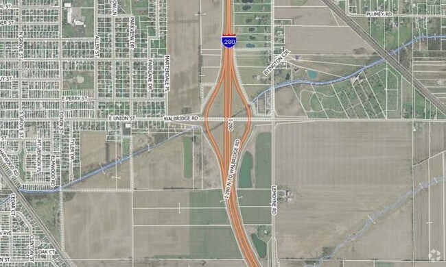
0 Union St, Millbury, OH 43447


NEARBY LISTINGS FOR SALE OR LEASE
Property Detail
0 Union St
H28-712-090101009000
SE NW LESS SWCOR W OF RR
Farms
Wood
AE
Ohio
39173C0053D
39.98 AC
2024
Perrysburg/Northwood
2024
Toledo
020901
Toledo, OH
DEMOGRAPHICS near 0 Union St
1 Mile
3 Mile
5 Mile
2024 Total Population
2,352
16,230
67,696
2029 Population
2,380
16,415
67,758
Pop Growth 2024-2029
+ 1.19%
+ 1.14%
+ 0.09%
Average Age
44
41
40
2024 Total Households
1,140
7,126
28,035
HH Growth 2024-2029
+ 1.23%
+ 1.15%
+ 0.02%
Median Household Inc
$46,956
$60,966
$51,525
Avg Household Size
2.00
2.20
2.30
2024 Avg HH Vehicles
2.00
2.00
2.00
Median Home Value
$128,440
$152,645
$136,825
Median Year Built
1967
1978
1963
Nearby Places
Map Layers
Map Styles
 Street
 Aerial
- Restaurants
- Banks
- Shops
- Fitness
- Groceries
PUBLIC TRANSPORTATION
COMMUTER RAIL
Toledo (Capitol Limited - Amtrak, Lake Shore Limited - Amtrak)
DRIVE
WALK
Distance
Toledo (Capitol Limited - Amtrak, Lake Shore Limited - Amtrak)
14 min
8.1 mi
AIRPORT
Eugene F Kranz Toledo Express
DRIVE
WALK
Distance
Eugene F Kranz Toledo Express
42 min
21.7 mi
Freight Ports
Port of Toledo
DRIVE
WALK
Distance
Port of Toledo
20 min
8.9 mi
SALE & LEASE HISTORY
LISTING DATE
SALE/LEASE

Sep 24, 2016
For Sale
Nearby Properties
Address
Land Use
TOTAL SIZE
Lot Size
Zoning
Address
Land Use
TOTAL SIZE
Lot Size
Zoning
1,887,402 SF
248.70 AC
Address
Land Use
TOTAL SIZE
Lot Size
Zoning
1,136,896 SF
73.62 AC
Address
Land Use
TOTAL SIZE
Lot Size
Zoning
1,124,336 SF
79.67 AC
Address
Land Use
TOTAL SIZE
Lot Size
Zoning
1,591,095 SF
8 AC
Address
Land Use
TOTAL SIZE
Lot Size
Zoning
313,004 SF
44.54 AC
40-C2
Address
Land Use
TOTAL SIZE
Lot Size
Zoning
496,062 SF
50.37 AC
Address
Land Use
TOTAL SIZE
Lot Size
Zoning
226,469 SF
17.38 AC
Address
Land Use
TOTAL SIZE
Lot Size
Zoning
219,265 SF
32.11 AC
Address
Land Use
TOTAL SIZE
Lot Size
Zoning
176,125 SF
21.61 AC
Address
Land Use
TOTAL SIZE
Lot Size
Zoning
136,090 SF
4 AC
Address
Land Use
TOTAL SIZE
Lot Size
Zoning
170,760 SF
51.98 AC
Address
Land Use
TOTAL SIZE
Lot Size
Zoning
225,918 SF
17.15 AC
Address
Land Use
TOTAL SIZE
Lot Size
Zoning
349,799 SF
51.86 AC
Address
Land Use
TOTAL SIZE
Lot Size
Zoning
228,251 SF
43.08 AC
10-RD6
Address
Land Use
TOTAL SIZE
Lot Size
Zoning
100,531 SF
3.07 AC
Address
Land Use
TOTAL SIZE
Lot Size
Zoning
34 AC
40-C5
Address
Land Use
TOTAL SIZE
Lot Size
Zoning
115,239 SF
12.89 AC
Address
Land Use
TOTAL SIZE
Lot Size
Zoning
132,284 SF
22.10 AC
Address
Land Use
TOTAL SIZE
Lot Size
Zoning
331,416 SF
30.56 AC
Address
Land Use
TOTAL SIZE
Lot Size
Zoning
199,768 SF
16.15 AC
40-C2
Address
Land Use
TOTAL SIZE
Lot Size
Zoning
40,214 SF
43.55 AC
Address
Land Use
TOTAL SIZE
Lot Size
Zoning
229,500 SF
9.97 AC
Address
Land Use
TOTAL SIZE
Lot Size
Zoning
180,900 SF
5 AC
Address
Land Use
TOTAL SIZE
Lot Size
Zoning
106,525 SF
18.90 AC
Address
Land Use
TOTAL SIZE
Lot Size
Zoning
124,380 SF
9.39 AC
Address
Land Use
TOTAL SIZE
Lot Size
Zoning
44.33 AC
40-C2
Address
Land Use
TOTAL SIZE
Lot Size
Zoning
74,842 SF
11.24 AC
Address
Land Use
TOTAL SIZE
Lot Size
Zoning
68,292 SF
10.18 AC
Address
Land Use
TOTAL SIZE
Lot Size
Zoning
222,570 SF
9.64 AC
Address
Land Use
TOTAL SIZE
Lot Size
Zoning
9.85 AC
The World's #1 Commercial Real Estate Marketplace
Connect with us
© 2026 CoStar Group
The information above has been obtained from sources believed reliable. While we do not doubt its accuracy we have not verified it and make no guarantee, warranty or representation about it. It is your responsibility to independently confirm its accuracy and completeness. Any projections, opinions, assumptions, or estimates used are for example only and do not represent the current or future performance of the property. The value of this transaction to you depends on tax and other factors which should be evaluated by your tax, financial, and legal advisors. You and your advisors should conduct a careful, independent investigation of the property to determine to your satisfaction the suitability of the property for your needs.