Property Record
5088 E University Ave, Pleasant Hill, IA 50327
NEARBY LISTINGS FOR SALE OR LEASE
-
-
View all Pleasant Hill listings for sale on LoopNet.com
Property Detail
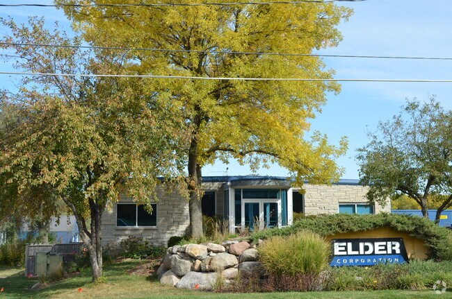
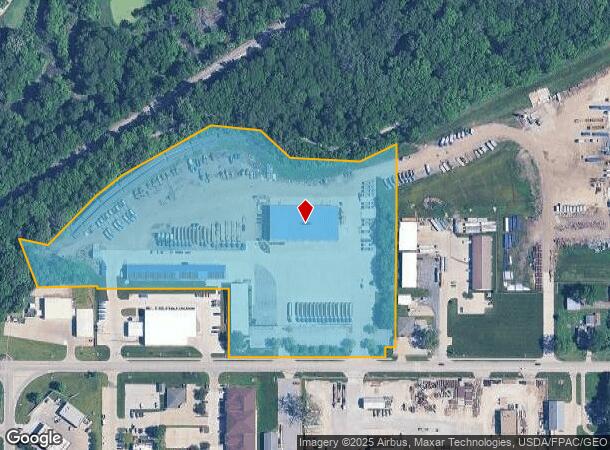
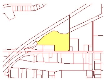
5088 E University Ave
221-00104006011
Sec 34-79-23
Officebuilding
PARCEL J BK 11793 PG 690 BEG 60F N OF SE COR THN N 593.29F TO SE ABND RR ROW LN SW 111.56F NW 210.11F NW 118.47F NW 145.44F SW 297.79F SW 99.94F SW 200.45F NW 85.78F SE 151.14F E171.86F S7.97F E 384.9F S 169.2F S 26.98F TO N LN NE 12TH AVE E 460.05F
X
Polk
19153C0360F
Iowa
2024
11.13 AC
2025
Northeast
010602
Des Moines
48,080 SF
Des Moines-West Des Moines, IA
DEMOGRAPHICS near 5088 E University Ave
1 Mile
3 Mile
5 Mile
2024 Total Population
6,160
42,330
97,514
2029 Population
6,381
44,124
101,646
Pop Growth 2024-2029
+ 3.59%
+ 4.24%
+ 4.24%
Average Age
42
39
38
2024 Total Households
2,539
16,475
37,089
HH Growth 2024-2029
+ 3.70%
+ 4.36%
+ 4.42%
Median Household Inc
$68,219
$65,869
$65,528
Avg Household Size
2.40
2.50
2.50
2024 Avg HH Vehicles
2.00
2.00
2.00
Median Home Value
$251,679
$180,746
$177,691
Median Year Built
1995
1977
1977
Nearby Places
Map Layers
Map Styles
 Street
 Aerial
- Restaurants
- Banks
- Shops
- Fitness
- Groceries
PUBLIC TRANSPORTATION
AIRPORT
Des Moines International
DRIVE
WALK
Distance
Des Moines International
25 min
12.1 mi
Freight Ports
Port Milwaukee
DRIVE
WALK
Distance
Port Milwaukee
411 min
368.3 mi
Nearby Properties
Address
Land Use
TOTAL SIZE
Lot Size
Zoning
Address
Land Use
TOTAL SIZE
Lot Size
Zoning
350,879 SF
16.14 AC
Address
Land Use
TOTAL SIZE
Lot Size
Zoning
475,929 SF
49.86 AC
M2
Address
Land Use
TOTAL SIZE
Lot Size
Zoning
320,429 SF
22.34 AC
R3
Address
Land Use
TOTAL SIZE
Lot Size
Zoning
90,325 SF
5.49 AC
PUD
Address
Land Use
TOTAL SIZE
Lot Size
Zoning
129,276 SF
7.63 AC
Address
Land Use
TOTAL SIZE
Lot Size
Zoning
175,854 SF
22.81 AC
Address
Land Use
TOTAL SIZE
Lot Size
Zoning
155,276 SF
6.66 AC
R-4
Address
Land Use
TOTAL SIZE
Lot Size
Zoning
201,072 SF
26.81 AC
Address
Land Use
TOTAL SIZE
Lot Size
Zoning
124,451 SF
10.40 AC
C-2
Address
Land Use
TOTAL SIZE
Lot Size
Zoning
47,267 SF
22.69 AC
R-4
Address
Land Use
TOTAL SIZE
Lot Size
Zoning
126,830 SF
6.53 AC
Address
Land Use
TOTAL SIZE
Lot Size
Zoning
39,936 SF
4.62 AC
R-4
Address
Land Use
TOTAL SIZE
Lot Size
Zoning
45,004 SF
5.68 AC
Address
Land Use
TOTAL SIZE
Lot Size
Zoning
134,393 SF
12.13 AC
C-2
Address
Land Use
TOTAL SIZE
Lot Size
Zoning
65,079 SF
6.19 AC
R-2
Address
Land Use
TOTAL SIZE
Lot Size
Zoning
55,091 SF
1.40 AC
Address
Land Use
TOTAL SIZE
Lot Size
Zoning
70,148 SF
5.52 AC
Address
Land Use
TOTAL SIZE
Lot Size
Zoning
89,286 SF
14.49 AC
R1-60
Address
Land Use
TOTAL SIZE
Lot Size
Zoning
31,544 SF
9.38 AC
R1-80
Address
Land Use
TOTAL SIZE
Lot Size
Zoning
51,023 SF
5.49 AC
R160
Address
Land Use
TOTAL SIZE
Lot Size
Zoning
123,059 SF
27.23 AC
M2
Address
Land Use
TOTAL SIZE
Lot Size
Zoning
64,734 SF
4.48 AC
Address
Land Use
TOTAL SIZE
Lot Size
Zoning
136,535 SF
9.66 AC
M-1
Address
Land Use
TOTAL SIZE
Lot Size
Zoning
71,730 SF
6.39 AC
I-2
Address
Land Use
TOTAL SIZE
Lot Size
Zoning
99,200 SF
7 AC
I-2
Address
Land Use
TOTAL SIZE
Lot Size
Zoning
62,467 SF
4.60 AC
Address
Land Use
TOTAL SIZE
Lot Size
Zoning
107,640 SF
9.57 AC
Address
Land Use
TOTAL SIZE
Lot Size
Zoning
107,190 SF
12.32 AC
C-4
Address
Land Use
TOTAL SIZE
Lot Size
Zoning
1,326 SF
5.15 AC
I-3
Address
Land Use
TOTAL SIZE
Lot Size
Zoning
56,281 SF
5.80 AC
C-1
The World's #1 Commercial Real Estate Marketplace
Connect with us
© 2025 CoStar Group
The information above has been obtained from sources believed reliable. While we do not doubt its accuracy we have not verified it and make no guarantee, warranty or representation about it. It is your responsibility to independently confirm its accuracy and completeness. Any projections, opinions, assumptions, or estimates used are for example only and do not represent the current or future performance of the property. The value of this transaction to you depends on tax and other factors which should be evaluated by your tax, financial, and legal advisors. You and your advisors should conduct a careful, independent investigation of the property to determine to your satisfaction the suitability of the property for your needs.