Property Record
5101 W 11800 Ln S, Herriman, UT 84096
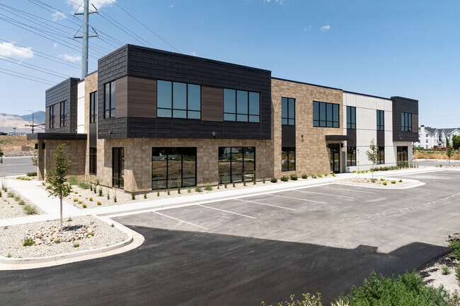
This Property Is For Sale
NEARBY LISTINGS FOR SALE OR LEASE
Property Detail
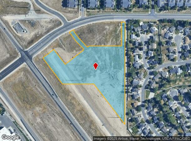
5101 W 11800 Ln S
Salt Lake City
Overlap
Salt Lake City, UT
BEG S 89^3915 E 1338.90 FT & S 0^2045 W 36.70 FT FR N 1/4 COR SEC 25, T3S, R2W, SLM; S 0^2047 W 976.64 FT; N 37^2806 W 484.81 FT; N 89^5058 W 297.67 FT; N 36^5658 W 360.81 FT; N 53^1025 E 46.61 FT; N 49^5040 E 161.13 FT; NELY ALG 1045.89 FT RADIUS CU
26-25-201-005-0000
Salt Lake
Residentialacreage
Utah
2023
8.06 AC
2024
Southwest Valley
113109
DEMOGRAPHICS near 5101 W 11800 Ln S
1 Mile
3 Mile
5 Mile
2024 Total Population
21,059
104,266
221,130
2029 Population
21,396
105,209
221,963
Pop Growth 2024-2029
+ 1.60%
+ 0.90%
+ 0.38%
Average Age
32
33
35
2024 Total Households
6,558
29,965
63,682
HH Growth 2024-2029
+ 1.75%
+ 0.91%
+ 0.32%
Median Household Inc
$115,585
$125,761
$122,614
Avg Household Size
3.20
3.50
3.40
2024 Avg HH Vehicles
2.00
2.00
2.00
Median Home Value
$645,239
$681,636
$678,234
Median Year Built
2010
2010
2007
Nearby Places
- Restaurants
- Banks
- Shops
- Fitness
- Groceries
PUBLIC TRANSPORTATION
TRANSIT/SUBWAY
Daybreak Parkway Station (Red Line - Utah Transit Authority (UTA))
DRIVE
WALK
Distance
Daybreak Parkway Station (Red Line - Utah Transit Authority (UTA))
3 min
13 min
0.7 mi
COMMUTER RAIL
South Jordan Station (FrontRunner - Utah Transit Authority (UTA))
DRIVE
WALK
Distance
South Jordan Station (FrontRunner - Utah Transit Authority (UTA))
15 min
7.5 mi
Draper Station (FrontRunner - Utah Transit Authority (UTA))
DRIVE
WALK
Distance
Draper Station (FrontRunner - Utah Transit Authority (UTA))
15 min
7.6 mi
AIRPORT
Salt Lake City International
DRIVE
WALK
Distance
Salt Lake City International
28 min
20.3 mi
Provo Municipal
DRIVE
WALK
Distance
Provo Municipal
47 min
33.6 mi
Freight Ports
Port of Stockton
DRIVE
WALK
Distance
Port of Stockton
721 min
700.0 mi
Nearby Properties
Address
Land Use
TOTAL SIZE
Lot Size
Zoning
Address
Land Use
TOTAL SIZE
Lot Size
Zoning
540,554 SF
63.03 AC
C-R
Address
Land Use
TOTAL SIZE
Lot Size
Zoning
340,894 SF
60.46 AC
P-C
Address
Land Use
TOTAL SIZE
Lot Size
Zoning
285,200 SF
55.78 AC
1210
Address
Land Use
TOTAL SIZE
Lot Size
Zoning
284,727 SF
26.33 AC
4144
Address
Land Use
TOTAL SIZE
Lot Size
Zoning
554,682 SF
30.25 AC
SLR-SP
Address
Land Use
TOTAL SIZE
Lot Size
Zoning
126,150 SF
25.43 AC
RM
Address
Land Use
TOTAL SIZE
Lot Size
Zoning
591,044 SF
13.87 AC
C-2
Address
Land Use
TOTAL SIZE
Lot Size
Zoning
469,074 SF
5.14 AC
C-P
Address
Land Use
TOTAL SIZE
Lot Size
Zoning
702,100 SF
13.83 AC
P-C
Address
Land Use
TOTAL SIZE
Lot Size
Zoning
73,318 SF
1.36 AC
PC
Address
Land Use
TOTAL SIZE
Lot Size
Zoning
241,215 SF
51.07 AC
M-1
Address
Land Use
TOTAL SIZE
Lot Size
Zoning
269,342 SF
12.68 AC
MU-2
Address
Land Use
TOTAL SIZE
Lot Size
Zoning
857,680 SF
75.49 AC
M-1
Address
Land Use
TOTAL SIZE
Lot Size
Zoning
323,922 SF
30.86 AC
PCC
Address
Land Use
TOTAL SIZE
Lot Size
Zoning
137,750 SF
12.64 AC
1210
Address
Land Use
TOTAL SIZE
Lot Size
Zoning
256,933 SF
19.68 AC
P-C
Address
Land Use
TOTAL SIZE
Lot Size
Zoning
59,711 SF
4.77 AC
C-2
Address
Land Use
TOTAL SIZE
Lot Size
Zoning
425,753 SF
2.28 AC
PC
Address
Land Use
TOTAL SIZE
Lot Size
Zoning
398,447 SF
11.04 AC
BMHU
Address
Land Use
TOTAL SIZE
Lot Size
Zoning
348,043 SF
5.35 AC
PC
Address
Land Use
TOTAL SIZE
Lot Size
Zoning
100,474 SF
12.99 AC
R-M-18
Address
Land Use
TOTAL SIZE
Lot Size
Zoning
348,917 SF
6.23 AC
PC
Address
Land Use
TOTAL SIZE
Lot Size
Zoning
456,759 SF
28.63 AC
C-R
Address
Land Use
TOTAL SIZE
Lot Size
Zoning
554,777 SF
168.76 AC
M-1
Address
Land Use
TOTAL SIZE
Lot Size
Zoning
4.76 AC
PC
Address
Land Use
TOTAL SIZE
Lot Size
Zoning
232,874 SF
7.04 AC
RM-18
Address
Land Use
TOTAL SIZE
Lot Size
Zoning
227,345 SF
34.06 AC
M-1
Address
Land Use
TOTAL SIZE
Lot Size
Zoning
239,900 SF
29.12 AC
P-C
Address
Land Use
TOTAL SIZE
Lot Size
Zoning
272,200 SF
10.66 AC
SPRM18
Address
Land Use
TOTAL SIZE
Lot Size
Zoning
292,006 SF
29.40 AC
1122
The World's #1 Commercial Real Estate Marketplace
Connect with us
© 2025 CoStar Group
The information above has been obtained from sources believed reliable. While we do not doubt its accuracy we have not verified it and make no guarantee, warranty or representation about it. It is your responsibility to independently confirm its accuracy and completeness. Any projections, opinions, assumptions, or estimates used are for example only and do not represent the current or future performance of the property. The value of this transaction to you depends on tax and other factors which should be evaluated by your tax, financial, and legal advisors. You and your advisors should conduct a careful, independent investigation of the property to determine to your satisfaction the suitability of the property for your needs.