Property Record
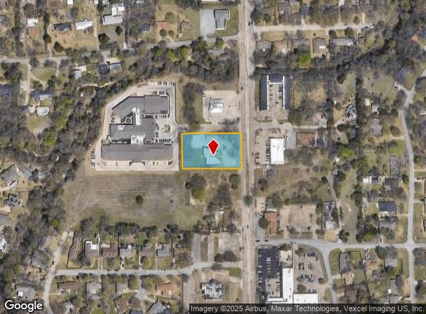
509 N Hampton Rd, Desoto, TX 75115


NEARBY LISTINGS FOR SALE OR LEASE
Property Detail
509 N Hampton Rd
Dallas-Fort Worth-Arlington, TX
W T R Professional Park Ph 2
20107010000010000
W T R PROFESSIONAL PARK PH 2 LOT 1 ACS 1.06 CALC INT201400193273 DD07252014 CO-DC 1070100000100 5CS10701000
Officebuilding
Dallas
AE
Texas
48139C0055G
1
2024
1.06 AC
2025
Southwest Dallas
016618
Dallas/Ft Worth
9,236 SF
DEMOGRAPHICS near 509 N Hampton Rd
1 Mile
3 Mile
5 Mile
2024 Total Population
8,396
65,355
187,475
2029 Population
8,299
64,480
189,278
Pop Growth 2024-2029
(1.16%)
(1.34%)
+ 0.96%
Average Age
41
39
37
2024 Total Households
2,929
22,774
64,590
HH Growth 2024-2029
(1.40%)
(1.61%)
+ 0.70%
Median Household Inc
$80,922
$77,971
$65,622
Avg Household Size
2.80
2.80
2.80
2024 Avg HH Vehicles
2.00
2.00
2.00
Median Home Value
$220,909
$238,303
$225,597
Median Year Built
1987
1993
1990
Nearby Places
Map Layers
Map Styles
 Street
 Aerial
- Restaurants
- Banks
- Shops
- Fitness
- Groceries
PUBLIC TRANSPORTATION
AIRPORT
Dallas Love Field
DRIVE
WALK
Distance
Dallas Love Field
32 min
21.2 mi
Dallas-Fort Worth International
DRIVE
WALK
Distance
Dallas-Fort Worth International
42 min
31.0 mi
Nearby Properties
Address
Land Use
TOTAL SIZE
Lot Size
Zoning
Address
Land Use
TOTAL SIZE
Lot Size
Zoning
1,316,325 SF
54.36 AC
Z111
Address
Land Use
TOTAL SIZE
Lot Size
Zoning
1,126,320 SF
63.41 AC
Z111
Address
Land Use
TOTAL SIZE
Lot Size
Zoning
1,167,500 SF
46.04 AC
Z06
Address
Land Use
TOTAL SIZE
Lot Size
Zoning
951,480 SF
50.63 AC
Z109
Address
Land Use
TOTAL SIZE
Lot Size
Zoning
872,640 SF
46.97 AC
Z125
Address
Land Use
TOTAL SIZE
Lot Size
Zoning
662,230 SF
38.49 AC
Z248
Address
Land Use
TOTAL SIZE
Lot Size
Zoning
123,880 SF
16.80 AC
Z236
Address
Land Use
TOTAL SIZE
Lot Size
Zoning
507,318 SF
28.40 AC
Z111
Address
Land Use
TOTAL SIZE
Lot Size
Zoning
552,200 SF
41.36 AC
Z109
Address
Land Use
TOTAL SIZE
Lot Size
Zoning
489,310 SF
33.91 AC
Z111
Address
Land Use
TOTAL SIZE
Lot Size
Zoning
531,254 SF
33.40 AC
Z06
Address
Land Use
TOTAL SIZE
Lot Size
Zoning
227,423 SF
13.86 AC
Z236
Address
Land Use
TOTAL SIZE
Lot Size
Zoning
281,669 SF
16.02 AC
Z312
Address
Land Use
TOTAL SIZE
Lot Size
Zoning
453,600 SF
29.54 AC
Z236
Address
Land Use
TOTAL SIZE
Lot Size
Zoning
421,890 SF
23.95 AC
Z111
Address
Land Use
TOTAL SIZE
Lot Size
Zoning
400,000 SF
24.69 AC
Z116
Address
Land Use
TOTAL SIZE
Lot Size
Zoning
253,794 SF
10.23 AC
Z201
Address
Land Use
TOTAL SIZE
Lot Size
Zoning
222,576 SF
35.20 AC
Z239
Address
Land Use
TOTAL SIZE
Lot Size
Zoning
418,511 SF
20.38 AC
Z111
Address
Land Use
TOTAL SIZE
Lot Size
Zoning
350,904 SF
18.46 AC
Z111
Address
Land Use
TOTAL SIZE
Lot Size
Zoning
140,590 SF
4.90 AC
Z236
Address
Land Use
TOTAL SIZE
Lot Size
Zoning
190,592 SF
101.54 AC
Z370
Address
Land Use
TOTAL SIZE
Lot Size
Zoning
119,190 SF
60.25 AC
Z239
Address
Land Use
TOTAL SIZE
Lot Size
Zoning
473,176 SF
24.02 AC
Address
Land Use
TOTAL SIZE
Lot Size
Zoning
209,742 SF
9.45 AC
Z175
Address
Land Use
TOTAL SIZE
Lot Size
Zoning
206,992 SF
14.25 AC
Z188
Address
Land Use
TOTAL SIZE
Lot Size
Zoning
210,008 SF
8.53 AC
Z175
Address
Land Use
TOTAL SIZE
Lot Size
Zoning
241,417 SF
22.80 AC
Z236
Address
Land Use
TOTAL SIZE
Lot Size
Zoning
272,596 SF
56.46 AC
Z111
Address
Land Use
TOTAL SIZE
Lot Size
Zoning
161,008 SF
10.62 AC
Z188
The World's #1 Commercial Real Estate Marketplace
Connect with us
© 2026 CoStar Group
The information above has been obtained from sources believed reliable. While we do not doubt its accuracy we have not verified it and make no guarantee, warranty or representation about it. It is your responsibility to independently confirm its accuracy and completeness. Any projections, opinions, assumptions, or estimates used are for example only and do not represent the current or future performance of the property. The value of this transaction to you depends on tax and other factors which should be evaluated by your tax, financial, and legal advisors. You and your advisors should conduct a careful, independent investigation of the property to determine to your satisfaction the suitability of the property for your needs.