Property Record
509 Nash St W, Wilson, NC 27893
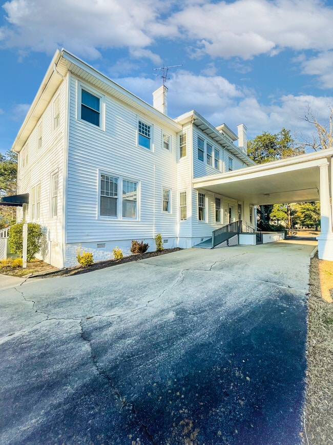
This Property Is For Sale
NEARBY LISTINGS FOR SALE OR LEASE
Property Detail
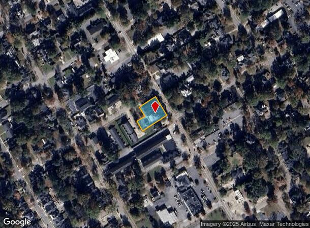
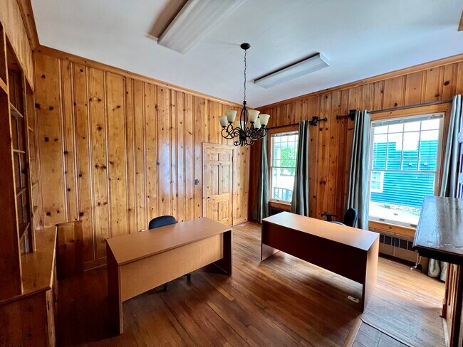
509 Nash St W
Wilson, NC
Wilson
3722-13-5143.000
North Carolina
Sfr
0.48 AC
X
Downtown Wilson
3720372200K
Other Market Areas
4,217 SF
DEMOGRAPHICS near 509 Nash St W
1 Mile
3 Mile
5 Mile
2024 Total Population
9,394
41,515
54,769
2029 Population
9,536
41,840
55,137
Pop Growth 2024-2029
+ 1.51%
+ 0.78%
+ 0.67%
Average Age
40
41
41
2024 Total Households
3,894
17,361
22,762
HH Growth 2024-2029
+ 1.41%
+ 0.74%
+ 0.64%
Median Household Inc
$33,730
$44,353
$47,597
Avg Household Size
2.20
2.30
2.30
2024 Avg HH Vehicles
1.00
2.00
2.00
Median Home Value
$124,813
$150,239
$153,156
Median Year Built
1963
1979
1984
Nearby Places
Map Layers
Map Styles
 Street
 Aerial
- Restaurants
- Banks
- Shops
- Fitness
- Groceries
PUBLIC TRANSPORTATION
COMMUTER RAIL
Wilson (Carolinian - Amtrak, Palmetto - Amtrak)
DRIVE
WALK
Distance
Wilson (Carolinian - Amtrak, Palmetto - Amtrak)
2 min
15 min
0.8 mi
Freight Ports
Port of Morehead City
DRIVE
WALK
Distance
Port of Morehead City
170 min
119.1 mi
Nearby Properties
Address
Land Use
TOTAL SIZE
Lot Size
Zoning
Address
Land Use
TOTAL SIZE
Lot Size
Zoning
11,771 SF
31.78 AC
ICD
Address
Land Use
TOTAL SIZE
Lot Size
Zoning
21,655 SF
34.44 AC
ICD
Address
Land Use
TOTAL SIZE
Lot Size
Zoning
220,639 SF
1.94 AC
CCMX
Address
Land Use
TOTAL SIZE
Lot Size
Zoning
6,704 SF
75.58 AC
ICD
Address
Land Use
TOTAL SIZE
Lot Size
Zoning
4,803 SF
10.23 AC
RMX
Address
Land Use
TOTAL SIZE
Lot Size
Zoning
259,000 SF
69.97 AC
HI
Address
Land Use
TOTAL SIZE
Lot Size
Zoning
10,152 SF
29.71 AC
ICD
Address
Land Use
TOTAL SIZE
Lot Size
Zoning
59,319 SF
1.01 AC
CCMX
Address
Land Use
TOTAL SIZE
Lot Size
Zoning
77,125 SF
2.98 AC
GC
Address
Land Use
TOTAL SIZE
Lot Size
Zoning
150,316 SF
10.97 AC
RMX
Address
Land Use
TOTAL SIZE
Lot Size
Zoning
30,488 SF
49.06 AC
GR6
Address
Land Use
TOTAL SIZE
Lot Size
Zoning
90,035 SF
91.87 AC
ICD
Address
Land Use
TOTAL SIZE
Lot Size
Zoning
80,000 SF
101.30 AC
HI
Address
Land Use
TOTAL SIZE
Lot Size
Zoning
185,515 SF
19.58 AC
HC
Address
Land Use
TOTAL SIZE
Lot Size
Zoning
11,664 SF
10.13 AC
HC
Address
Land Use
TOTAL SIZE
Lot Size
Zoning
25,888 SF
73.36 AC
LI
Address
Land Use
TOTAL SIZE
Lot Size
Zoning
192,420 SF
34.36 AC
HI
Address
Land Use
TOTAL SIZE
Lot Size
Zoning
91,637 SF
1.95 AC
CCMX
Address
Land Use
TOTAL SIZE
Lot Size
Zoning
78,875 SF
34.82 AC
ICD
Address
Land Use
TOTAL SIZE
Lot Size
Zoning
111,191 SF
10.64 AC
B4
Address
Land Use
TOTAL SIZE
Lot Size
Zoning
75,622 SF
9.13 AC
ICD
Address
Land Use
TOTAL SIZE
Lot Size
Zoning
33,650 SF
35.52 AC
ICD
Address
Land Use
TOTAL SIZE
Lot Size
Zoning
133,549 SF
21.49 AC
HC
Address
Land Use
TOTAL SIZE
Lot Size
Zoning
1,944 SF
13.64 AC
GR6
Address
Land Use
TOTAL SIZE
Lot Size
Zoning
13,672 SF
7.68 AC
NC
Address
Land Use
TOTAL SIZE
Lot Size
Zoning
8,616 SF
40 AC
ICD
Address
Land Use
TOTAL SIZE
Lot Size
Zoning
20,705 SF
7.88 AC
GR6
Address
Land Use
TOTAL SIZE
Lot Size
Zoning
6,600 SF
707.94 AC
M2
Address
Land Use
TOTAL SIZE
Lot Size
Zoning
35,406 SF
2.91 AC
GR6
Address
Land Use
TOTAL SIZE
Lot Size
Zoning
12,560 SF
11.89 AC
HC
The World's #1 Commercial Real Estate Marketplace
Connect with us
© 2026 CoStar Group
The information above has been obtained from sources believed reliable. While we do not doubt its accuracy we have not verified it and make no guarantee, warranty or representation about it. It is your responsibility to independently confirm its accuracy and completeness. Any projections, opinions, assumptions, or estimates used are for example only and do not represent the current or future performance of the property. The value of this transaction to you depends on tax and other factors which should be evaluated by your tax, financial, and legal advisors. You and your advisors should conduct a careful, independent investigation of the property to determine to your satisfaction the suitability of the property for your needs.