Property Record
509 Ruxton Ave, Manitou Springs, CO 80829
NEARBY LISTINGS FOR SALE OR LEASE
Property Detail
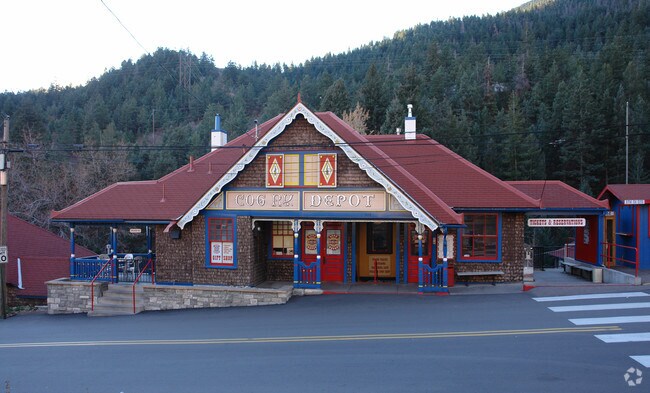
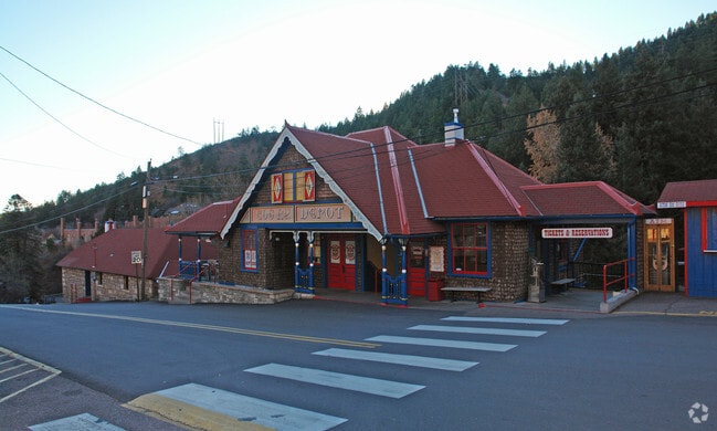
509 Ruxton Ave
Colorado Springs
Manitou And Pikes Peak Railway
Colorado Springs, CO
LOT 1 MANITOU & PIKES PEAK RAILWAY
74063-03-014
El Paso
Commercialnec
Colorado
0
1
2025
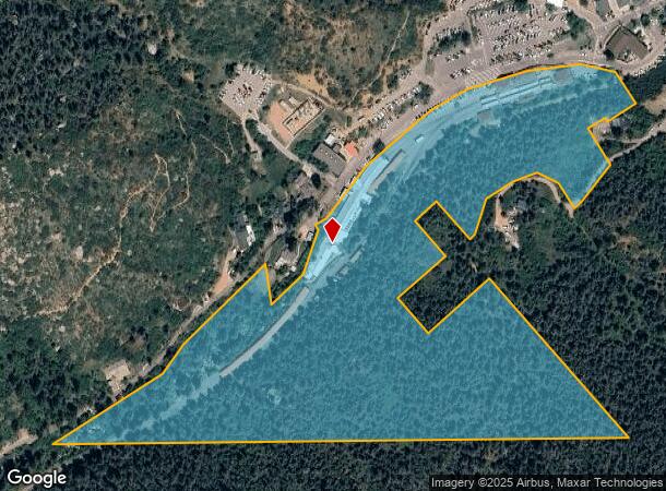
17.08 AC
006701
Southwest
30,532 SF
DEMOGRAPHICS near 509 Ruxton Ave
1 Mile
3 Mile
5 Mile
2024 Total Population
2,152
7,302
36,948
2029 Population
2,256
7,634
38,664
Pop Growth 2024-2029
+ 4.83%
+ 4.55%
+ 4.64%
Average Age
44
47
45
2024 Total Households
1,139
3,588
17,327
HH Growth 2024-2029
+ 5.00%
+ 4.79%
+ 4.96%
Median Household Inc
$70,134
$81,393
$76,729
Avg Household Size
1.90
2.00
2.10
2024 Avg HH Vehicles
2.00
2.00
2.00
Median Home Value
$543,706
$569,511
$477,602
Median Year Built
1947
1961
1977
Nearby Places
Map Layers
Map Styles
 Street
 Aerial
- Restaurants
- Banks
- Shops
- Fitness
- Groceries
PUBLIC TRANSPORTATION
AIRPORT
City of Colorado Springs Municipal
DRIVE
WALK
Distance
City of Colorado Springs Municipal
34 min
17.2 mi
Freight Ports
Tulsa Port Of Catoosa
DRIVE
WALK
Distance
Tulsa Port Of Catoosa
757 min
701.3 mi
Nearby Properties
Address
Land Use
TOTAL SIZE
Lot Size
Zoning
Address
Land Use
TOTAL SIZE
Lot Size
Zoning
2,422 SF
616.19 AC
PK MX-I PD
Address
Land Use
TOTAL SIZE
Lot Size
Zoning
75,349 SF
27.75 AC
EPC
Address
Land Use
TOTAL SIZE
Lot Size
Zoning
4.78 AC
R-T
Address
Land Use
TOTAL SIZE
Lot Size
Zoning
34,296 SF
0.85 AC
Address
Land Use
TOTAL SIZE
Lot Size
Zoning
3,058 SF
28.22 AC
HLDR
Address
Land Use
TOTAL SIZE
Lot Size
Zoning
4,062 SF
355.88 AC
PK HS
Address
Land Use
TOTAL SIZE
Lot Size
Zoning
925 SF
3.55 AC
R-T
Address
Land Use
TOTAL SIZE
Lot Size
Zoning
17,645 SF
50 AC
R-T
Address
Land Use
TOTAL SIZE
Lot Size
Zoning
7,364 SF
0.34 AC
C
Address
Land Use
TOTAL SIZE
Lot Size
Zoning
625 SF
2.42 AC
GR
Address
Land Use
TOTAL SIZE
Lot Size
Zoning
21,989 SF
0.79 AC
Address
Land Use
TOTAL SIZE
Lot Size
Zoning
171.67 AC
PK
Address
Land Use
TOTAL SIZE
Lot Size
Zoning
14,248 SF
0.93 AC
C
Address
Land Use
TOTAL SIZE
Lot Size
Zoning
11,452 SF
2.12 AC
R-5 HS
Address
Land Use
TOTAL SIZE
Lot Size
Zoning
54,398 SF
1.20 AC
Address
Land Use
TOTAL SIZE
Lot Size
Zoning
36,745 SF
0.95 AC
Address
Land Use
TOTAL SIZE
Lot Size
Zoning
254 SF
4.74 AC
Address
Land Use
TOTAL SIZE
Lot Size
Zoning
13,987 SF
0.74 AC
Address
Land Use
TOTAL SIZE
Lot Size
Zoning
7,082 SF
0.78 AC
C
Address
Land Use
TOTAL SIZE
Lot Size
Zoning
32,939 SF
1.21 AC
Address
Land Use
TOTAL SIZE
Lot Size
Zoning
19,911 SF
2.42 AC
Address
Land Use
TOTAL SIZE
Lot Size
Zoning
14,750 SF
38.63 AC
HLDR
Address
Land Use
TOTAL SIZE
Lot Size
Zoning
31,391 SF
1.63 AC
Address
Land Use
TOTAL SIZE
Lot Size
Zoning
25,323 SF
9.04 AC
R
Address
Land Use
TOTAL SIZE
Lot Size
Zoning
40.25 AC
PK HS
Address
Land Use
TOTAL SIZE
Lot Size
Zoning
455 SF
2.05 AC
HLDR
Address
Land Use
TOTAL SIZE
Lot Size
Zoning
11,382 SF
463.83 AC
F-5
Address
Land Use
TOTAL SIZE
Lot Size
Zoning
640 AC
R-T
Address
Land Use
TOTAL SIZE
Lot Size
Zoning
The World's #1 Commercial Real Estate Marketplace
Connect with us
© 2026 CoStar Group
The information above has been obtained from sources believed reliable. While we do not doubt its accuracy we have not verified it and make no guarantee, warranty or representation about it. It is your responsibility to independently confirm its accuracy and completeness. Any projections, opinions, assumptions, or estimates used are for example only and do not represent the current or future performance of the property. The value of this transaction to you depends on tax and other factors which should be evaluated by your tax, financial, and legal advisors. You and your advisors should conduct a careful, independent investigation of the property to determine to your satisfaction the suitability of the property for your needs.