Property Record
509 Saratoga Ave, Santa Clara, CA 95050


NEARBY LISTINGS FOR SALE OR LEASE
Property Detail
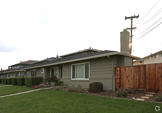
509 Saratoga Ave
San Jose-Sunnyvale-Santa Clara, CA
Town & Country Estates
303-08-073
TRACT 3210 TOWN AND COUNTRY ESTATES BOOK 146 PAGE 44 PAGE 45 LOT 49
Multifamilydwelling
Santa Clara
X
California
06085C0229H
49
2024
0.26 AC
2025
Outer Santa Clara
505902
South Bay/San Jose
6,624 SF
DEMOGRAPHICS near 509 Saratoga Ave
1 Mile
3 Mile
5 Mile
2024 Total Population
26,143
227,184
613,296
2029 Population
25,188
219,747
593,426
Pop Growth 2024-2029
(3.65%)
(3.27%)
(3.24%)
Average Age
40
38
39
2024 Total Households
10,141
84,047
227,919
HH Growth 2024-2029
(3.93%)
(3.48%)
(3.39%)
Median Household Inc
$138,477
$133,998
$144,119
Avg Household Size
2.50
2.60
2.60
2024 Avg HH Vehicles
2.00
2.00
2.00
Median Home Value
$1,121,090
$1,112,224
$1,111,317
Median Year Built
1959
1969
1972
Nearby Places
Map Layers
Map Styles
 Street
 Aerial
- Restaurants
- Banks
- Shops
- Fitness
- Groceries
PUBLIC TRANSPORTATION
COMMUTER RAIL
Santa Clara (Caltrain - Caltrain (Caltrain))
DRIVE
WALK
Distance
Santa Clara (Caltrain - Caltrain (Caltrain))
5 min
2.1 mi
DRIVE
WALK
Distance
5 min
2.1 mi
AIRPORT
Norman Y Mineta San Jose International
DRIVE
WALK
Distance
Norman Y Mineta San Jose International
7 min
2.8 mi
San Francisco International
DRIVE
WALK
Distance
San Francisco International
46 min
34.4 mi
Metro Oakland International
DRIVE
WALK
Distance
Metro Oakland International
48 min
37.9 mi
Freight Ports
Port of Redwood City
DRIVE
WALK
Distance
Port of Redwood City
31 min
21.3 mi
Nearby Properties
Address
Land Use
TOTAL SIZE
Lot Size
Zoning
Address
Land Use
TOTAL SIZE
Lot Size
Zoning
2,819,800 SF
91.85 AC
CU
Address
Land Use
TOTAL SIZE
Lot Size
Zoning
57,096 SF
58.04 AC
PM0
Address
Land Use
TOTAL SIZE
Lot Size
Zoning
0.06 AC
PD
Address
Land Use
TOTAL SIZE
Lot Size
Zoning
238,239 SF
24.67 AC
PD
Address
Land Use
TOTAL SIZE
Lot Size
Zoning
576,892 SF
8.28 AC
APD
Address
Land Use
TOTAL SIZE
Lot Size
Zoning
111,585 SF
6.69 AC
ML
Address
Land Use
TOTAL SIZE
Lot Size
Zoning
360,000 SF
18.81 AC
MH
Address
Land Use
TOTAL SIZE
Lot Size
Zoning
9.11 AC
ML
Address
Land Use
TOTAL SIZE
Lot Size
Zoning
194,790 SF
5.30 AC
APDCI
Address
Land Use
TOTAL SIZE
Lot Size
Zoning
1,121,228 SF
7.68 AC
RM(PD
Address
Land Use
TOTAL SIZE
Lot Size
Zoning
2.99 AC
MH
Address
Land Use
TOTAL SIZE
Lot Size
Zoning
180,846 SF
12.19 AC
ML
Address
Land Use
TOTAL SIZE
Lot Size
Zoning
833,956 SF
55.15 AC
PD
Address
Land Use
TOTAL SIZE
Lot Size
Zoning
304,000 SF
6.79 AC
PM0
Address
Land Use
TOTAL SIZE
Lot Size
Zoning
146,390 SF
9.04 AC
MP
Address
Land Use
TOTAL SIZE
Lot Size
Zoning
4.56 AC
CP
Address
Land Use
TOTAL SIZE
Lot Size
Zoning
8.22 AC
PD
Address
Land Use
TOTAL SIZE
Lot Size
Zoning
50,774 SF
3.84 AC
MP
Address
Land Use
TOTAL SIZE
Lot Size
Zoning
320,000 SF
15.18 AC
APD
Address
Land Use
TOTAL SIZE
Lot Size
Zoning
897,944 SF
7.40 AC
PD
Address
Land Use
TOTAL SIZE
Lot Size
Zoning
500,000 SF
41.05 AC
MH
Address
Land Use
TOTAL SIZE
Lot Size
Zoning
1,016,763 SF
7.63 AC
CC
Address
Land Use
TOTAL SIZE
Lot Size
Zoning
2.99 AC
MH
Address
Land Use
TOTAL SIZE
Lot Size
Zoning
457,162 SF
3.97 AC
A(PD)
Address
Land Use
TOTAL SIZE
Lot Size
Zoning
473,849 SF
6 AC
ML
Address
Land Use
TOTAL SIZE
Lot Size
Zoning
27,000 SF
2 AC
MH
Address
Land Use
TOTAL SIZE
Lot Size
Zoning
486,104 SF
5.43 AC
ML
Address
Land Use
TOTAL SIZE
Lot Size
Zoning
617,814 SF
21.96 AC
CG
Address
Land Use
TOTAL SIZE
Lot Size
Zoning
34,876 SF
2.73 AC
ML
The World's #1 Commercial Real Estate Marketplace
Connect with us
© 2025 CoStar Group
The information above has been obtained from sources believed reliable. While we do not doubt its accuracy we have not verified it and make no guarantee, warranty or representation about it. It is your responsibility to independently confirm its accuracy and completeness. Any projections, opinions, assumptions, or estimates used are for example only and do not represent the current or future performance of the property. The value of this transaction to you depends on tax and other factors which should be evaluated by your tax, financial, and legal advisors. You and your advisors should conduct a careful, independent investigation of the property to determine to your satisfaction the suitability of the property for your needs.