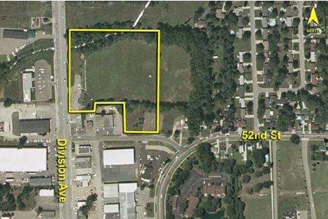
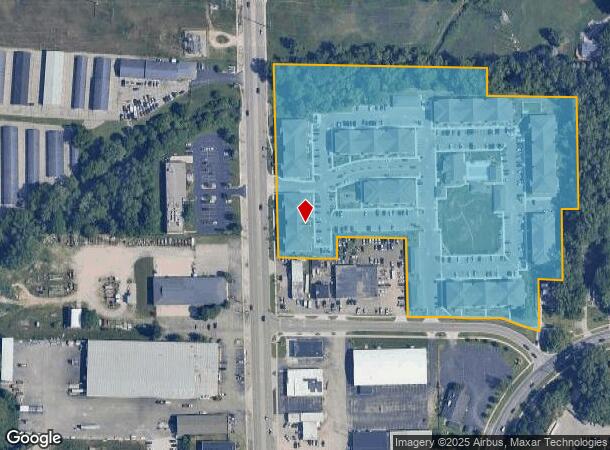
Property Record
5090 Division Ave S, Grand Rapids, MI 49548
NEARBY LISTINGS FOR SALE OR LEASE
Property Detail
5090 Division Ave S
41-18-30-351-034
W Along E Line Of Division
Commercialnec
411830351058 PART OF SW 1/4 COM 198.14 FT N 0D 29M 02S W ALONG W SEC LINE & 50.0 FT S 88D 18M 16S E FROM SW COR OF SEC TH N
X
Kent
26005C0125G
Michigan
0
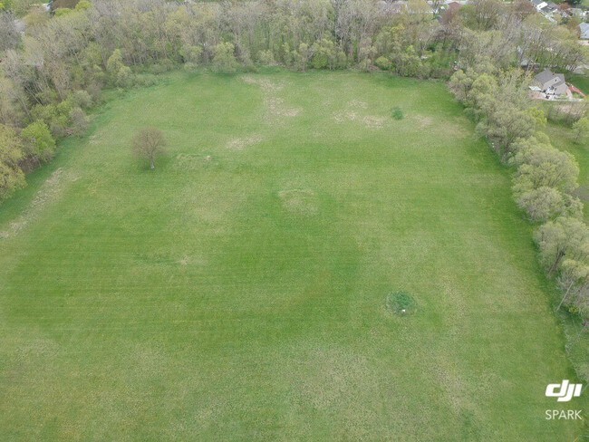
11.91 AC
2025
S Grand Rapids/Kentwood
012901
West Michigan
1,936 SF
Grand Rapids-Wyoming, MI
DEMOGRAPHICS near 5090 Division Ave S
1 Mile
3 Mile
5 Mile
2024 Total Population
13,084
94,496
227,797
2029 Population
13,326
95,204
229,623
Pop Growth 2024-2029
+ 1.85%
+ 0.75%
+ 0.80%
Average Age
37
38
37
2024 Total Households
4,882
35,372
85,261
HH Growth 2024-2029
+ 1.84%
+ 0.74%
+ 0.84%
Median Household Inc
$57,429
$62,191
$64,749
Avg Household Size
2.60
2.60
2.60
2024 Avg HH Vehicles
2.00
2.00
2.00
Median Home Value
$168,030
$189,953
$207,661
Median Year Built
1972
1976
1975
Nearby Places
Map Layers
Map Styles
 Street
 Aerial
- Restaurants
- Banks
- Shops
- Fitness
- Groceries
PUBLIC TRANSPORTATION
COMMUTER RAIL
DRIVE
WALK
Distance
11 min
7.3 mi
AIRPORT
Gerald R Ford International
DRIVE
WALK
Distance
Gerald R Ford International
16 min
7.6 mi
SALE & LEASE HISTORY
LISTING DATE
SALE/LEASE

Sep 24, 2016
For Sale
May 09, 2019
For Sale
Nearby Properties
Address
Land Use
TOTAL SIZE
Lot Size
Zoning
Address
Land Use
TOTAL SIZE
Lot Size
Zoning
290,627 SF
Address
Land Use
TOTAL SIZE
Lot Size
Zoning
295,027 SF
51.42 AC
I3
Address
Land Use
TOTAL SIZE
Lot Size
Zoning
48.43 AC
PUD-PL UNI
Address
Land Use
TOTAL SIZE
Lot Size
Zoning
649,177 SF
55.67 AC
SD-IT
Address
Land Use
TOTAL SIZE
Lot Size
Zoning
941,968 SF
38.56 AC
SD-IT
Address
Land Use
TOTAL SIZE
Lot Size
Zoning
216,171 SF
32.06 AC
R4
Address
Land Use
TOTAL SIZE
Lot Size
Zoning
27.25 AC
SD-PRD
Address
Land Use
TOTAL SIZE
Lot Size
Zoning
487,739 SF
73.87 AC
RR
Address
Land Use
TOTAL SIZE
Lot Size
Zoning
1,426,319 SF
54.81 AC
SD-IT
Address
Land Use
TOTAL SIZE
Lot Size
Zoning
26.94 AC
Address
Land Use
TOTAL SIZE
Lot Size
Zoning
Address
Land Use
TOTAL SIZE
Lot Size
Zoning
38.98 AC
PUD-PL UNI
Address
Land Use
TOTAL SIZE
Lot Size
Zoning
112,040 SF
9.69 AC
PUD3
Address
Land Use
TOTAL SIZE
Lot Size
Zoning
386,450 SF
29.10 AC
Address
Land Use
TOTAL SIZE
Lot Size
Zoning
264,739 SF
26.56 AC
I2
Address
Land Use
TOTAL SIZE
Lot Size
Zoning
25.05 AC
R3-MED RES
Address
Land Use
TOTAL SIZE
Lot Size
Zoning
465,772 SF
61.95 AC
I1
Address
Land Use
TOTAL SIZE
Lot Size
Zoning
206,562 SF
15.12 AC
R1
Address
Land Use
TOTAL SIZE
Lot Size
Zoning
22.35 AC
Address
Land Use
TOTAL SIZE
Lot Size
Zoning
153,571 SF
12.28 AC
SD-PRD
Address
Land Use
TOTAL SIZE
Lot Size
Zoning
536,296 SF
26.16 AC
SD-IT
Address
Land Use
TOTAL SIZE
Lot Size
Zoning
179,436 SF
24.94 AC
I2
Address
Land Use
TOTAL SIZE
Lot Size
Zoning
212,353 SF
16.52 AC
R4
Address
Land Use
TOTAL SIZE
Lot Size
Zoning
20.30 AC
Address
Land Use
TOTAL SIZE
Lot Size
Zoning
165,085 SF
22.58 AC
R4
Address
Land Use
TOTAL SIZE
Lot Size
Zoning
128,872 SF
7.32 AC
PUD3
Address
Land Use
TOTAL SIZE
Lot Size
Zoning
2,593 SF
18 AC
PUD-PL UNI
Address
Land Use
TOTAL SIZE
Lot Size
Zoning
Address
Land Use
TOTAL SIZE
Lot Size
Zoning
Address
Land Use
TOTAL SIZE
Lot Size
Zoning
158,240 SF
13.56 AC
R4
The World's #1 Commercial Real Estate Marketplace
Connect with us
© 2025 CoStar Group
The information above has been obtained from sources believed reliable. While we do not doubt its accuracy we have not verified it and make no guarantee, warranty or representation about it. It is your responsibility to independently confirm its accuracy and completeness. Any projections, opinions, assumptions, or estimates used are for example only and do not represent the current or future performance of the property. The value of this transaction to you depends on tax and other factors which should be evaluated by your tax, financial, and legal advisors. You and your advisors should conduct a careful, independent investigation of the property to determine to your satisfaction the suitability of the property for your needs.