Property Record
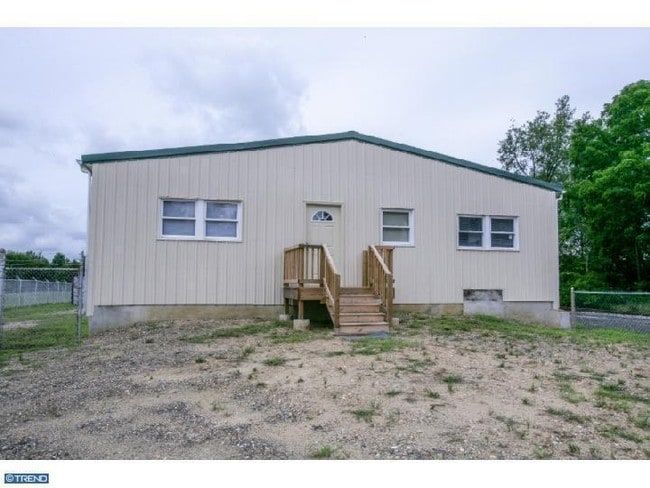
51 Democrat Rd, Mickleton, NJ 08056


Property Detail
51 Democrat Rd
03-01002-0000-00003
ADDITIONAL LOTS: AUTO REPAIR&RESTORAT
Servicestation
Gloucester
RRC
New Jersey
B and X Area of moderate flood hazard, usually the area between the limits of the 100-year and 500-year floods.
3
2024
0.06 AC
2025
Gloucester County
500602
Philadelphia
2,056 SF
Philadelphia-Camden-Wilmington, PA-NJ-DE-MD
NEARBY LISTINGS FOR SALE OR LEASE
DEMOGRAPHICS near 51 Democrat Rd
1 mile
3 mile
5 mile
2024 Total Population
3,339
22,785
69,536
2029 Population
3,475
23,415
71,402
Pop Growth 2024-2029
+ 4.07%
+ 2.76%
+ 2.68%
Average Age
44
40
41
2024 Total Households
1,219
8,137
26,139
HH Growth 2024-2029
+ 4.51%
+ 2.85%
+ 2.74%
Median Household Inc
$144,894
$113,143
$106,160
Avg Household Size
2.70
2.80
2.60
2024 Avg HH Vehicles
2.00
2.00
2.00
Median Home Value
$380,804
$367,645
$349,690
Median Year Built
1995
1980
1979
Nearby Places
Map Layers
Map Styles
 Street
 Aerial
Transit
 Traffic
 Biking
Places
Listings with unknown addresses are not visible on the map
- Restaurants
- Banks
- Shops
- Fitness
- Groceries
PUBLIC TRANSPORTATION
AIRPORT
Philadelphia International
Drive
Walk
Distance
Philadelphia International
31 min
18.2 mi
Trenton Mercer
Drive
Walk
Distance
Trenton Mercer
72 min
48.2 mi
Freight Ports
Broadway Terminal - Pier 5
Drive
Walk
Distance
Broadway Terminal - Pier 5
20 min
12.1 mi
Nearby Properties
Address
Land Use
TOTAL SIZE
Lot Size
Zoning
Address
Land Use
TOTAL SIZE
Lot Size
Zoning
69.05 AC
M2
Address
Land Use
TOTAL SIZE
Lot Size
Zoning
Address
Land Use
TOTAL SIZE
Lot Size
Zoning
40.25 AC
M
Address
Land Use
TOTAL SIZE
Lot Size
Zoning
32.88 AC
M1
Address
Land Use
TOTAL SIZE
Lot Size
Zoning
Address
Land Use
TOTAL SIZE
Lot Size
Zoning
Address
Land Use
TOTAL SIZE
Lot Size
Zoning
Address
Land Use
TOTAL SIZE
Lot Size
Zoning
24.27 AC
M2
Address
Land Use
TOTAL SIZE
Lot Size
Zoning
55.38 AC
M2
Address
Land Use
TOTAL SIZE
Lot Size
Zoning
111.40 AC
RRC
Address
Land Use
TOTAL SIZE
Lot Size
Zoning
31 AC
M1
Address
Land Use
TOTAL SIZE
Lot Size
Zoning
27.18 AC
M1
Address
Land Use
TOTAL SIZE
Lot Size
Zoning
30.76 AC
BP
Address
Land Use
TOTAL SIZE
Lot Size
Zoning
10.13 AC
Address
Land Use
TOTAL SIZE
Lot Size
Zoning
5 AC
R1
Address
Land Use
TOTAL SIZE
Lot Size
Zoning
10.39 AC
RRC
Address
Land Use
TOTAL SIZE
Lot Size
Zoning
17.42 AC
M2
Address
Land Use
TOTAL SIZE
Lot Size
Zoning
10.21 AC
RRC
Address
Land Use
TOTAL SIZE
Lot Size
Zoning
15.08 AC
R2A
Address
Land Use
TOTAL SIZE
Lot Size
Zoning
17.08 AC
BP
Address
Land Use
TOTAL SIZE
Lot Size
Zoning
18.47 AC
M1
Address
Land Use
TOTAL SIZE
Lot Size
Zoning
7.25 AC
Address
Land Use
TOTAL SIZE
Lot Size
Zoning
22.05 AC
B1
Address
Land Use
TOTAL SIZE
Lot Size
Zoning
9.05 AC
R2
Address
Land Use
TOTAL SIZE
Lot Size
Zoning
31.77 AC
R2A
Address
Land Use
TOTAL SIZE
Lot Size
Zoning
4.19 AC
R2A
Address
Land Use
TOTAL SIZE
Lot Size
Zoning
Address
Land Use
TOTAL SIZE
Lot Size
Zoning
33.01 AC
M2
Address
Land Use
TOTAL SIZE
Lot Size
Zoning
9.12 AC
B2
Address
Land Use
TOTAL SIZE
Lot Size
Zoning
The World's #1 Commercial Real Estate Marketplace
Connect with us
© 2026 CoStar Group
The information above has been obtained from sources believed reliable. While we do not doubt its accuracy we have not verified it and make no guarantee, warranty or representation about it. It is your responsibility to independently confirm its accuracy and completeness. Any projections, opinions, assumptions, or estimates used are for example only and do not represent the current or future performance of the property. The value of this transaction to you depends on tax and other factors which should be evaluated by your tax, financial, and legal advisors. You and your advisors should conduct a careful, independent investigation of the property to determine to your satisfaction the suitability of the property for your needs.