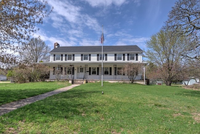
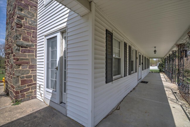
Property Record
51 Main St, Englishtown, NJ 07726

NEARBY LISTINGS FOR SALE OR LEASE
Property Detail
51 Main St
New York-Jersey City-White Plains, NY-NJ
Final Plat Major Subdivision Of Property
13-00004-0000-00014-02
Monmouth
Sfr
New Jersey
X
2 AC
34023C0286F
Western Monmouth
2,592 SF
Northern New Jersey
DEMOGRAPHICS near 51 Main St
1 Mile
3 Mile
5 Mile
2024 Total Population
7,121
34,795
87,524
2029 Population
7,163
34,701
86,838
Pop Growth 2024-2029
+ 0.59%
(0.27%)
(0.78%)
Average Age
39
44
44
2024 Total Households
2,359
12,223
31,467
HH Growth 2024-2029
+ 0.47%
(0.30%)
(0.94%)
Median Household Inc
$125,463
$137,143
$128,046
Avg Household Size
3.00
2.80
2.70
2024 Avg HH Vehicles
2.00
2.00
2.00
Median Home Value
$474,816
$607,923
$567,388
Median Year Built
1989
1992
1986
Nearby Places
Map Layers
Map Styles
 Street
 Aerial
- Restaurants
- Banks
- Shops
- Fitness
- Groceries
PUBLIC TRANSPORTATION
AIRPORT
Trenton Mercer
DRIVE
WALK
Distance
Trenton Mercer
49 min
31.9 mi
Newark Liberty International
DRIVE
WALK
Distance
Newark Liberty International
50 min
39.1 mi
Freight Ports
New York Container Terminal
DRIVE
WALK
Distance
New York Container Terminal
43 min
31.3 mi
SALE & LEASE HISTORY
LISTING DATE
SALE/LEASE

May 01, 2019
For Sale
Nearby Properties
Address
Land Use
TOTAL SIZE
Lot Size
Zoning
Address
Land Use
TOTAL SIZE
Lot Size
Zoning
67.30 AC
PB
Address
Land Use
TOTAL SIZE
Lot Size
Zoning
12.10 AC
PB
Address
Land Use
TOTAL SIZE
Lot Size
Zoning
23.08 AC
PB
Address
Land Use
TOTAL SIZE
Lot Size
Zoning
6.97 AC
C2
Address
Land Use
TOTAL SIZE
Lot Size
Zoning
9.28 AC
MF08
Address
Land Use
TOTAL SIZE
Lot Size
Zoning
1,980 SF
22.35 AC
Address
Land Use
TOTAL SIZE
Lot Size
Zoning
8.15 AC
C2-M
Address
Land Use
TOTAL SIZE
Lot Size
Zoning
10.25 AC
PB
Address
Land Use
TOTAL SIZE
Lot Size
Zoning
58,024 SF
9.45 AC
C2
Address
Land Use
TOTAL SIZE
Lot Size
Zoning
6.37 AC
C2
Address
Land Use
TOTAL SIZE
Lot Size
Zoning
18 AC
PB
Address
Land Use
TOTAL SIZE
Lot Size
Zoning
16.46 AC
PB
Address
Land Use
TOTAL SIZE
Lot Size
Zoning
6.68 AC
C3
Address
Land Use
TOTAL SIZE
Lot Size
Zoning
28 AC
PB
Address
Land Use
TOTAL SIZE
Lot Size
Zoning
17.70 AC
PB
Address
Land Use
TOTAL SIZE
Lot Size
Zoning
10.02 AC
Address
Land Use
TOTAL SIZE
Lot Size
Zoning
6.66 AC
CDFS
Address
Land Use
TOTAL SIZE
Lot Size
Zoning
750 SF
280.39 AC
SD5
Address
Land Use
TOTAL SIZE
Lot Size
Zoning
6.60 AC
C50
Address
Land Use
TOTAL SIZE
Lot Size
Zoning
15.26 AC
PB
Address
Land Use
TOTAL SIZE
Lot Size
Zoning
16 AC
R20
Address
Land Use
TOTAL SIZE
Lot Size
Zoning
4.04 AC
MU08
Address
Land Use
TOTAL SIZE
Lot Size
Zoning
5.54 AC
C2
Address
Land Use
TOTAL SIZE
Lot Size
Zoning
19.34 AC
PB
Address
Land Use
TOTAL SIZE
Lot Size
Zoning
5.25 AC
C-3
Address
Land Use
TOTAL SIZE
Lot Size
Zoning
149.99 AC
GCRC
Address
Land Use
TOTAL SIZE
Lot Size
Zoning
9 AC
RAG4
Address
Land Use
TOTAL SIZE
Lot Size
Zoning
48,088 SF
7.40 AC
C-3
Address
Land Use
TOTAL SIZE
Lot Size
Zoning
22.92 AC
VC-1
Address
Land Use
TOTAL SIZE
Lot Size
Zoning
23,697 SF
3.71 AC
R-LD
The World's #1 Commercial Real Estate Marketplace
Connect with us
© 2025 CoStar Group
The information above has been obtained from sources believed reliable. While we do not doubt its accuracy we have not verified it and make no guarantee, warranty or representation about it. It is your responsibility to independently confirm its accuracy and completeness. Any projections, opinions, assumptions, or estimates used are for example only and do not represent the current or future performance of the property. The value of this transaction to you depends on tax and other factors which should be evaluated by your tax, financial, and legal advisors. You and your advisors should conduct a careful, independent investigation of the property to determine to your satisfaction the suitability of the property for your needs.