Property Record
51 Marigold Dr, Newtown, PA 18940
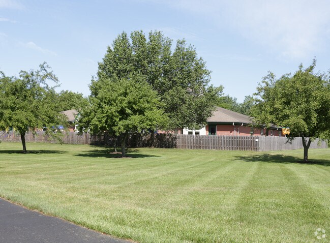


Property Detail
51 Marigold Dr
29-019-155
1.549AC NEWTOWN GRANT COMMERCIAL AREA 238 ON MARIGOLD DR
Daycare
Bucks
R2
Pennsylvania
B and X Area of moderate flood hazard, usually the area between the limits of the 100-year and 500-year floods.
1.55 AC
2024
Lower Bucks County
2025
Philadelphia
105207
Philadelphia-Camden-Wilmington, PA-NJ-DE-MD
7,988 SF
NEARBY LISTINGS FOR SALE OR LEASE
DEMOGRAPHICS near 51 Marigold Dr
1 mile
3 mile
5 mile
2025 Total Population
5,902
28,116
76,105
2030 Population
5,908
28,076
76,258
Pop Growth 2025-2030
+ 0.10%
(0.14%)
+ 0.20%
Average Age
44
45
45
2025 Total Households
2,232
10,740
28,163
HH Growth 2025-2030
0.00%
(0.17%)
+ 0.15%
Median Household Inc
$168,200
$154,148
$152,463
Avg Household Size
2.60
2.60
2.60
2025 Avg HH Vehicles
2.00
2.00
2.00
Median Home Value
$654,194
$676,461
$678,501
Median Year Built
1991
1985
1984
Nearby Places
Map Layers
Map Styles
 Street
 Aerial
Layers
 Traffic
 Biking
Places
Listings with unknown addresses are not visible on the map
- Restaurants
- Banks
- Shops
- Fitness
- Groceries
PUBLIC TRANSPORTATION
COMMUTER RAIL
Yardley (R3 - Southeastern Pennsylvania Transportation Authority Regional Rail (SEPTA Regional Rail))
Drive
Walk
Distance
Yardley (R3 - Southeastern Pennsylvania Transportation Authority Regional Rail (SEPTA Regional Rail))
17 min
8.9 mi
Woodbourne (R3 - Southeastern Pennsylvania Transportation Authority Regional Rail (SEPTA Regional Rail))
Drive
Walk
Distance
Woodbourne (R3 - Southeastern Pennsylvania Transportation Authority Regional Rail (SEPTA Regional Rail))
16 min
9.2 mi
AIRPORT
Trenton Mercer
Drive
Walk
Distance
Trenton Mercer
20 min
9.6 mi
Freight Ports
Port of Philadelphia
Drive
Walk
Distance
Port of Philadelphia
42 min
23.6 mi
Nearby Properties
Address
Land Use
TOTAL SIZE
Lot Size
Zoning
Address
Land Use
TOTAL SIZE
Lot Size
Zoning
170,342 SF
28.26 AC
PC
Address
Land Use
TOTAL SIZE
Lot Size
Zoning
113,929 SF
10.43 AC
VRI
Address
Land Use
TOTAL SIZE
Lot Size
Zoning
162,990 SF
10.75 AC
LI
Address
Land Use
TOTAL SIZE
Lot Size
Zoning
131,927 SF
14.73 AC
LI
Address
Land Use
TOTAL SIZE
Lot Size
Zoning
65,124 SF
8.52 AC
PG
Address
Land Use
TOTAL SIZE
Lot Size
Zoning
35,713 SF
7.09 AC
L1
Address
Land Use
TOTAL SIZE
Lot Size
Zoning
64,164 SF
8.29 AC
PC
Address
Land Use
TOTAL SIZE
Lot Size
Zoning
48,948 SF
4.48 AC
VRI
Address
Land Use
TOTAL SIZE
Lot Size
Zoning
34,186 SF
3.89 AC
VI
Address
Land Use
TOTAL SIZE
Lot Size
Zoning
83,816 SF
9.27 AC
LI
Address
Land Use
TOTAL SIZE
Lot Size
Zoning
21,220 SF
1.96 AC
R1
Address
Land Use
TOTAL SIZE
Lot Size
Zoning
53,644 SF
8.91 AC
R1
Address
Land Use
TOTAL SIZE
Lot Size
Zoning
36,490 SF
3.96 AC
PC
Address
Land Use
TOTAL SIZE
Lot Size
Zoning
34,138 SF
5.46 AC
PE
Address
Land Use
TOTAL SIZE
Lot Size
Zoning
27,280 SF
0.28 AC
VC
Address
Land Use
TOTAL SIZE
Lot Size
Zoning
945 SF
4.57 AC
R2
Address
Land Use
TOTAL SIZE
Lot Size
Zoning
12,242 SF
0.43 AC
VC
Address
Land Use
TOTAL SIZE
Lot Size
Zoning
34,550 SF
4.17 AC
LI
Address
Land Use
TOTAL SIZE
Lot Size
Zoning
27,590 SF
7.24 AC
LI
Address
Land Use
TOTAL SIZE
Lot Size
Zoning
93,588 SF
10.45 AC
LI
Address
Land Use
TOTAL SIZE
Lot Size
Zoning
65,983 SF
6.21 AC
LI
Address
Land Use
TOTAL SIZE
Lot Size
Zoning
23,248 SF
2.82 AC
R1
Address
Land Use
TOTAL SIZE
Lot Size
Zoning
39,450 SF
5.10 AC
LI
Address
Land Use
TOTAL SIZE
Lot Size
Zoning
32,975 SF
3.90 AC
LI
Address
Land Use
TOTAL SIZE
Lot Size
Zoning
28,692 SF
3.44 AC
LI
Address
Land Use
TOTAL SIZE
Lot Size
Zoning
30,922 SF
4.06 AC
LI
Address
Land Use
TOTAL SIZE
Lot Size
Zoning
22,782 SF
3.91 AC
CC
Address
Land Use
TOTAL SIZE
Lot Size
Zoning
29,076 SF
3.30 AC
LI
Address
Land Use
TOTAL SIZE
Lot Size
Zoning
48,904 SF
6.48 AC
LI
Address
Land Use
TOTAL SIZE
Lot Size
Zoning
22,023 SF
5.70 AC
VC2
The World's #1 Commercial Real Estate Marketplace
Connect with us
© 2026 CoStar Group
The information above has been obtained from sources believed reliable. While we do not doubt its accuracy we have not verified it and make no guarantee, warranty or representation about it. It is your responsibility to independently confirm its accuracy and completeness. Any projections, opinions, assumptions, or estimates used are for example only and do not represent the current or future performance of the property. The value of this transaction to you depends on tax and other factors which should be evaluated by your tax, financial, and legal advisors. You and your advisors should conduct a careful, independent investigation of the property to determine to your satisfaction the suitability of the property for your needs.