Property Record
51 N Main St, Coalville, UT 84017


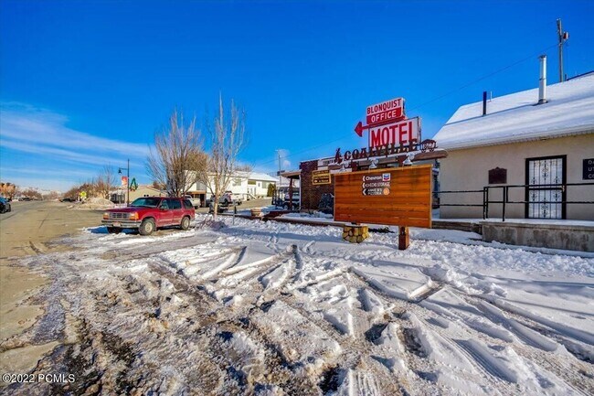
Property Detail
51 N Main St
CT-164
COMMENCING AT THE INTERSECTION MONUMENT AT 100 NORTH AND MAIN STREETS THENCE NORTH 233000 WEST 33.00 FEET COINCIDENT WITH THE CENTERLINE OF SAID MAIN STREET; THENCE SOUTH 663000 WEST 54.45 FEET TO THE SOUTHEAST CORNER OF LOT 1, BLOCK 109, PLAT B, COA
Commercialbuilding
Summit
AE The base floodplain where base flood elevations are provided. AE Zones are now used on new format FIRMs instead of A1-A30 Zones.
Utah
2025
0.19 AC
2025
Outlying Summit County
964201
Salt Lake City
4,500 SF
Heber, UT
NEARBY LISTINGS FOR SALE OR LEASE
DEMOGRAPHICS near 51 N Main St
1 mile
3 mile
5 mile
2025 Total Population
1,161
1,819
2,253
2030 Population
1,081
1,696
2,106
Pop Growth 2025-2030
(6.89%)
(6.76%)
(6.52%)
Average Age
36
37
37
2025 Total Households
390
607
758
HH Growth 2025-2030
(7.69%)
(7.41%)
(7.12%)
Median Household Inc
$86,458
$87,786
$90,397
Avg Household Size
3.00
3.00
3.00
2025 Avg HH Vehicles
2.00
3.00
3.00
Median Home Value
$593,333
$613,636
$640,532
Median Year Built
1990
1991
1991
Nearby Places
Map Layers
Map Styles
 Street
 Aerial
Layers
 Traffic
 Biking
Places
Listings with unknown addresses are not visible on the map
- Restaurants
- Banks
- Shops
- Fitness
- Groceries
PUBLIC TRANSPORTATION
AIRPORT
Salt Lake City International
Drive
Walk
Distance
Salt Lake City International
57 min
49.1 mi
SALE & LEASE HISTORY
LISTING DATE
SALE/LEASE

Feb 01, 2022
For Sale
Nearby Properties
Address
Land Use
TOTAL SIZE
Lot Size
Zoning
Address
Land Use
TOTAL SIZE
Lot Size
Zoning
0.90 AC
Address
Land Use
TOTAL SIZE
Lot Size
Zoning
1.89 AC
Address
Land Use
TOTAL SIZE
Lot Size
Zoning
9,792 SF
6.66 AC
Address
Land Use
TOTAL SIZE
Lot Size
Zoning
1,456 SF
37.30 AC
Address
Land Use
TOTAL SIZE
Lot Size
Zoning
0.71 AC
Address
Land Use
TOTAL SIZE
Lot Size
Zoning
1.23 AC
Address
Land Use
TOTAL SIZE
Lot Size
Zoning
23,375 SF
1.89 AC
Address
Land Use
TOTAL SIZE
Lot Size
Zoning
11,196 SF
0.61 AC
Address
Land Use
TOTAL SIZE
Lot Size
Zoning
2.68 AC
Address
Land Use
TOTAL SIZE
Lot Size
Zoning
2,830 SF
1.29 AC
Address
Land Use
TOTAL SIZE
Lot Size
Zoning
Address
Land Use
TOTAL SIZE
Lot Size
Zoning
Address
Land Use
TOTAL SIZE
Lot Size
Zoning
Address
Land Use
TOTAL SIZE
Lot Size
Zoning
8,796 SF
1.88 AC
Address
Land Use
TOTAL SIZE
Lot Size
Zoning
Address
Land Use
TOTAL SIZE
Lot Size
Zoning
Address
Land Use
TOTAL SIZE
Lot Size
Zoning
Address
Land Use
TOTAL SIZE
Lot Size
Zoning
6,286 SF
7.56 AC
Address
Land Use
TOTAL SIZE
Lot Size
Zoning
Address
Land Use
TOTAL SIZE
Lot Size
Zoning
Address
Land Use
TOTAL SIZE
Lot Size
Zoning
Address
Land Use
TOTAL SIZE
Lot Size
Zoning
2,094 SF
0.57 AC
Address
Land Use
TOTAL SIZE
Lot Size
Zoning
Address
Land Use
TOTAL SIZE
Lot Size
Zoning
Address
Land Use
TOTAL SIZE
Lot Size
Zoning
0.43 AC
Address
Land Use
TOTAL SIZE
Lot Size
Zoning
Address
Land Use
TOTAL SIZE
Lot Size
Zoning
Address
Land Use
TOTAL SIZE
Lot Size
Zoning
Address
Land Use
TOTAL SIZE
Lot Size
Zoning
The World's #1 Commercial Real Estate Marketplace
Connect with us
© 2026 CoStar Group
The information above has been obtained from sources believed reliable. While we do not doubt its accuracy we have not verified it and make no guarantee, warranty or representation about it. It is your responsibility to independently confirm its accuracy and completeness. Any projections, opinions, assumptions, or estimates used are for example only and do not represent the current or future performance of the property. The value of this transaction to you depends on tax and other factors which should be evaluated by your tax, financial, and legal advisors. You and your advisors should conduct a careful, independent investigation of the property to determine to your satisfaction the suitability of the property for your needs.