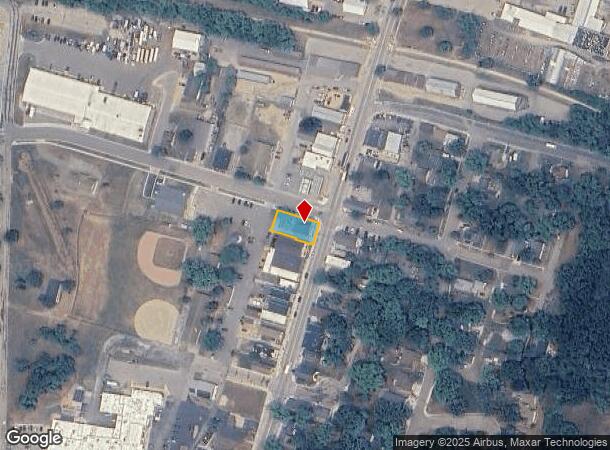
Property Record
51 N Main St, Deerfield, WI 53531

NEARBY LISTINGS FOR SALE OR LEASE
Property Detail
51 N Main St
Madison, WI
Certified
0712-214-7238-1
LOT 1 CSM 14748 CS103/14&16-3/26/2018 F/K/A LOTS 1, 2, 3 & 4 BLOCK 6 ALEK NELSON 'S SURVEY & PLAT OF DEERFIELD DESCR AS SEC 21-7-12 PRT SE1/4SE1/4 EXC PRT IN TIF 3
Commercialnec
Dane
X
Wisconsin
55055C0150F
38
2024
0.18 AC
2024
Outlying Dane East
011900
Milwaukee/Madison
DEMOGRAPHICS near 51 N Main St
1 Mile
3 Mile
5 Mile
2024 Total Population
2,667
3,757
7,199
2029 Population
2,750
3,869
7,358
Pop Growth 2024-2029
+ 3.11%
+ 2.98%
+ 2.21%
Average Age
40
41
42
2024 Total Households
1,021
1,440
2,774
HH Growth 2024-2029
+ 3.23%
+ 2.99%
+ 2.20%
Median Household Inc
$91,083
$91,309
$87,672
Avg Household Size
2.50
2.50
2.50
2024 Avg HH Vehicles
2.00
2.00
2.00
Median Home Value
$339,340
$341,844
$341,440
Median Year Built
1989
1987
1981
Nearby Places
Map Layers
Map Styles
 Street
 Aerial
- Restaurants
- Banks
- Shops
- Fitness
- Groceries
PUBLIC TRANSPORTATION
AIRPORT
Dane County Regional/Truax Field
DRIVE
WALK
Distance
Dane County Regional/Truax Field
27 min
19.8 mi
SALE & LEASE HISTORY
LISTING DATE
SALE/LEASE

Oct 29, 2020
For Sale
Oct 29, 2020
For Lease
Jun 24, 2020
For Sale
Nearby Properties
Address
Land Use
TOTAL SIZE
Lot Size
Zoning
Address
Land Use
TOTAL SIZE
Lot Size
Zoning
11.24 AC
Address
Land Use
TOTAL SIZE
Lot Size
Zoning
16.52 AC
Address
Land Use
TOTAL SIZE
Lot Size
Zoning
9.30 AC
Address
Land Use
TOTAL SIZE
Lot Size
Zoning
3,391 SF
0.08 AC
DC
Address
Land Use
TOTAL SIZE
Lot Size
Zoning
5.43 AC
Address
Land Use
TOTAL SIZE
Lot Size
Zoning
7.96 AC
Address
Land Use
TOTAL SIZE
Lot Size
Zoning
40.30 AC
A-1 EX
Address
Land Use
TOTAL SIZE
Lot Size
Zoning
2,186 SF
0.05 AC
DC
Address
Land Use
TOTAL SIZE
Lot Size
Zoning
2.37 AC
Address
Land Use
TOTAL SIZE
Lot Size
Zoning
7.04 AC
Address
Land Use
TOTAL SIZE
Lot Size
Zoning
3,474 SF
35 AC
R-1
Address
Land Use
TOTAL SIZE
Lot Size
Zoning
5,568 SF
19.50 AC
A-1 EX
Address
Land Use
TOTAL SIZE
Lot Size
Zoning
12.20 AC
SFR08
Address
Land Use
TOTAL SIZE
Lot Size
Zoning
4,898 SF
13.98 AC
RH-3
Address
Land Use
TOTAL SIZE
Lot Size
Zoning
5.80 AC
C-2
Address
Land Use
TOTAL SIZE
Lot Size
Zoning
2,986 SF
0.12 AC
DC
Address
Land Use
TOTAL SIZE
Lot Size
Zoning
5,582 SF
22.30 AC
RH-3
Address
Land Use
TOTAL SIZE
Lot Size
Zoning
4.67 AC
B-1
Address
Land Use
TOTAL SIZE
Lot Size
Zoning
5.33 AC
Address
Land Use
TOTAL SIZE
Lot Size
Zoning
0.50 AC
Address
Land Use
TOTAL SIZE
Lot Size
Zoning
3,601 SF
35.10 AC
A-1 EX
Address
Land Use
TOTAL SIZE
Lot Size
Zoning
3,904 SF
26 AC
A-1 EX
Address
Land Use
TOTAL SIZE
Lot Size
Zoning
4,440 SF
10.78 AC
RH-3
Address
Land Use
TOTAL SIZE
Lot Size
Zoning
4,179 SF
33.30 AC
R-1A
Address
Land Use
TOTAL SIZE
Lot Size
Zoning
18.73 AC
RH-4
Address
Land Use
TOTAL SIZE
Lot Size
Zoning
3,153 SF
12.62 AC
RH-3
Address
Land Use
TOTAL SIZE
Lot Size
Zoning
14.08 AC
Address
Land Use
TOTAL SIZE
Lot Size
Zoning
4,794 SF
12.63 AC
RH-3
Address
Land Use
TOTAL SIZE
Lot Size
Zoning
5,166 SF
13.10 AC
A-2(8)
The World's #1 Commercial Real Estate Marketplace
Connect with us
© 2026 CoStar Group
The information above has been obtained from sources believed reliable. While we do not doubt its accuracy we have not verified it and make no guarantee, warranty or representation about it. It is your responsibility to independently confirm its accuracy and completeness. Any projections, opinions, assumptions, or estimates used are for example only and do not represent the current or future performance of the property. The value of this transaction to you depends on tax and other factors which should be evaluated by your tax, financial, and legal advisors. You and your advisors should conduct a careful, independent investigation of the property to determine to your satisfaction the suitability of the property for your needs.